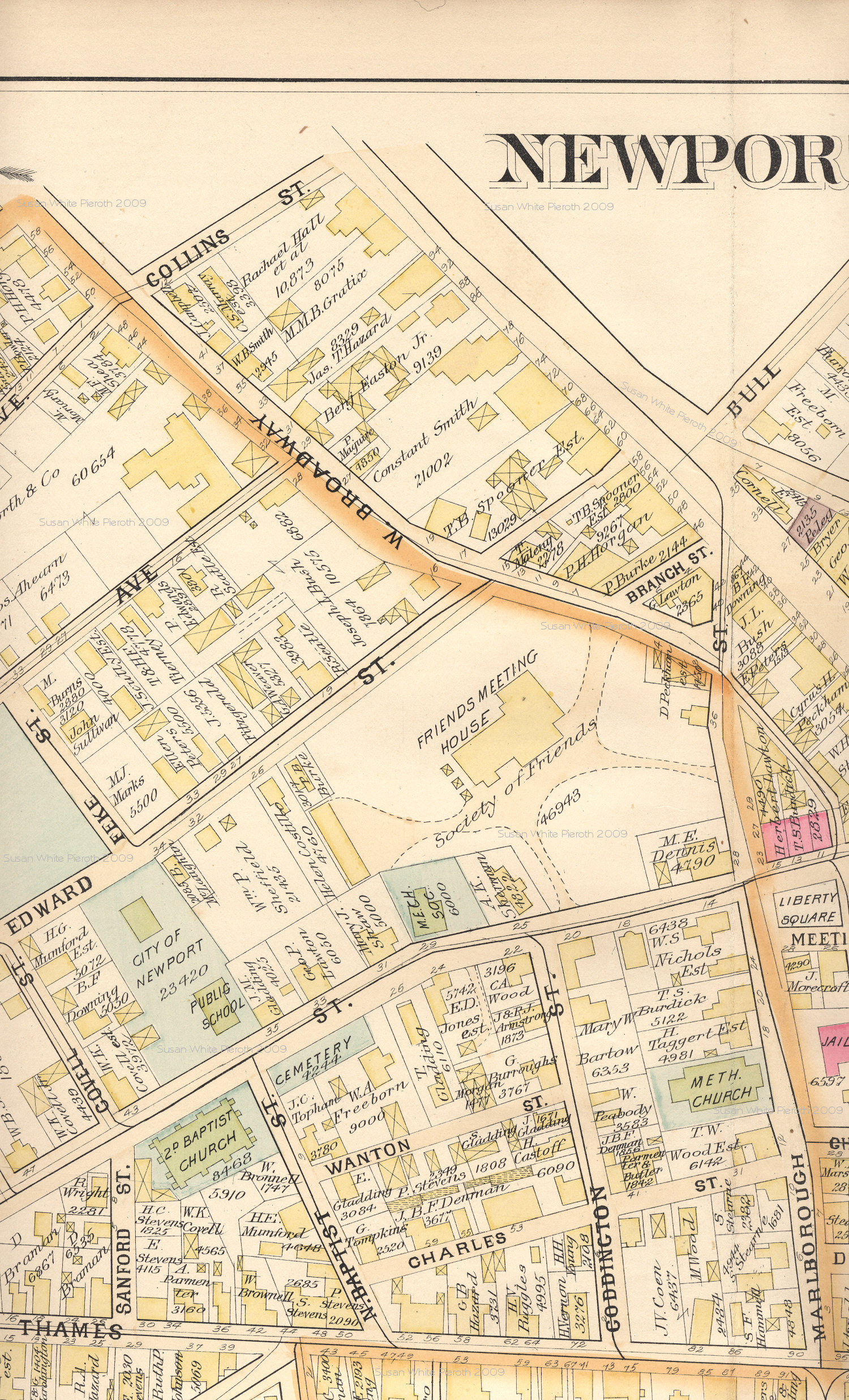
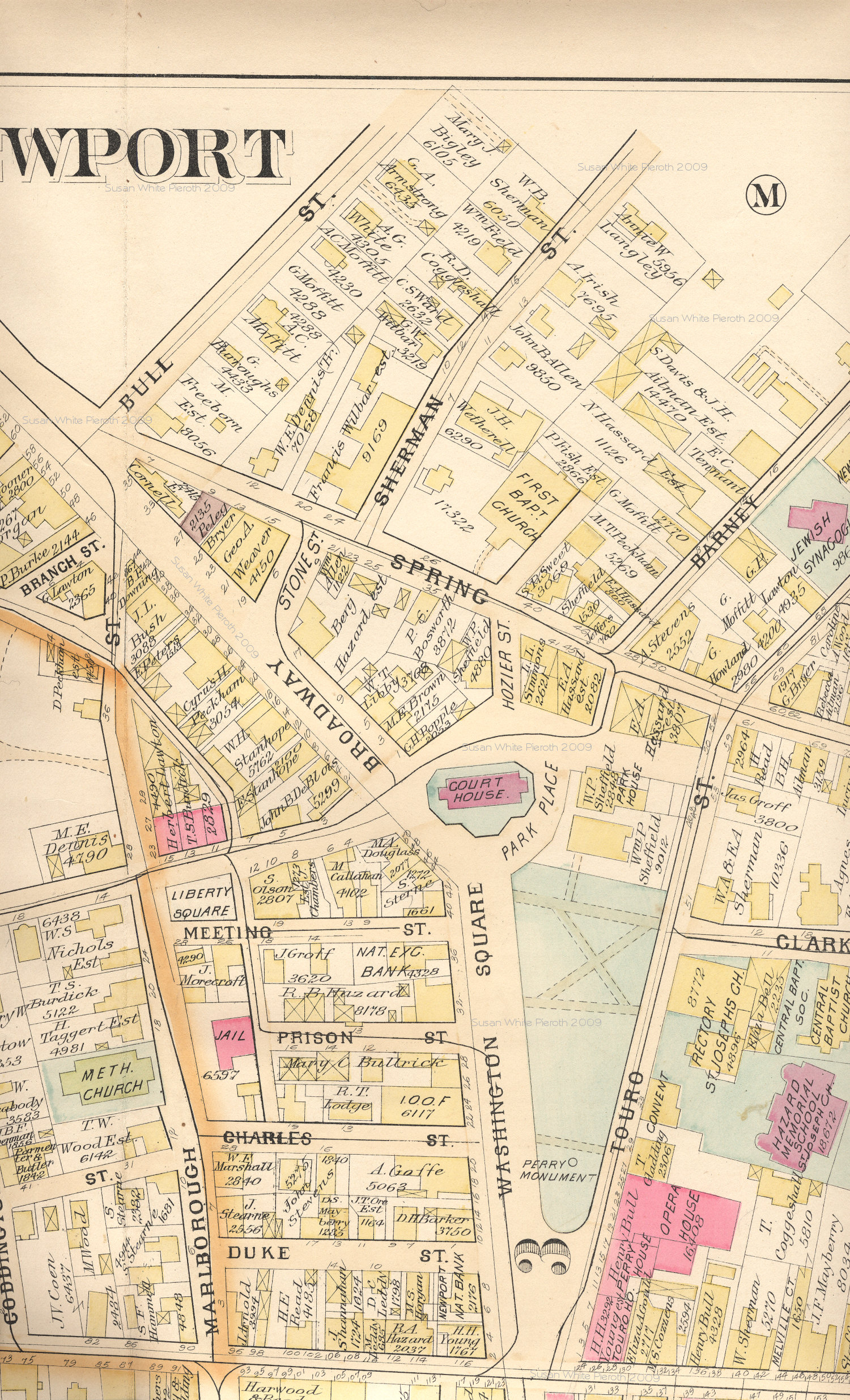
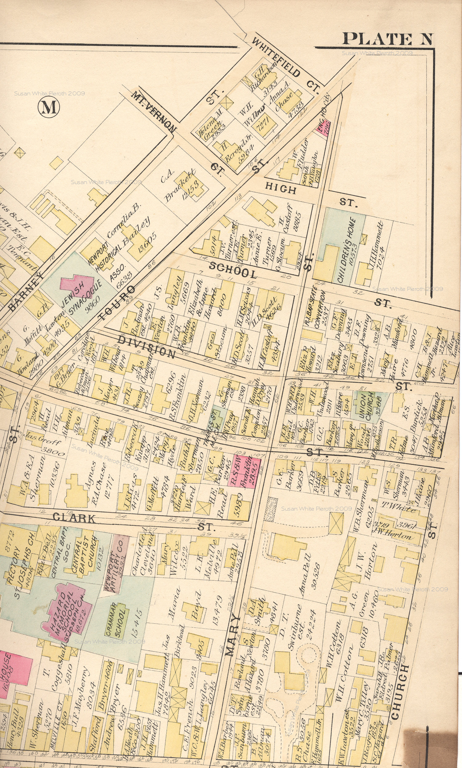
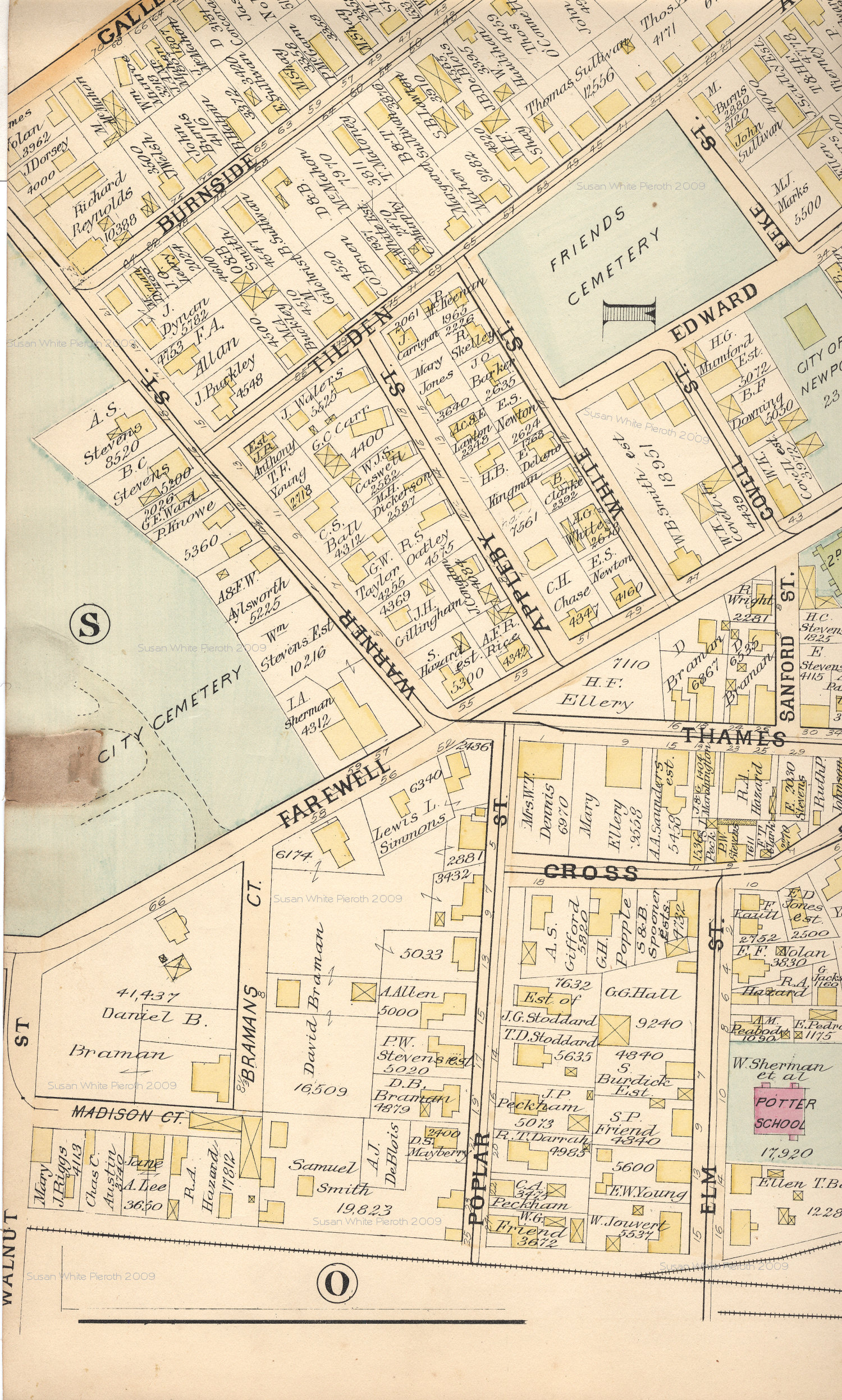
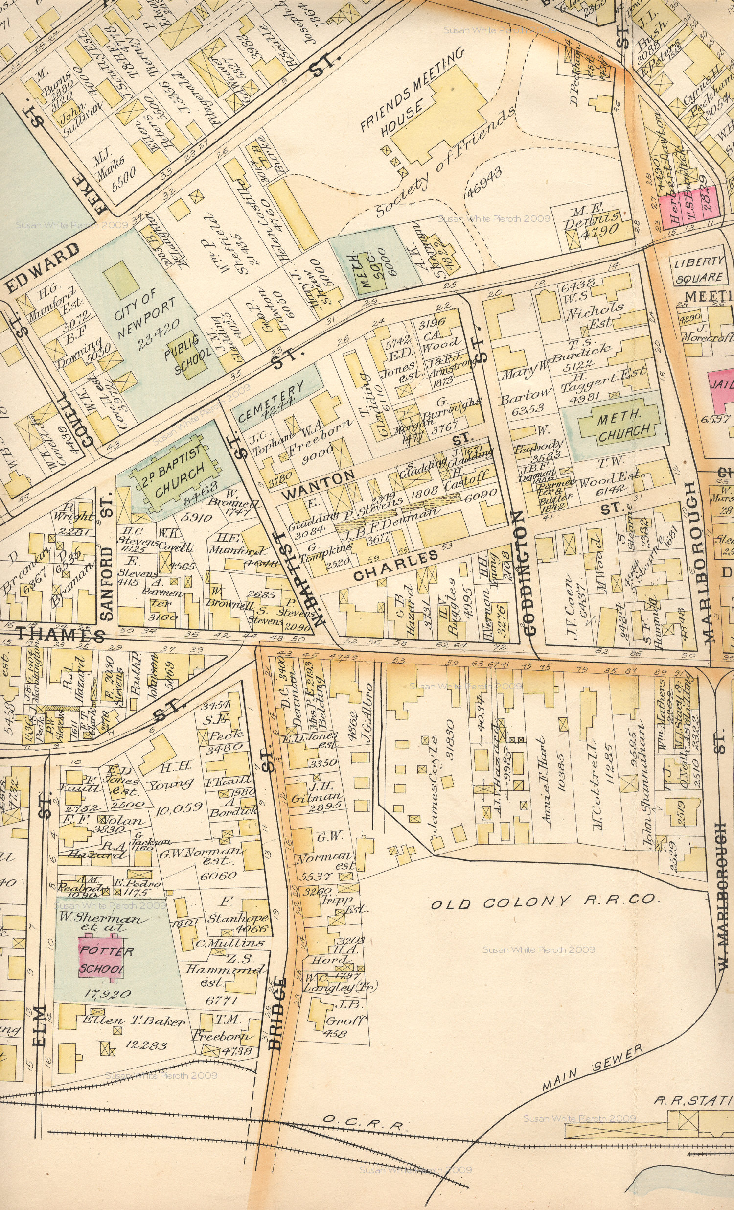
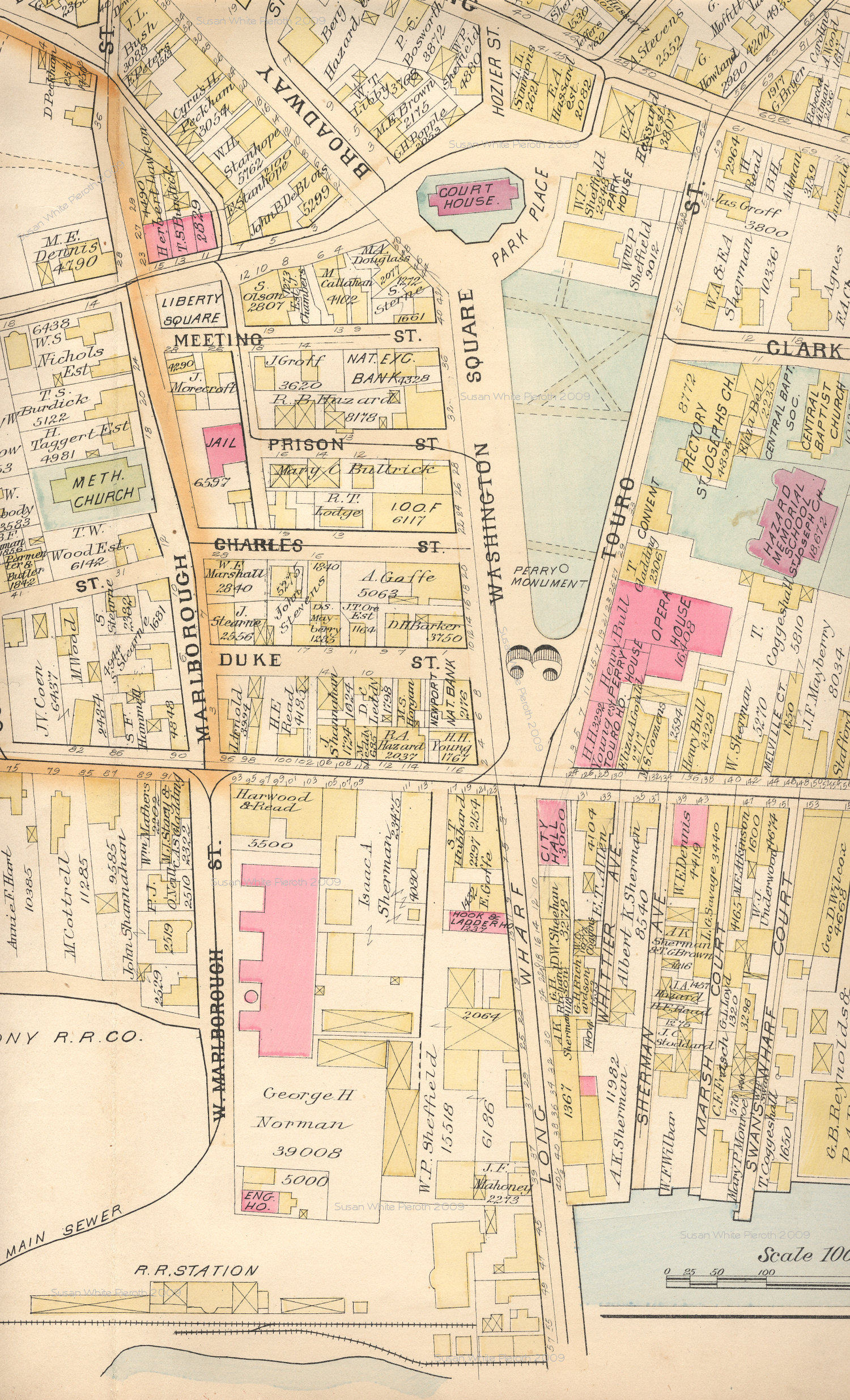
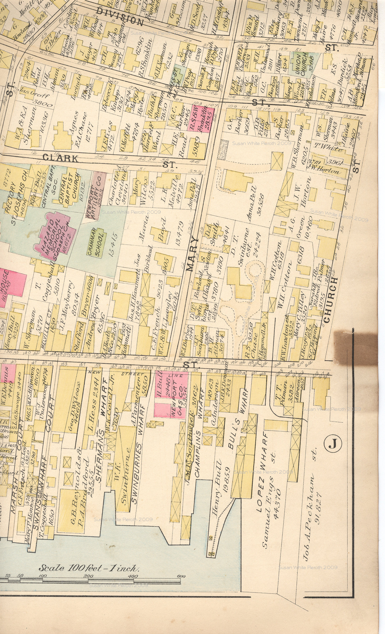
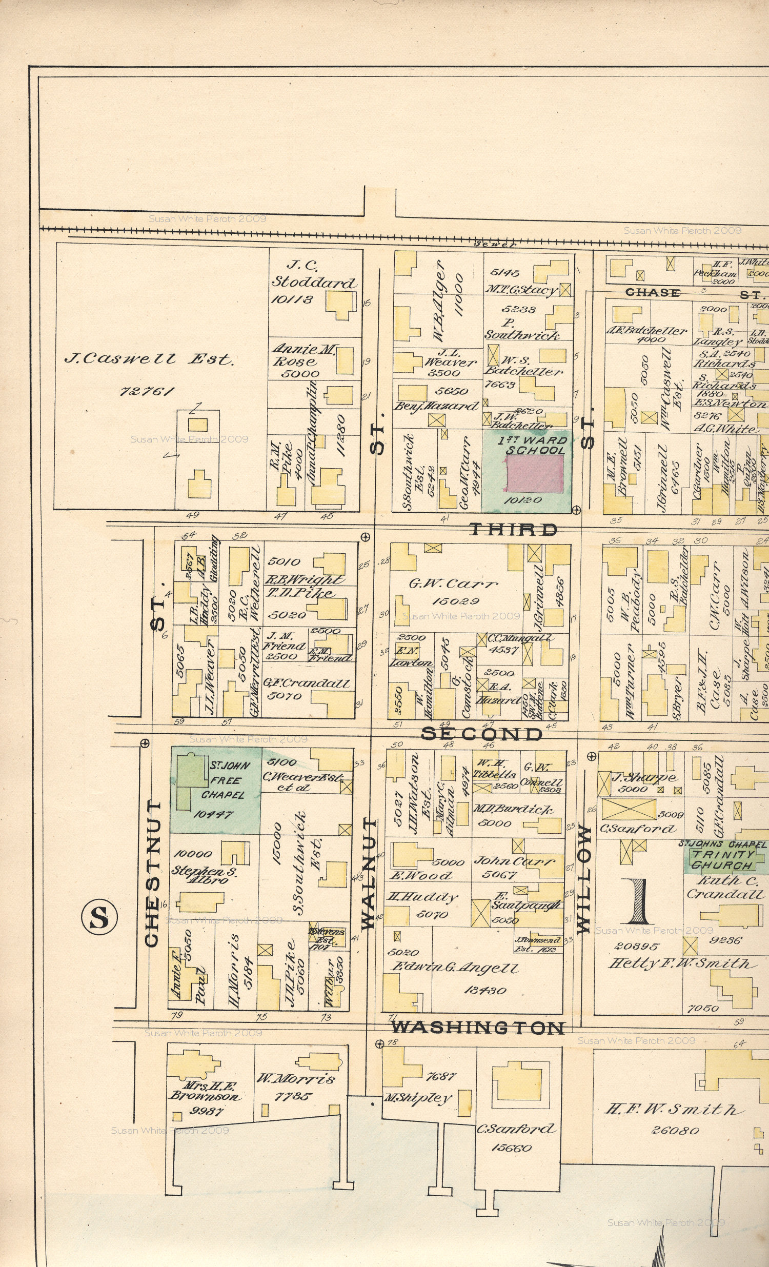
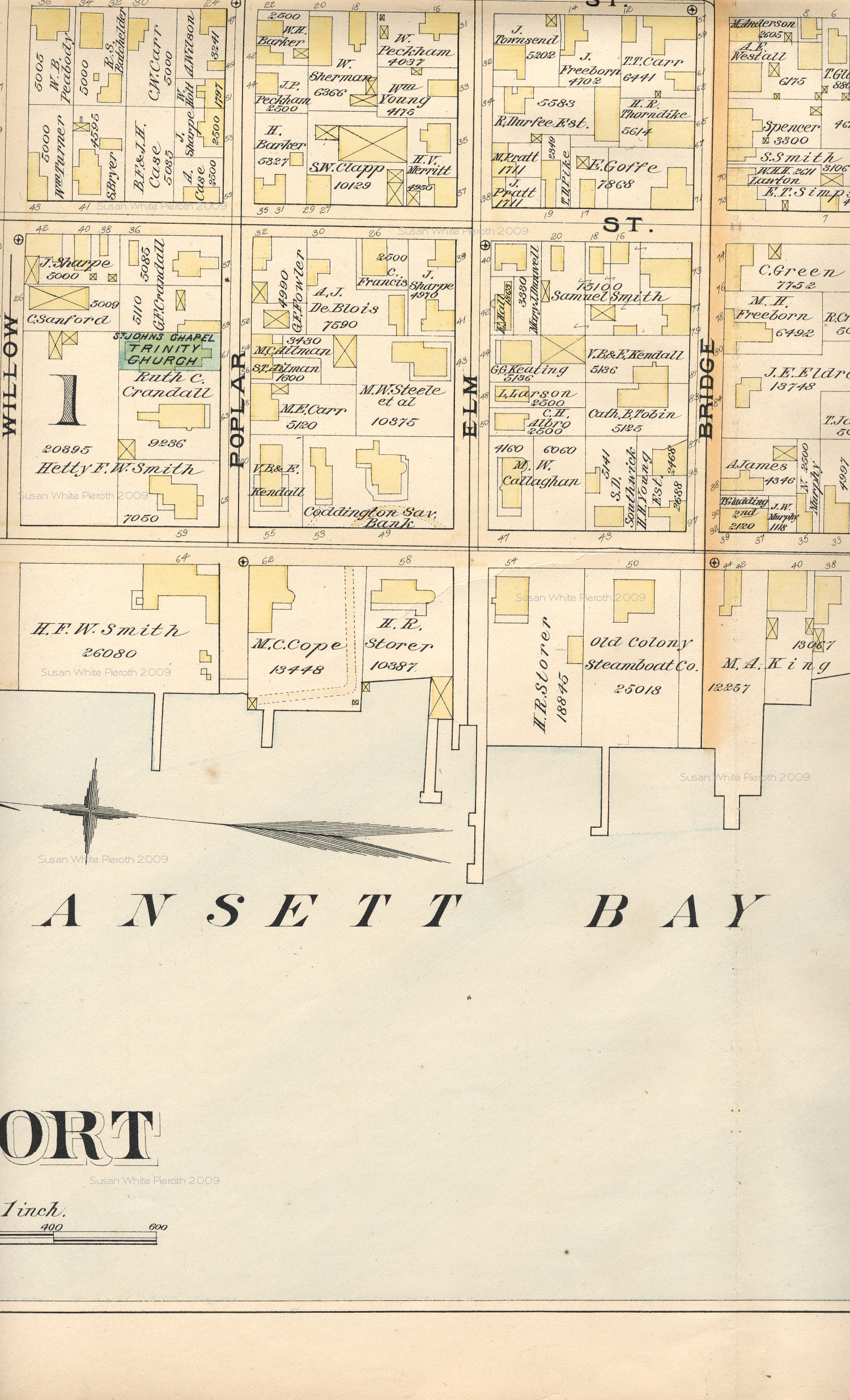
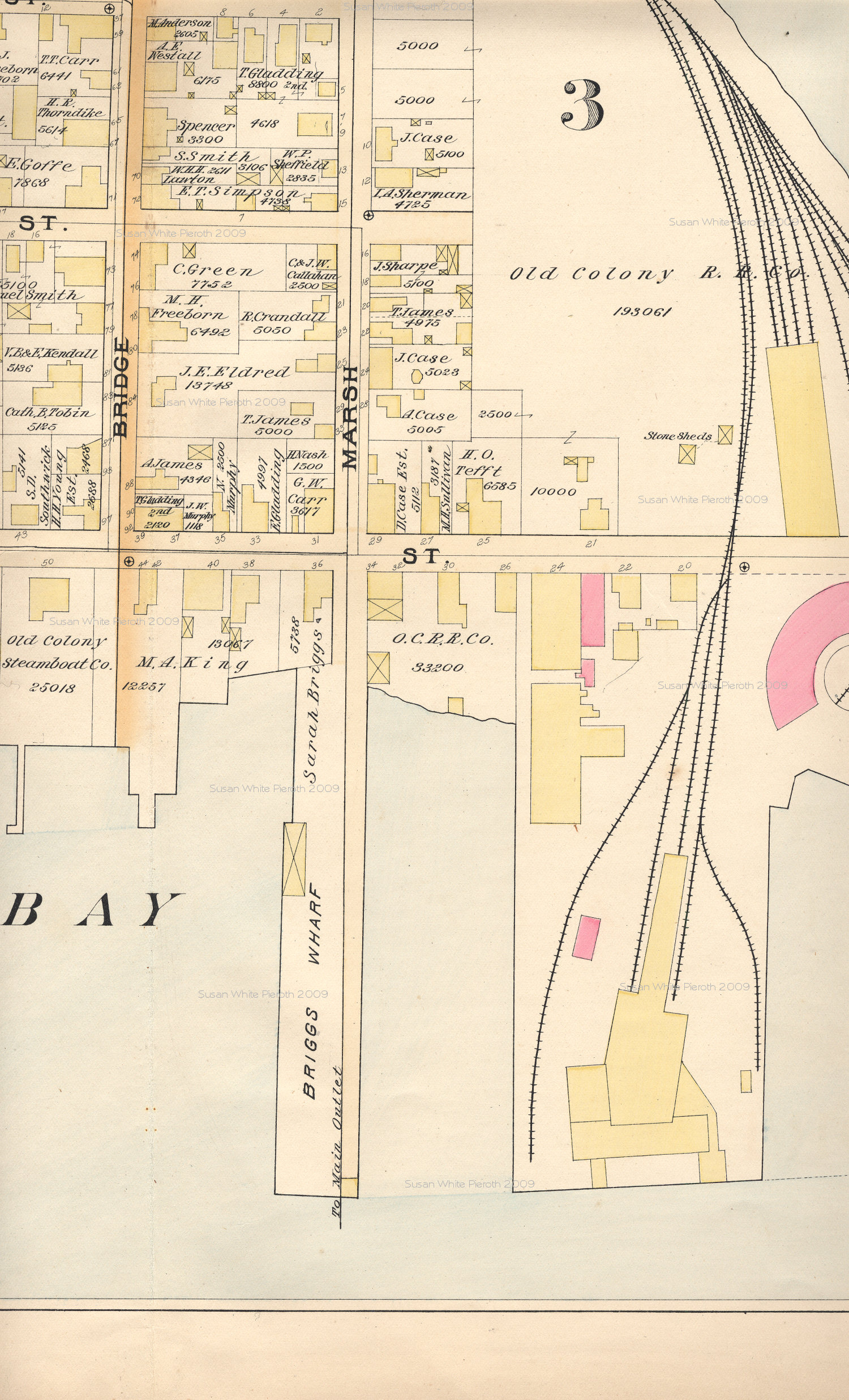
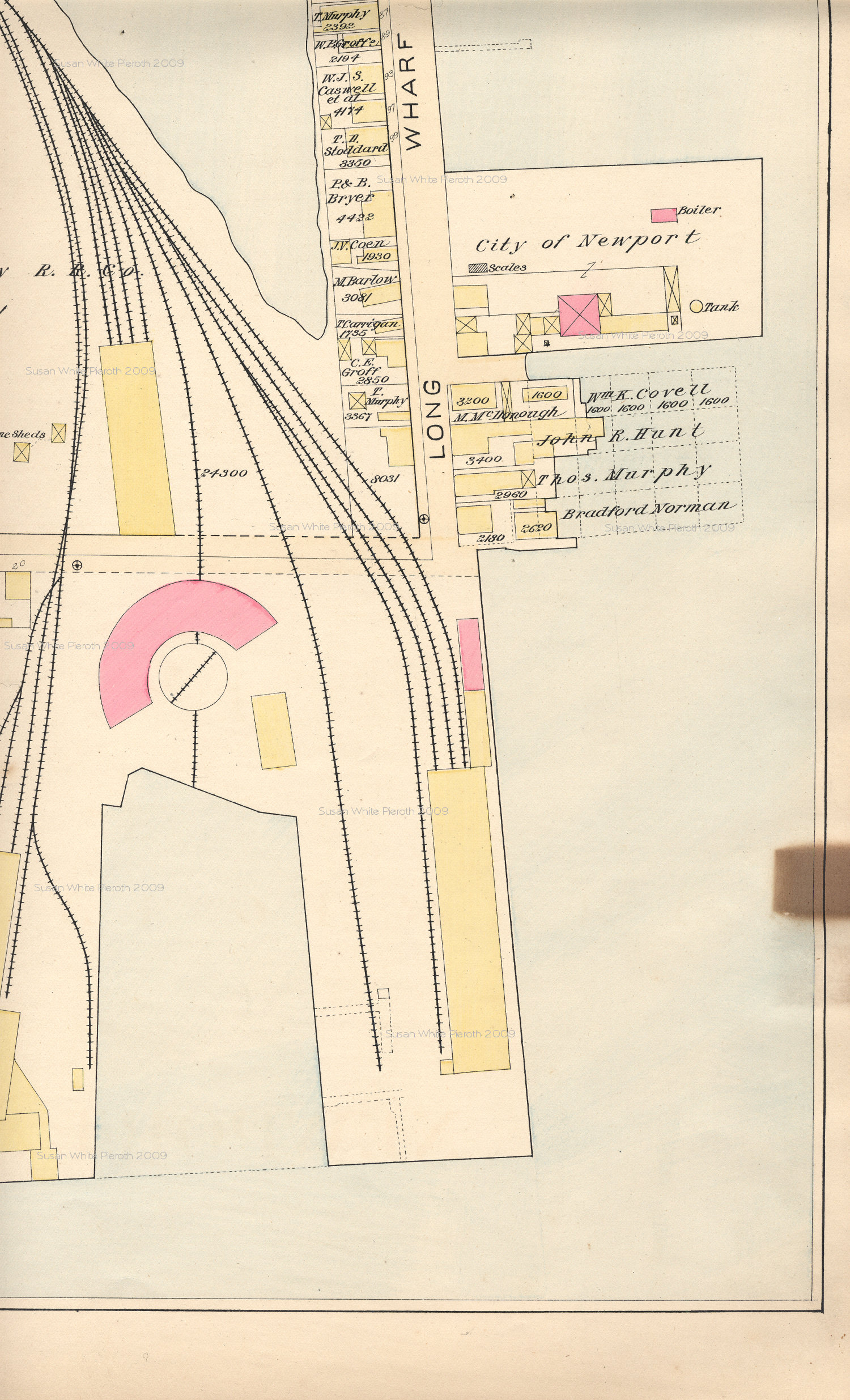
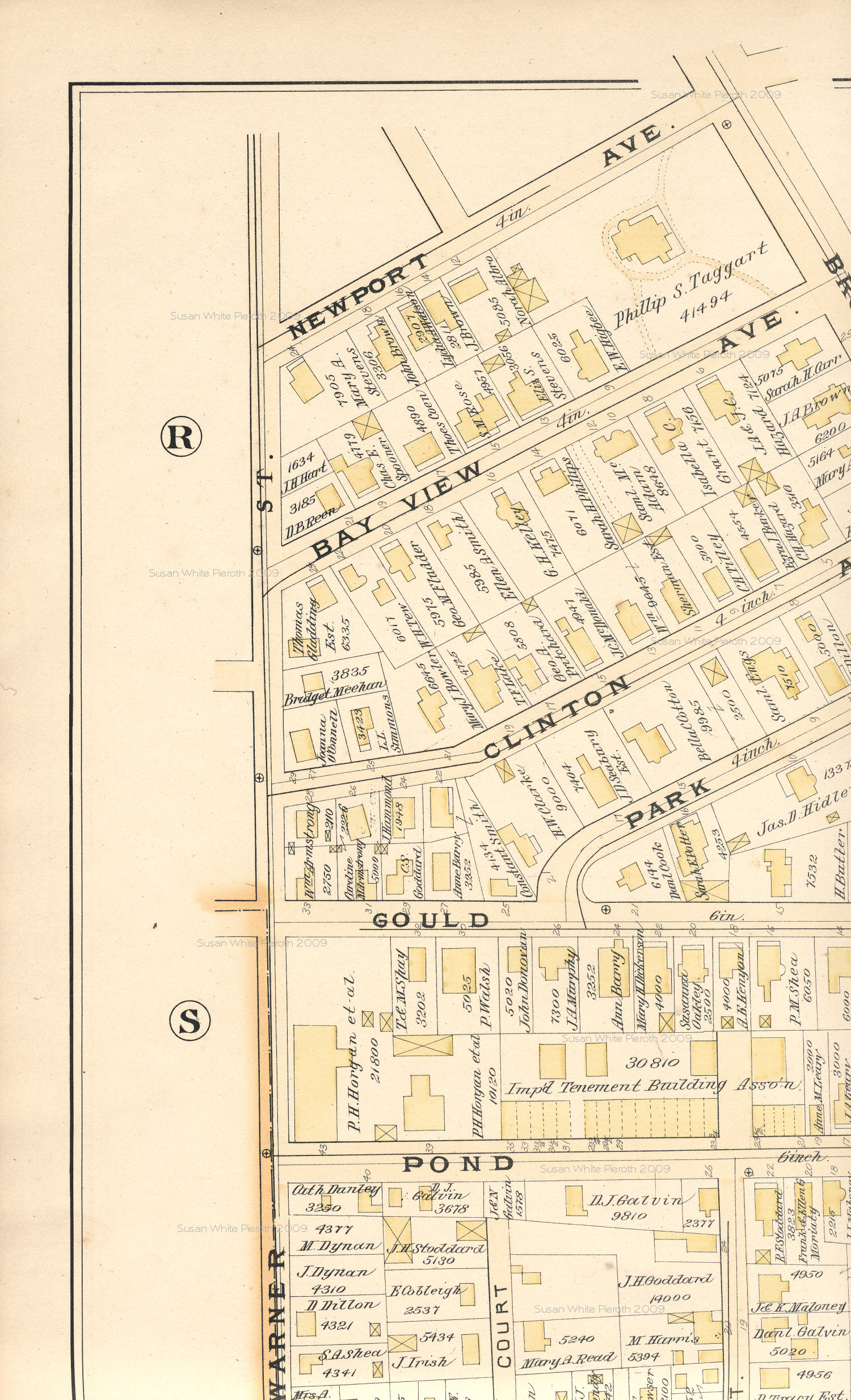
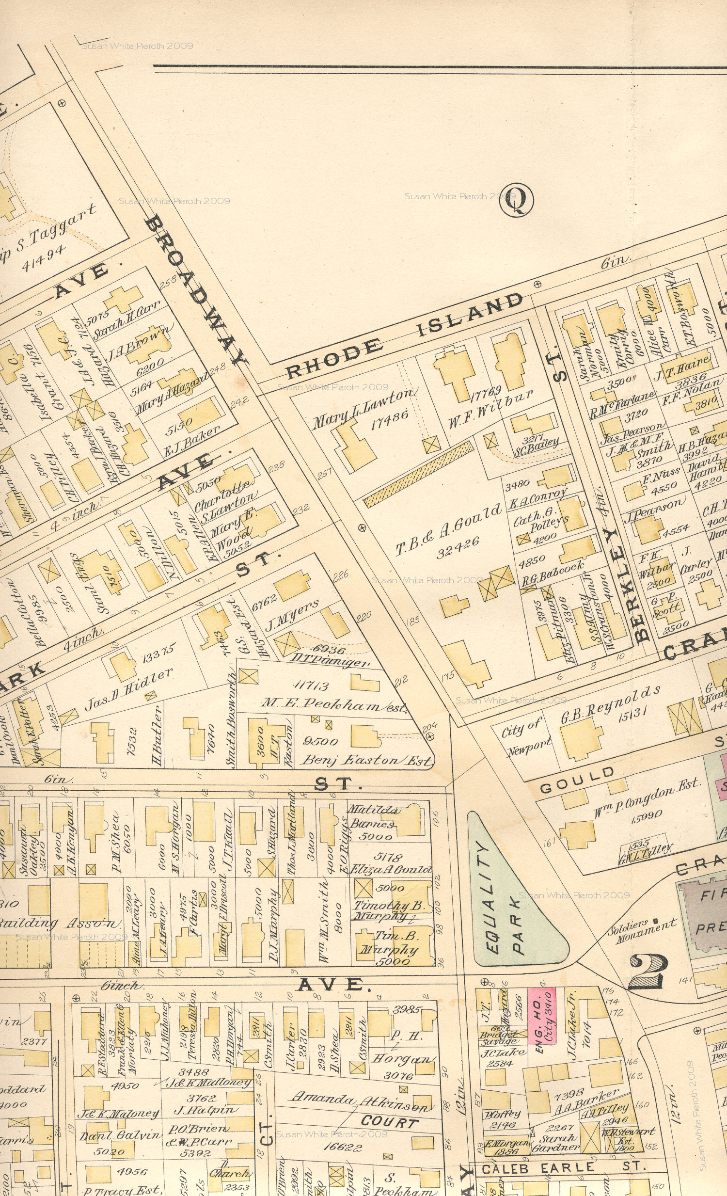
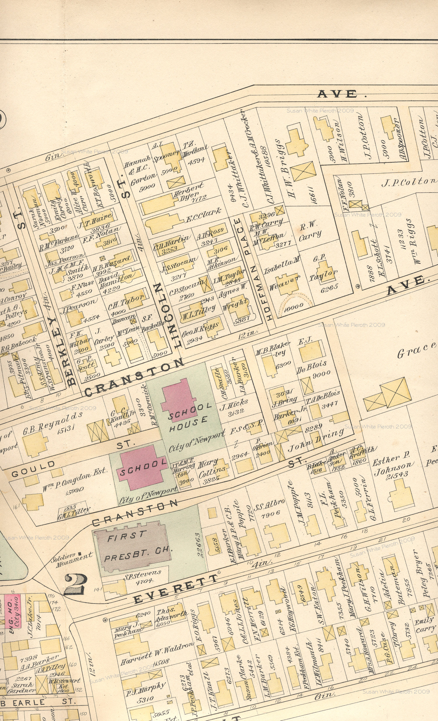
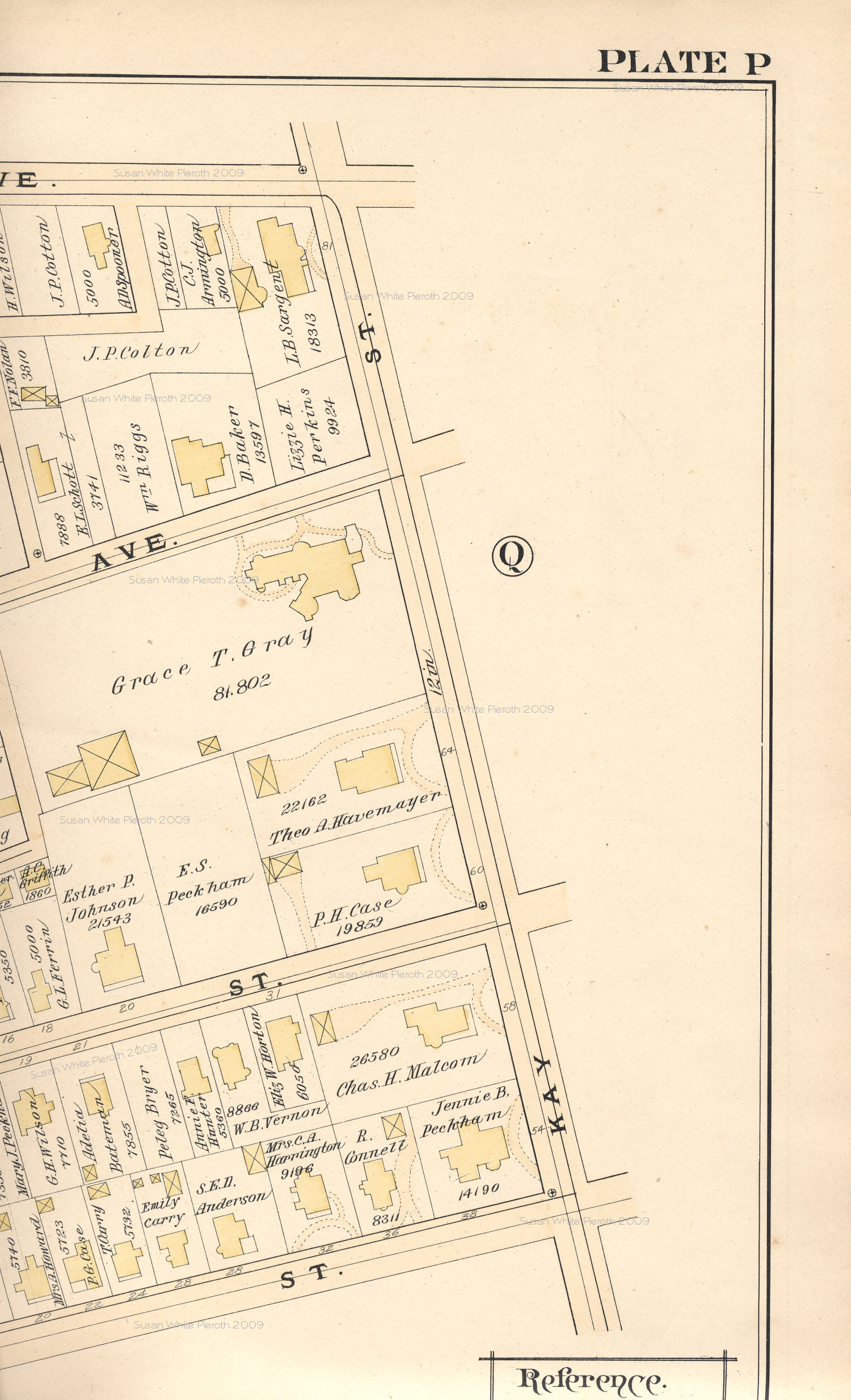
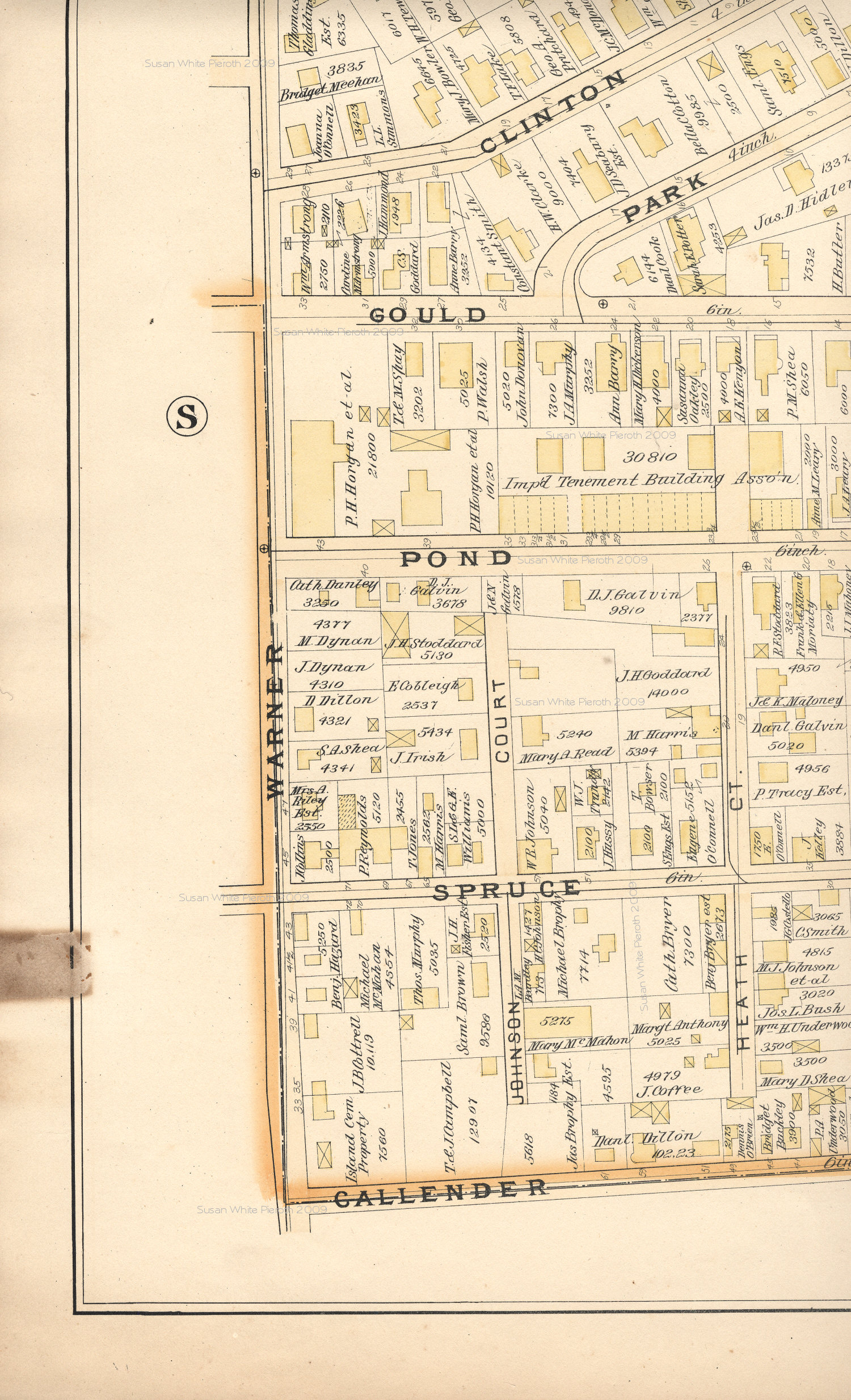
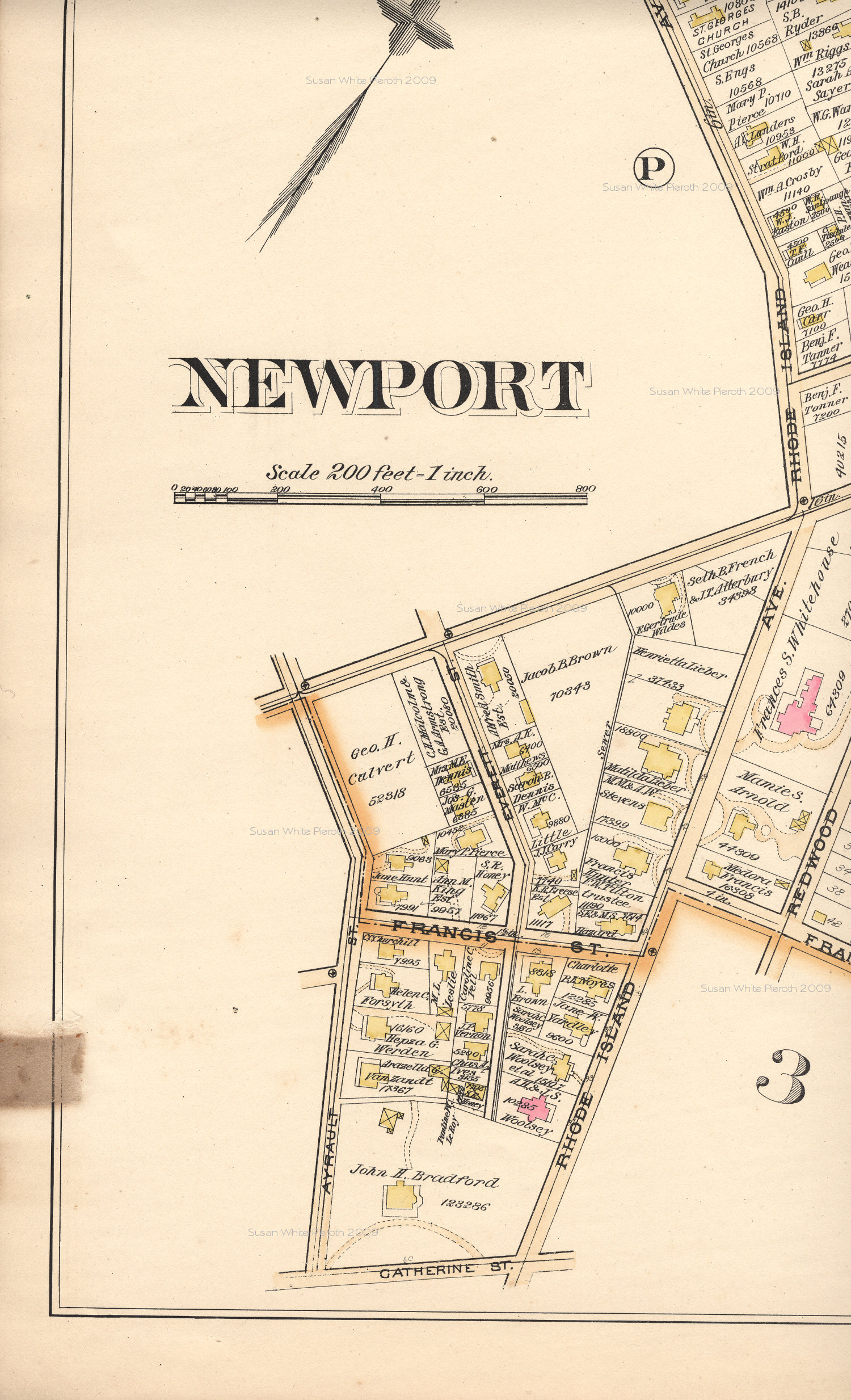
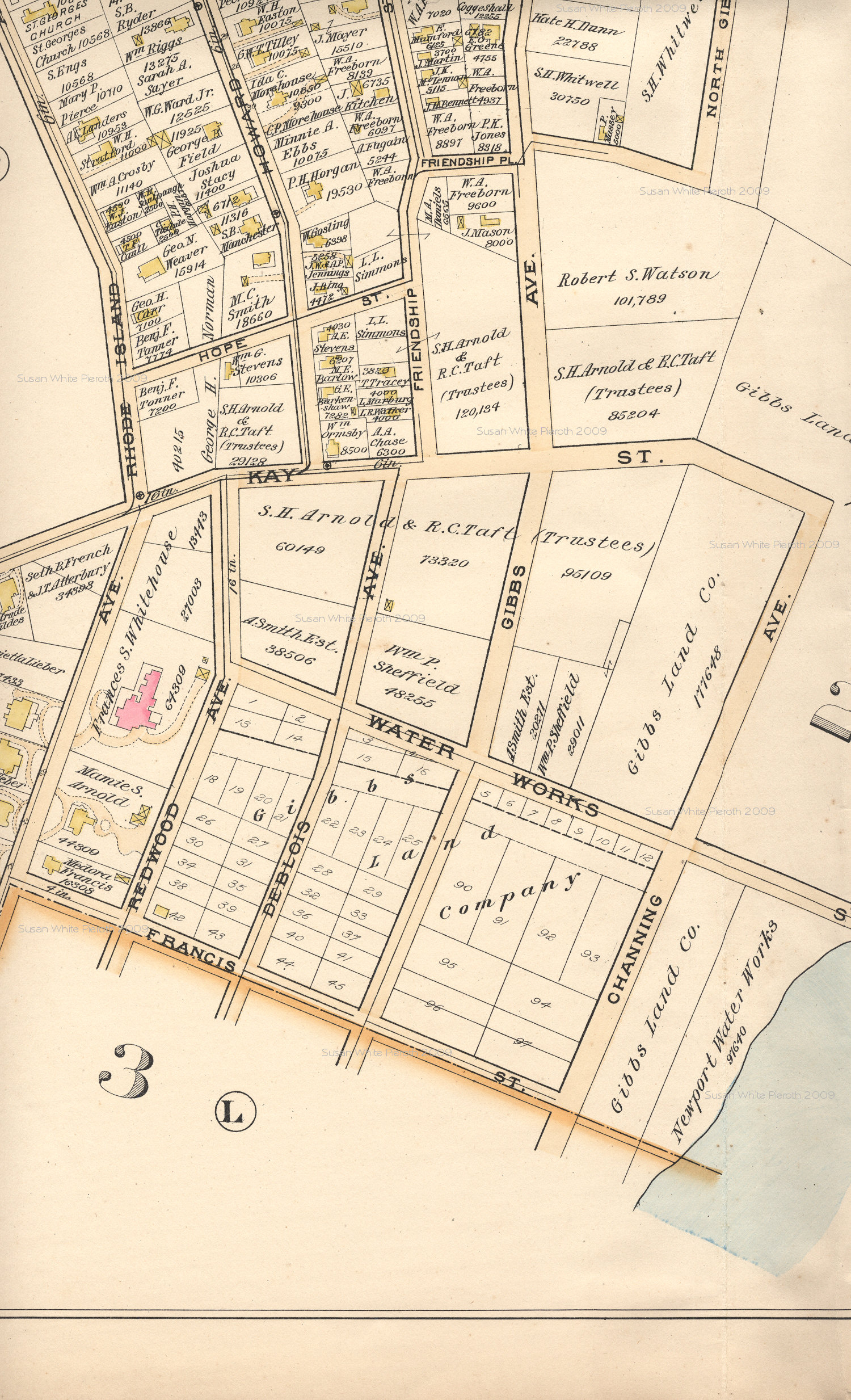
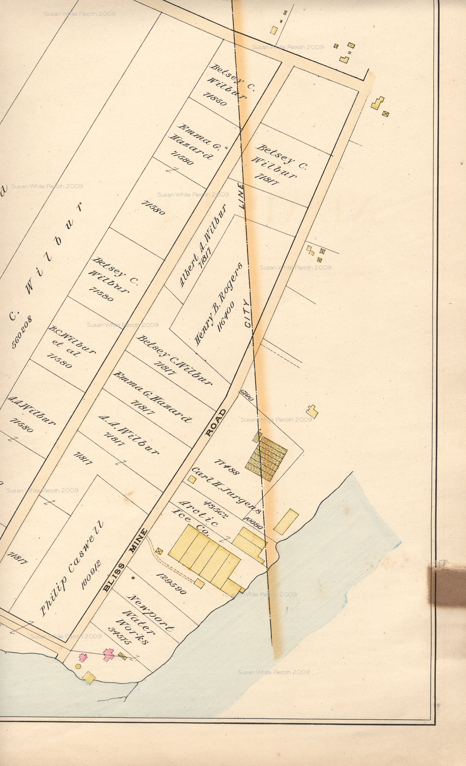
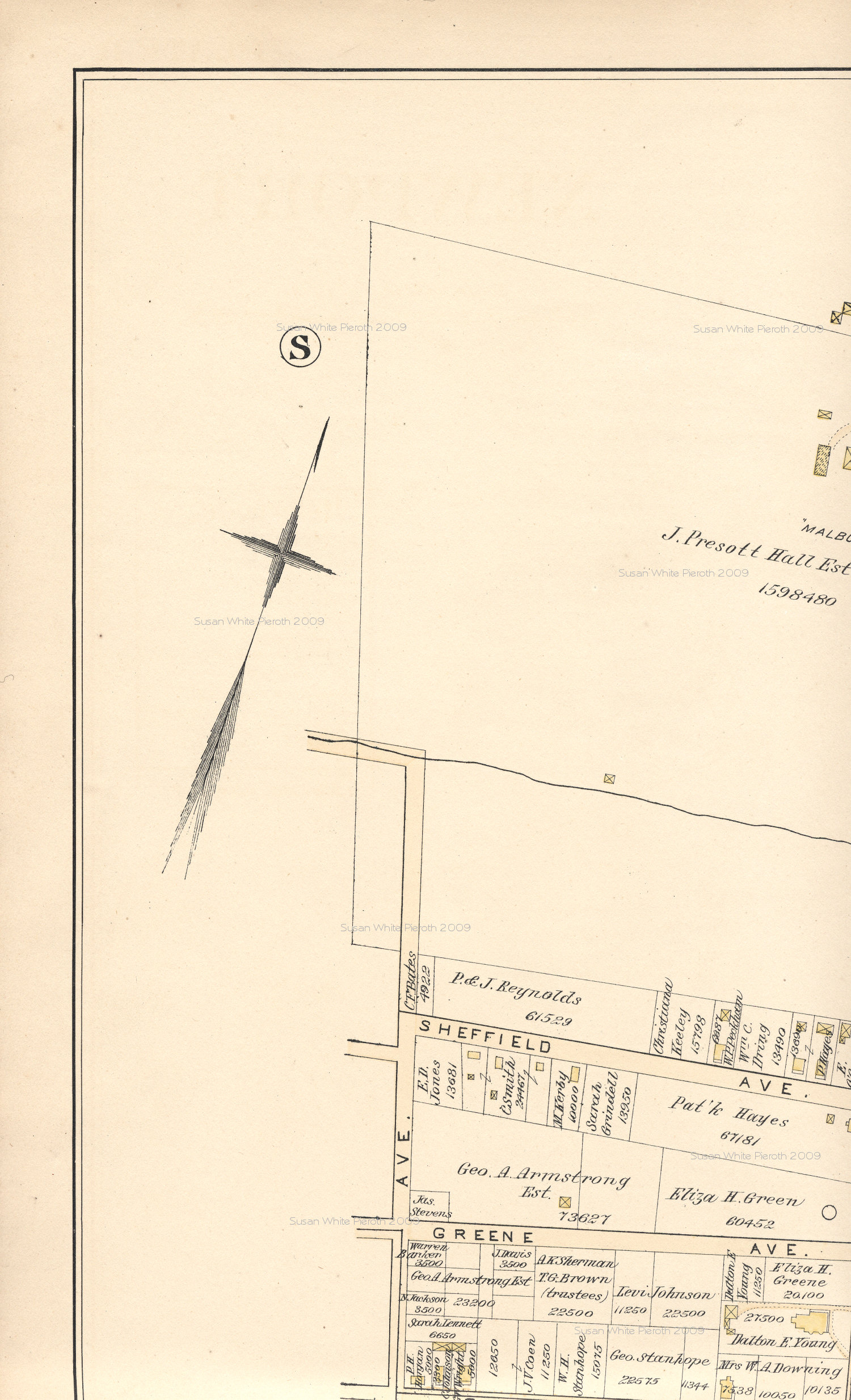
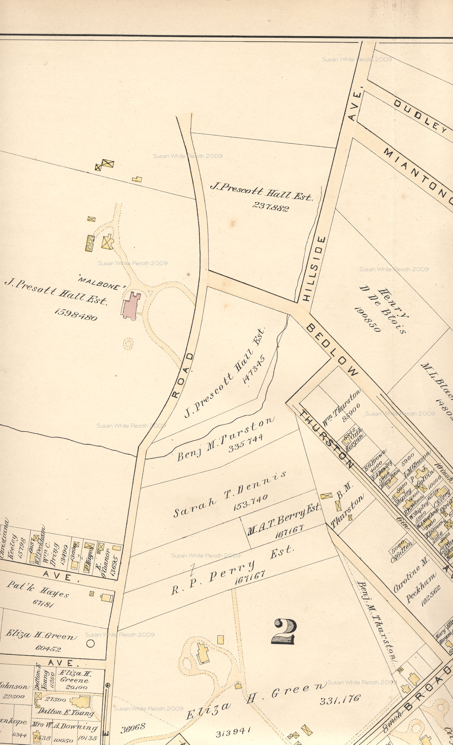
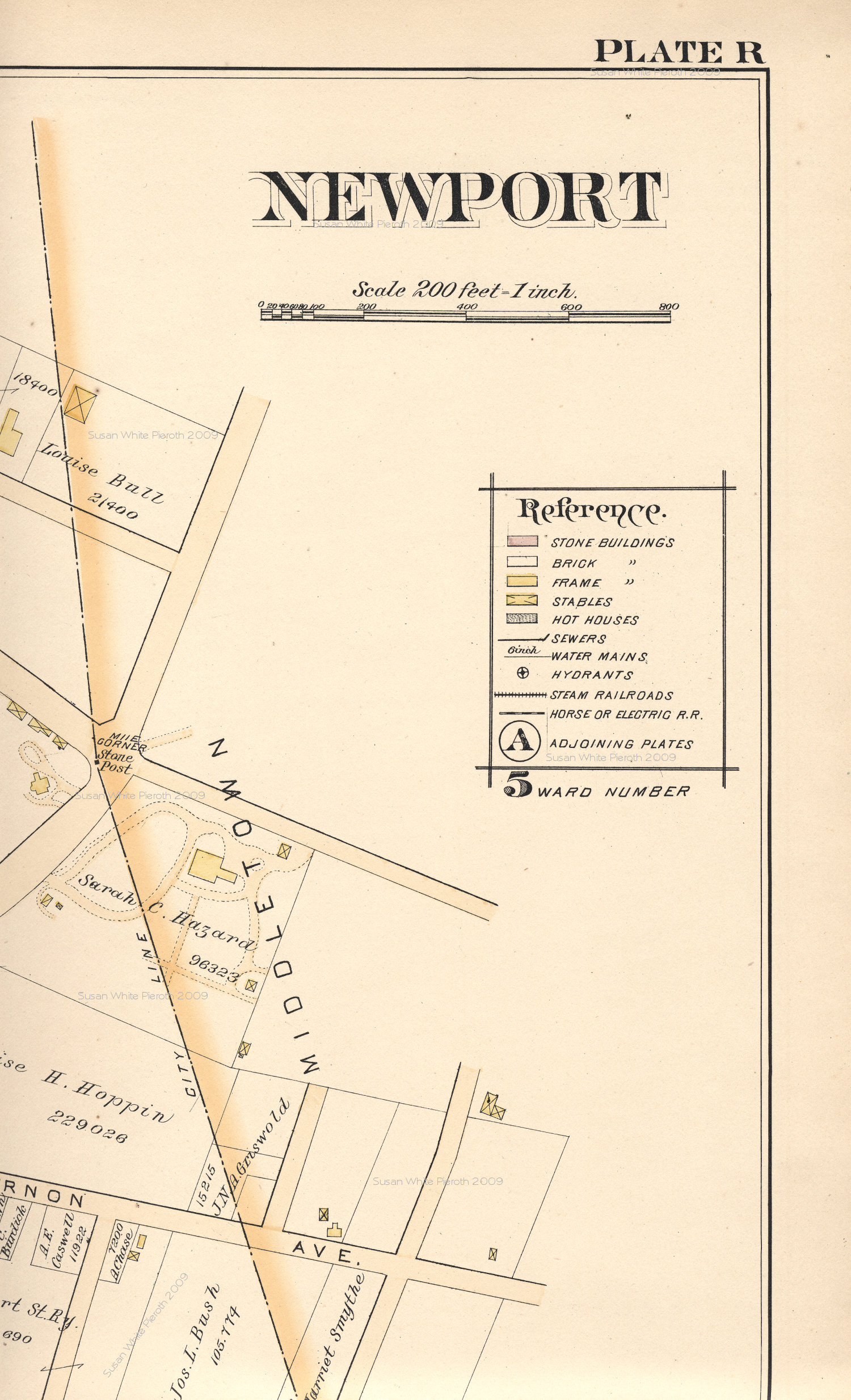
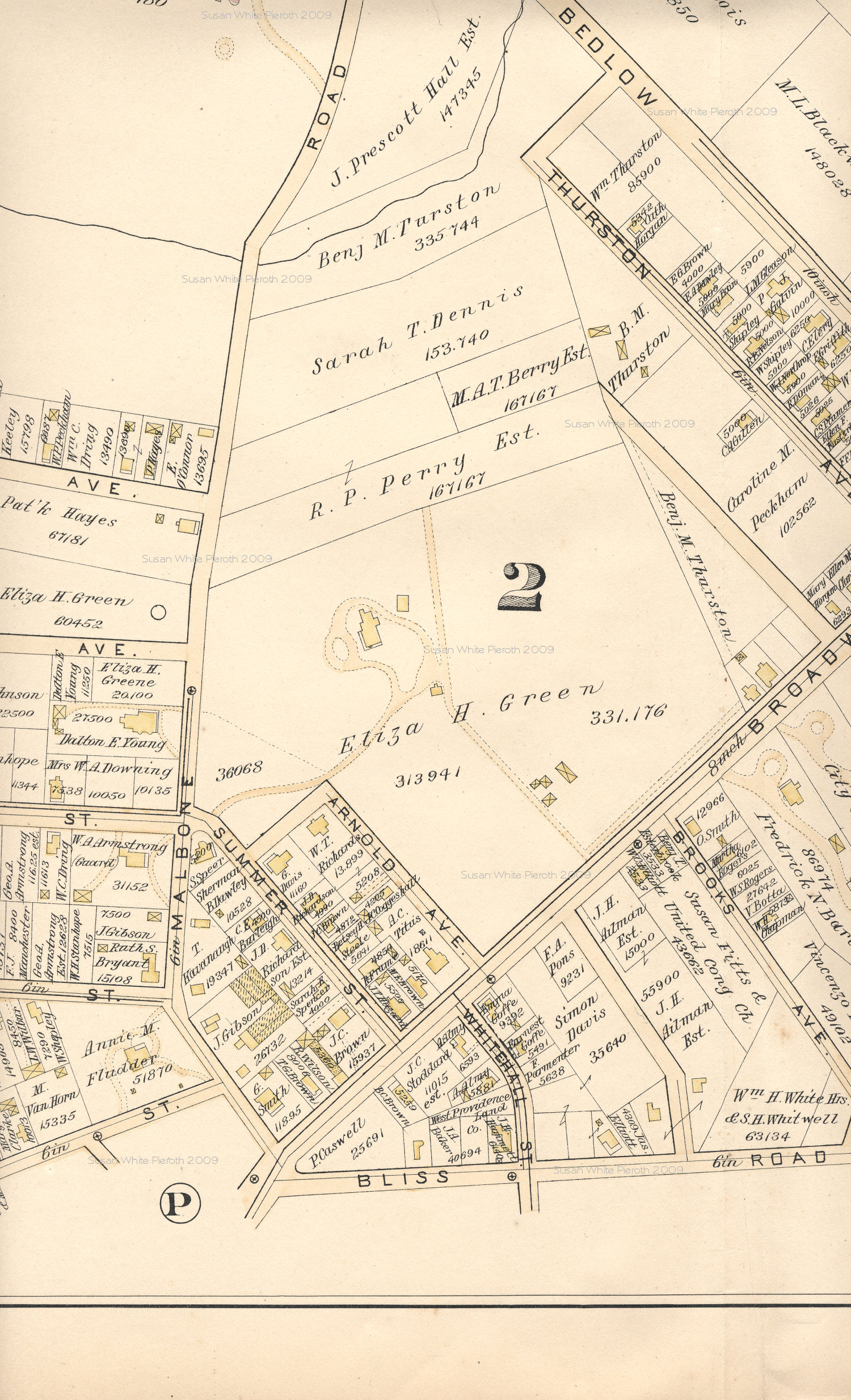
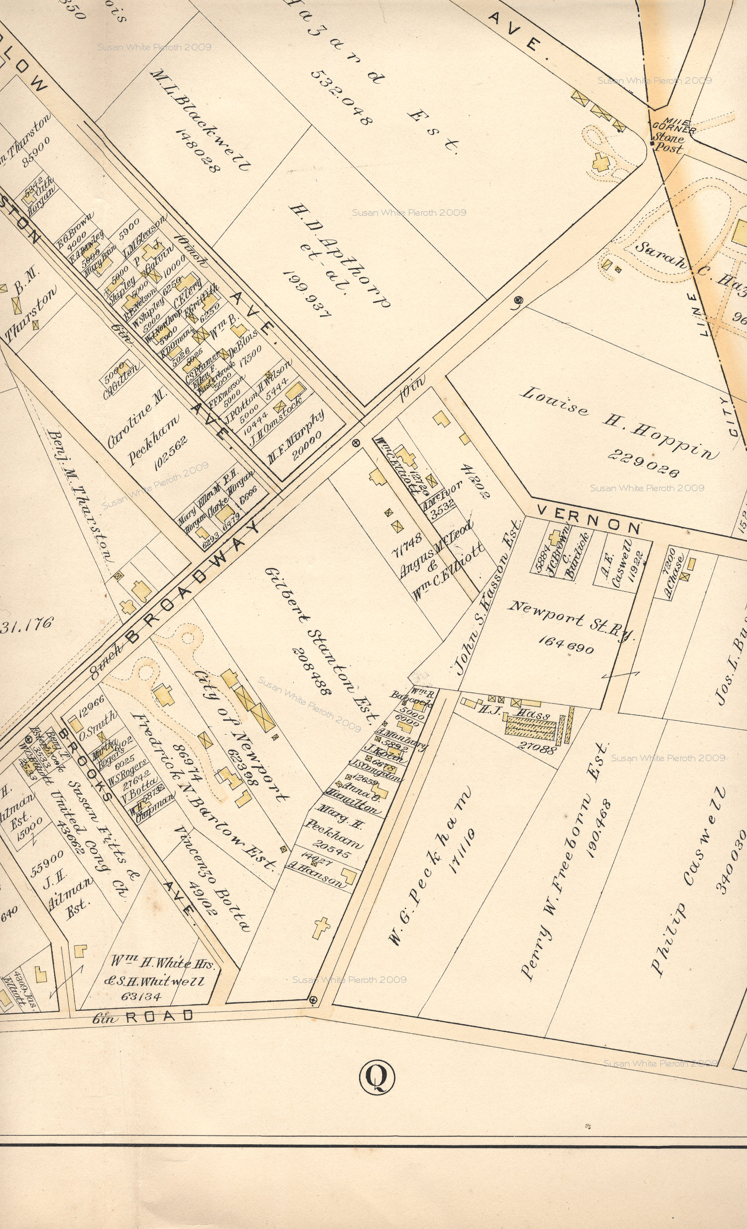
1893
Atlas of the City of Newport, Rhode Island - 4
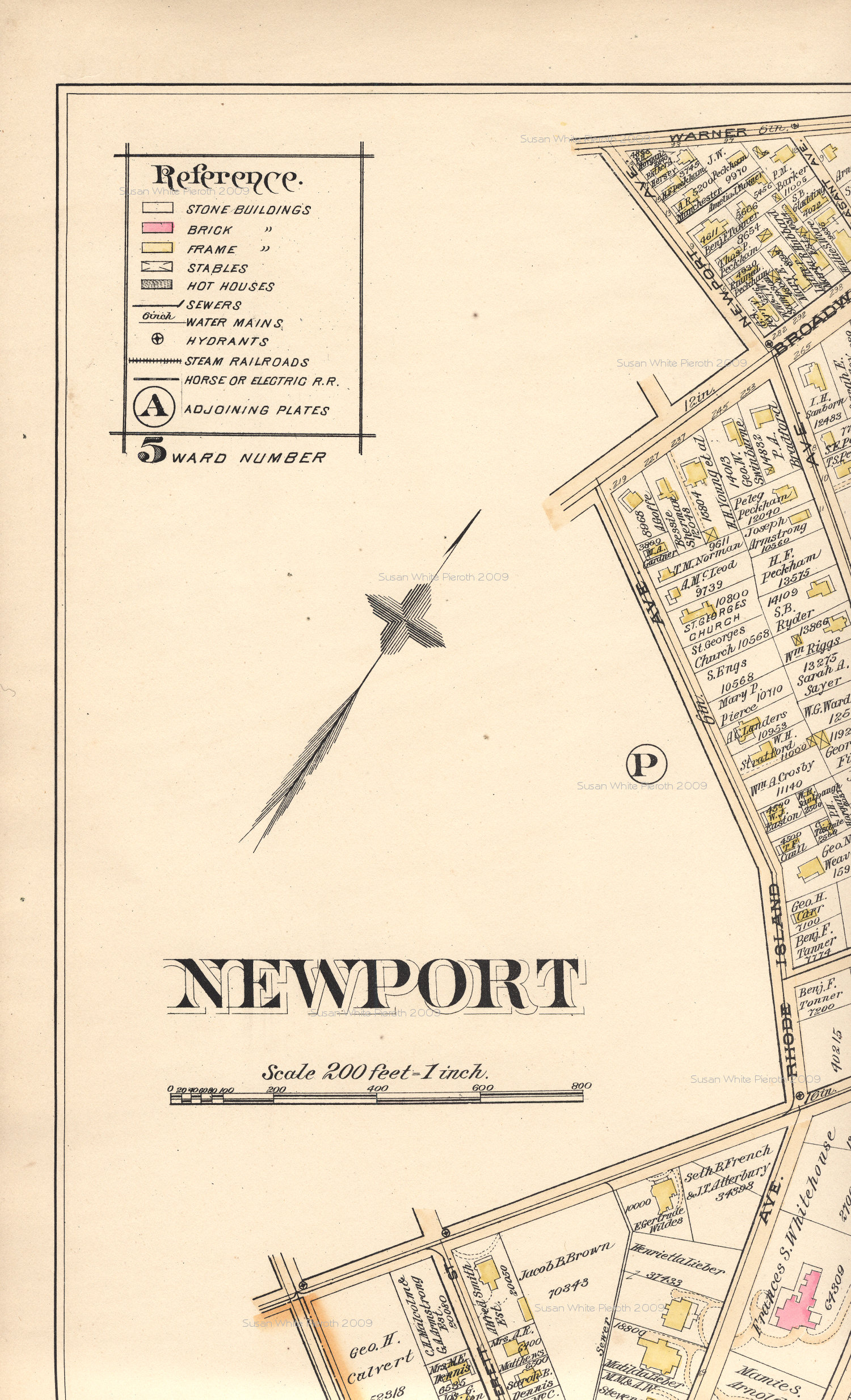
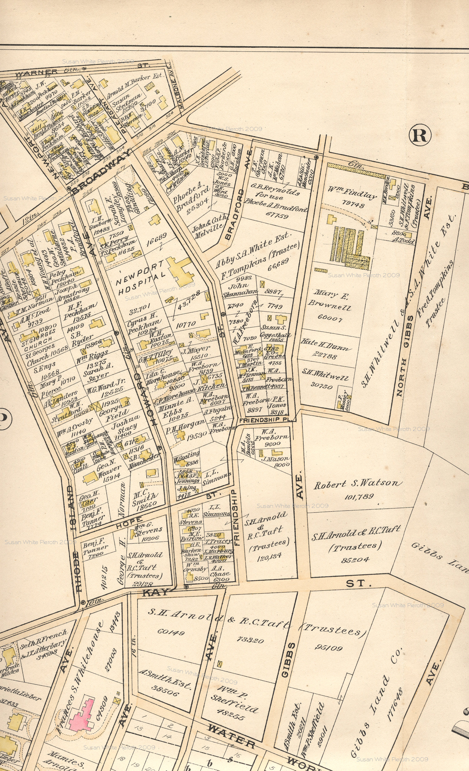
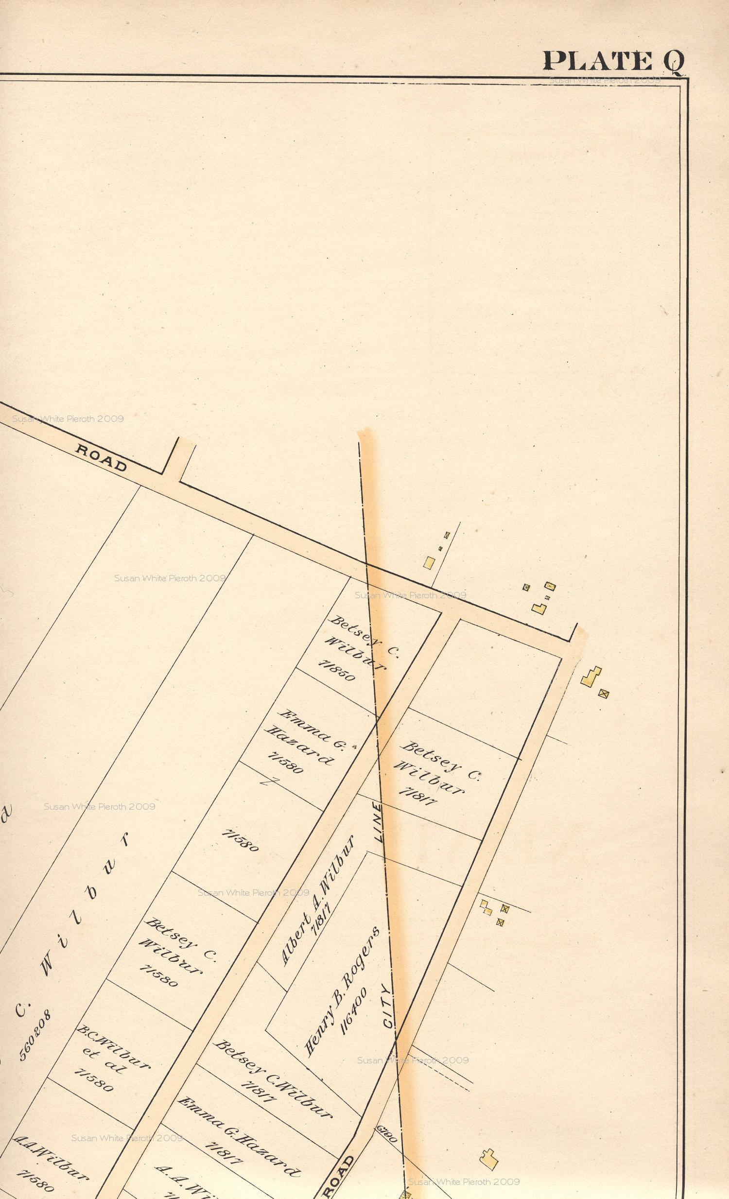
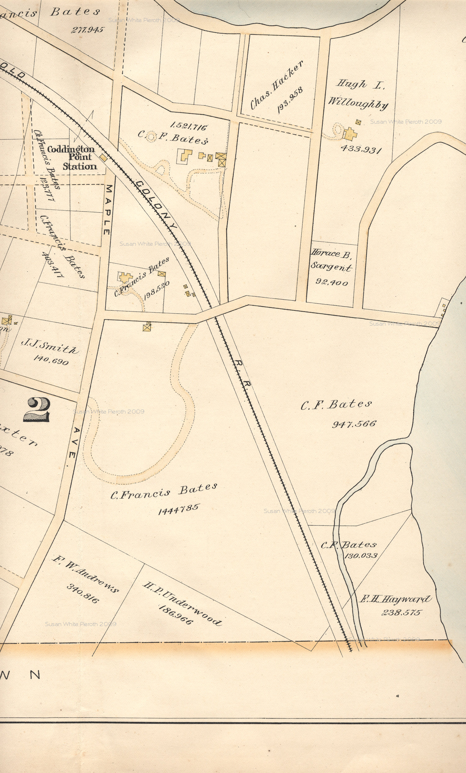
The individual plates of the atlas are
scanned in the same
pattern as the index page for a total of eight scans per plate. The one
exception is plate C, which is half the size. Although the
scans are all
done at the same resolution, the scale of the maps is not consistent
from
plate to plate, so you will not be able to paste sections together.
These are configured for viewing
on your computer. For printing, save and use an imaging
program.
Links to Scans of Individual
Plates
| A | B
| C | D
| E | F
| G | H
| I | J
| K | L
| M | N
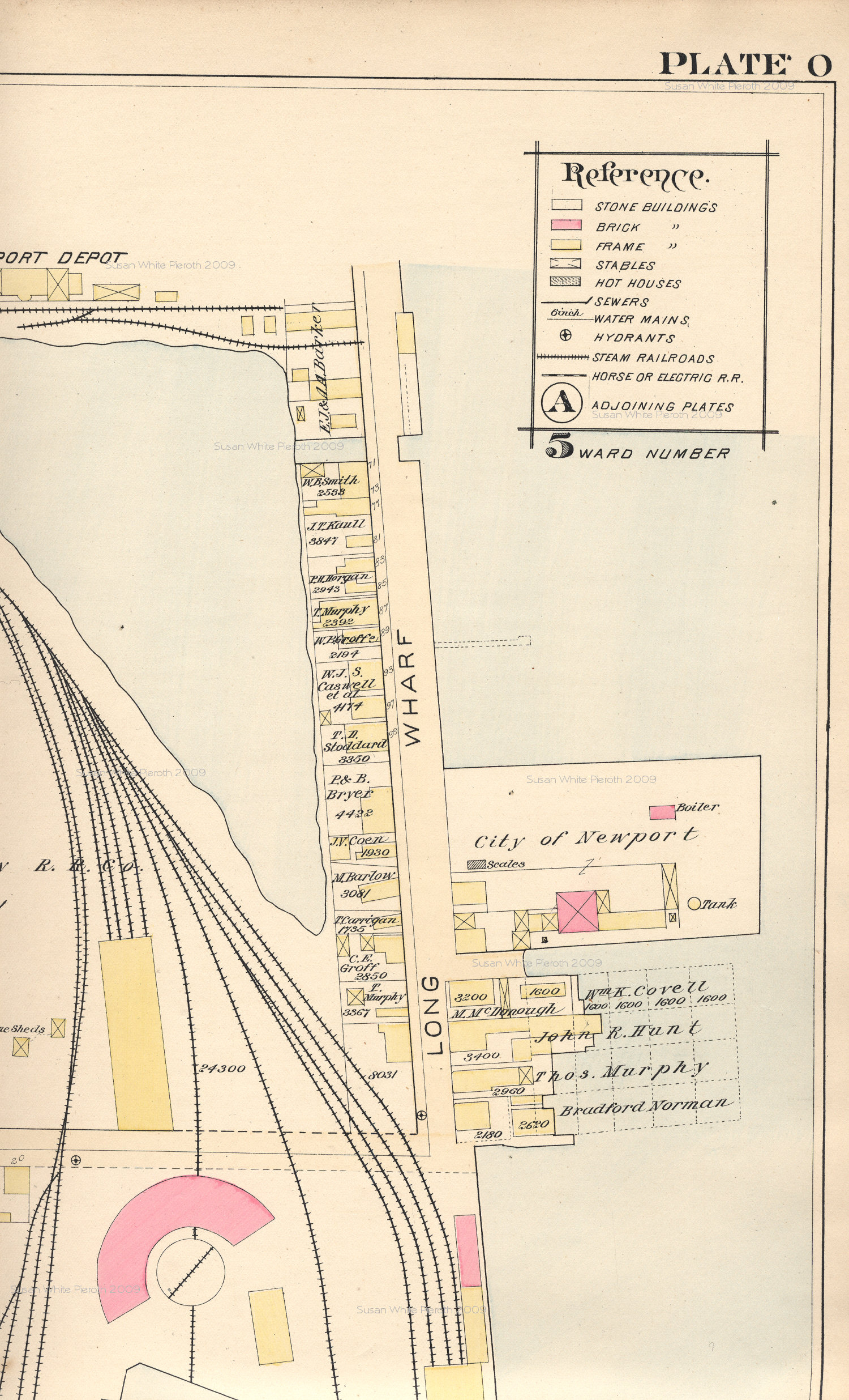
| O | P
| Q | R
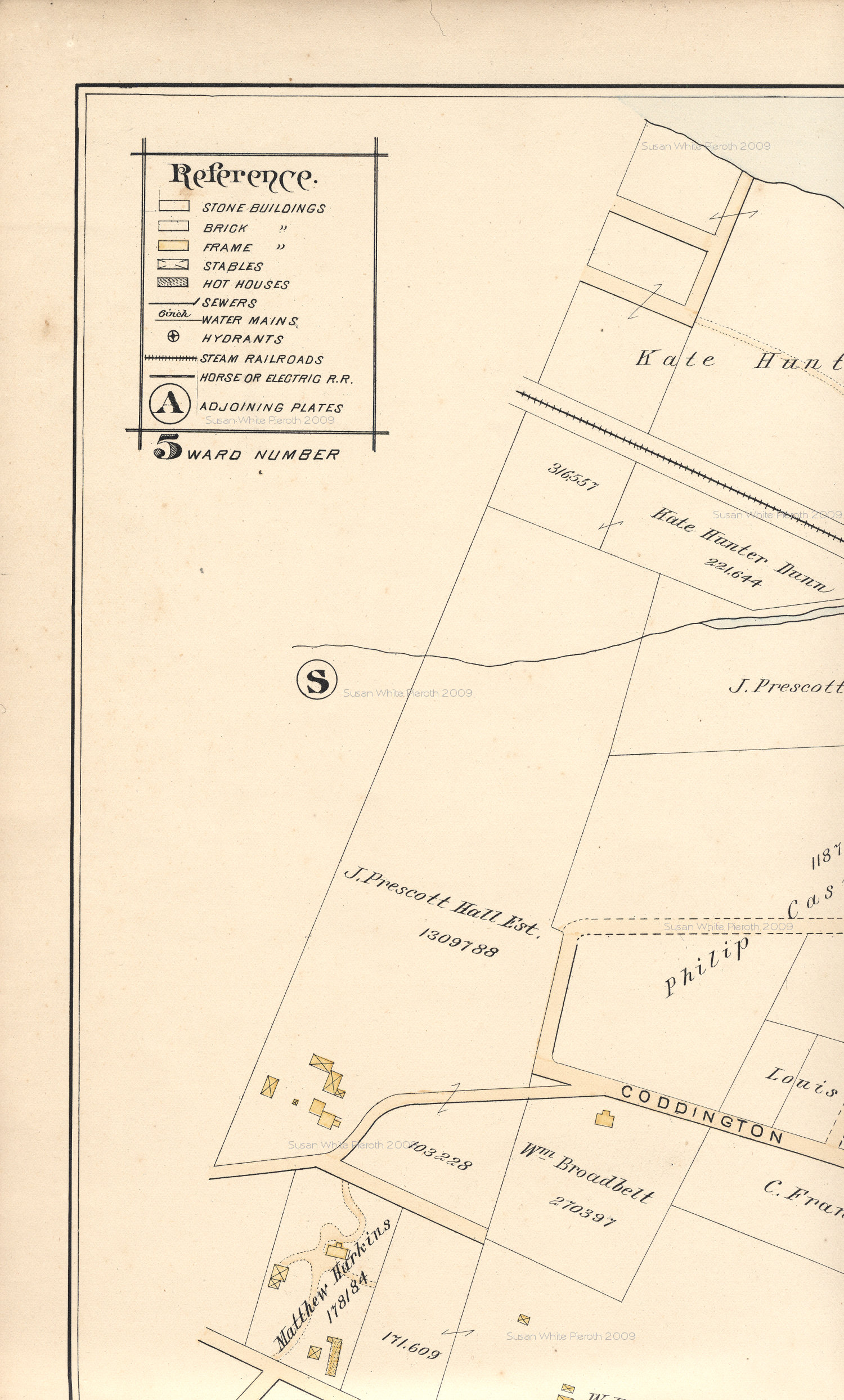
| S | T
| Middletown &
Portsmouth |
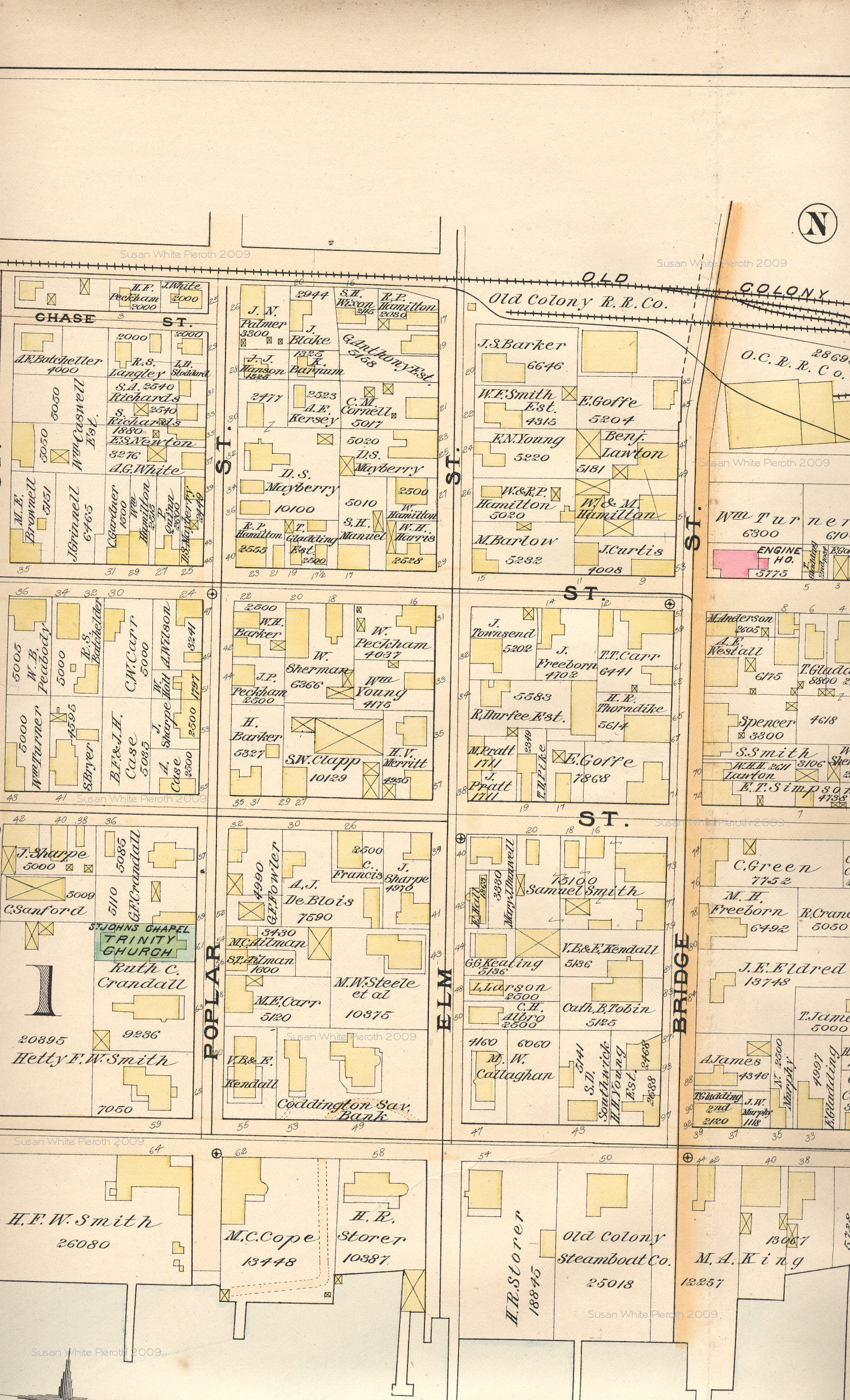
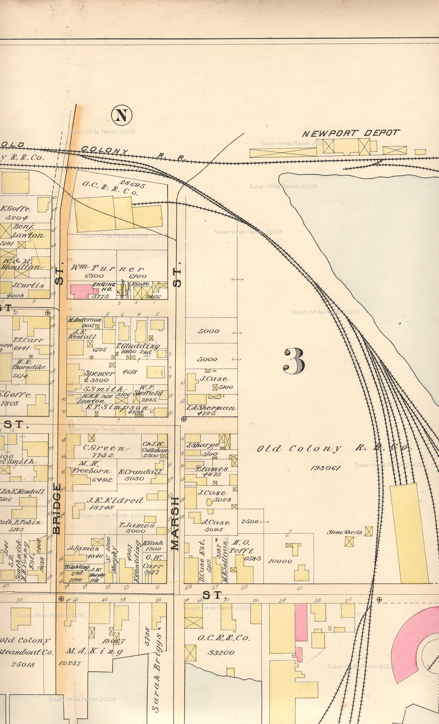
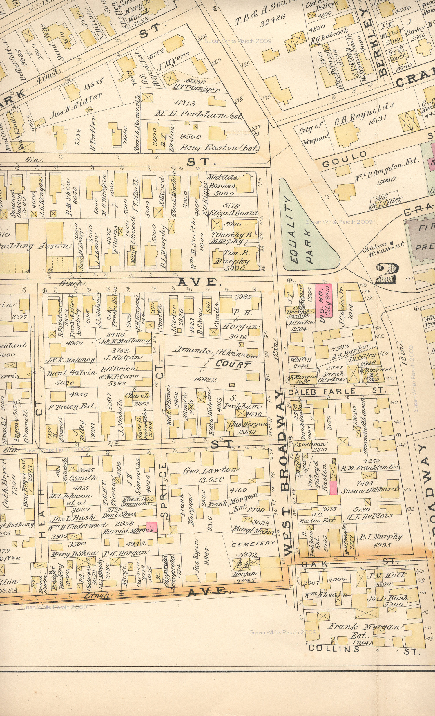
Plate N:
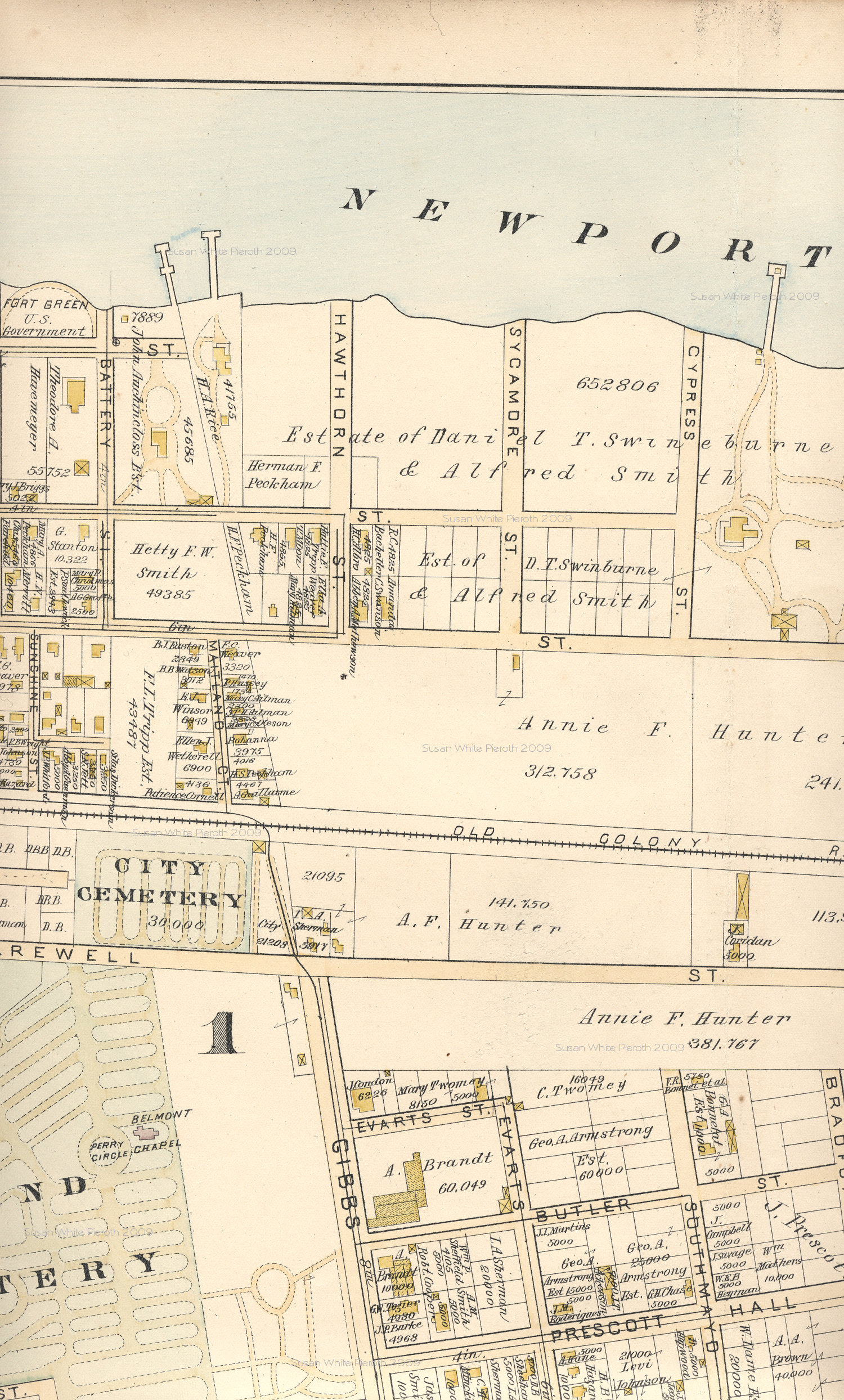
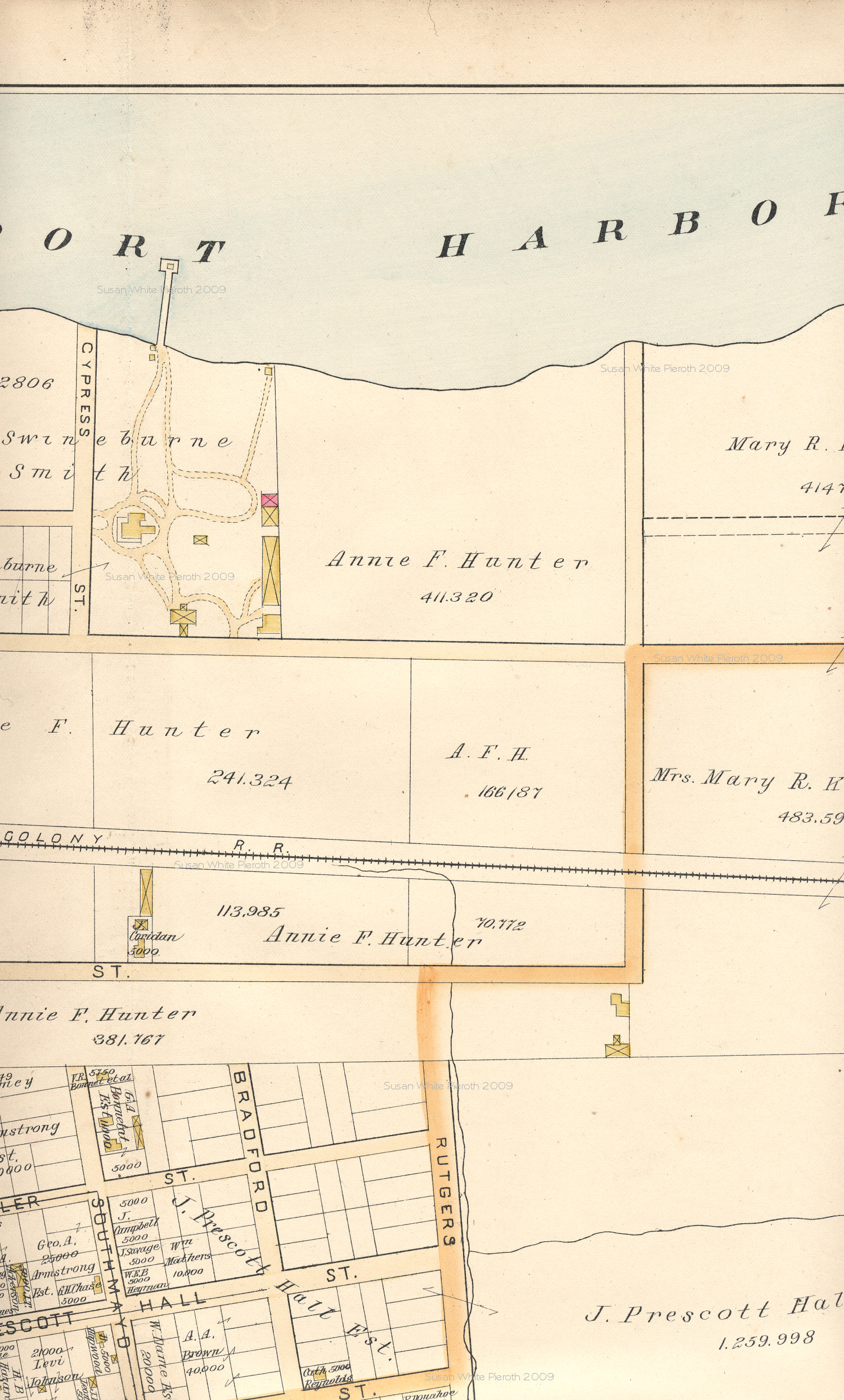
Plate O:
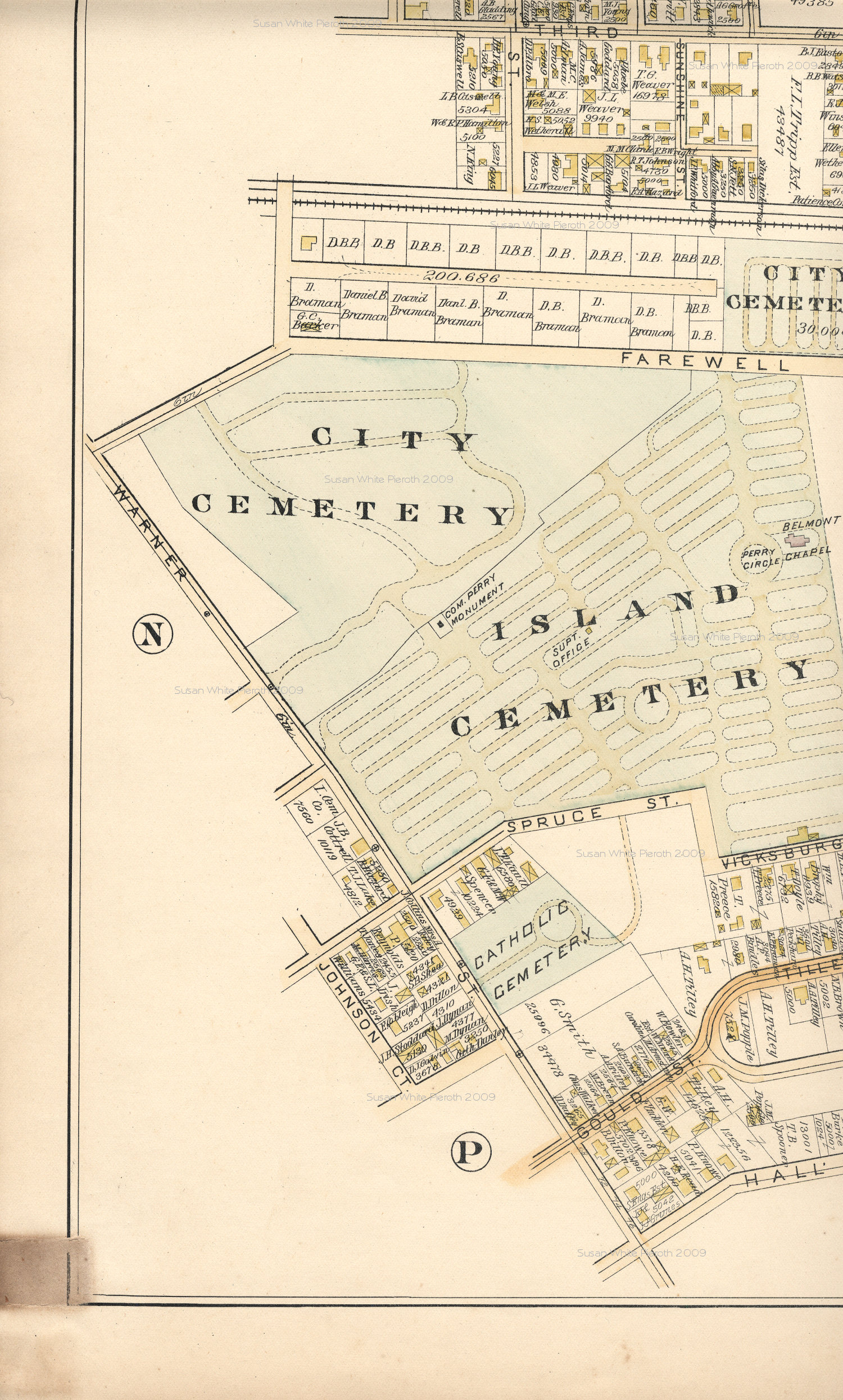
Plate P:
Plate Q:
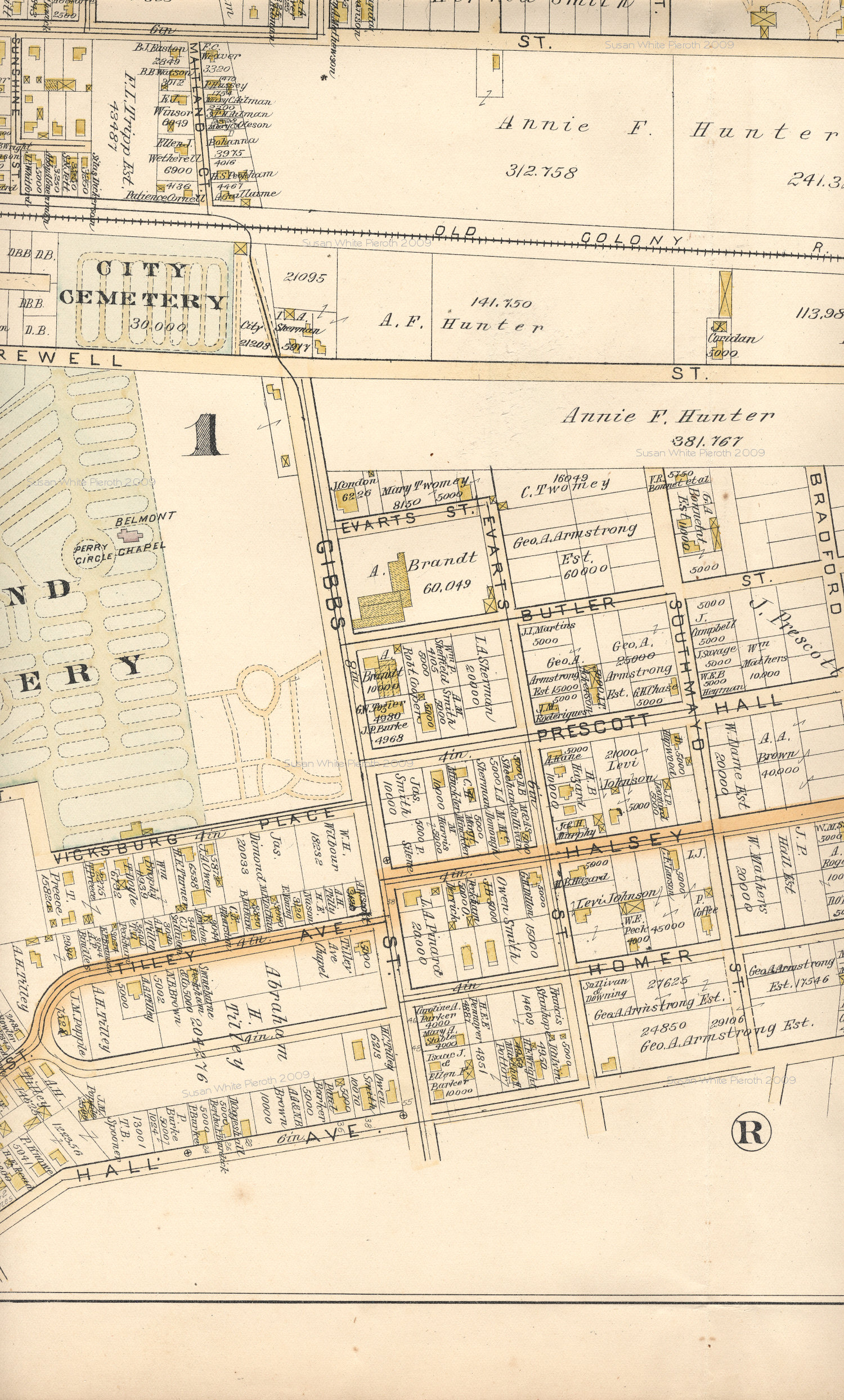
Plate R:
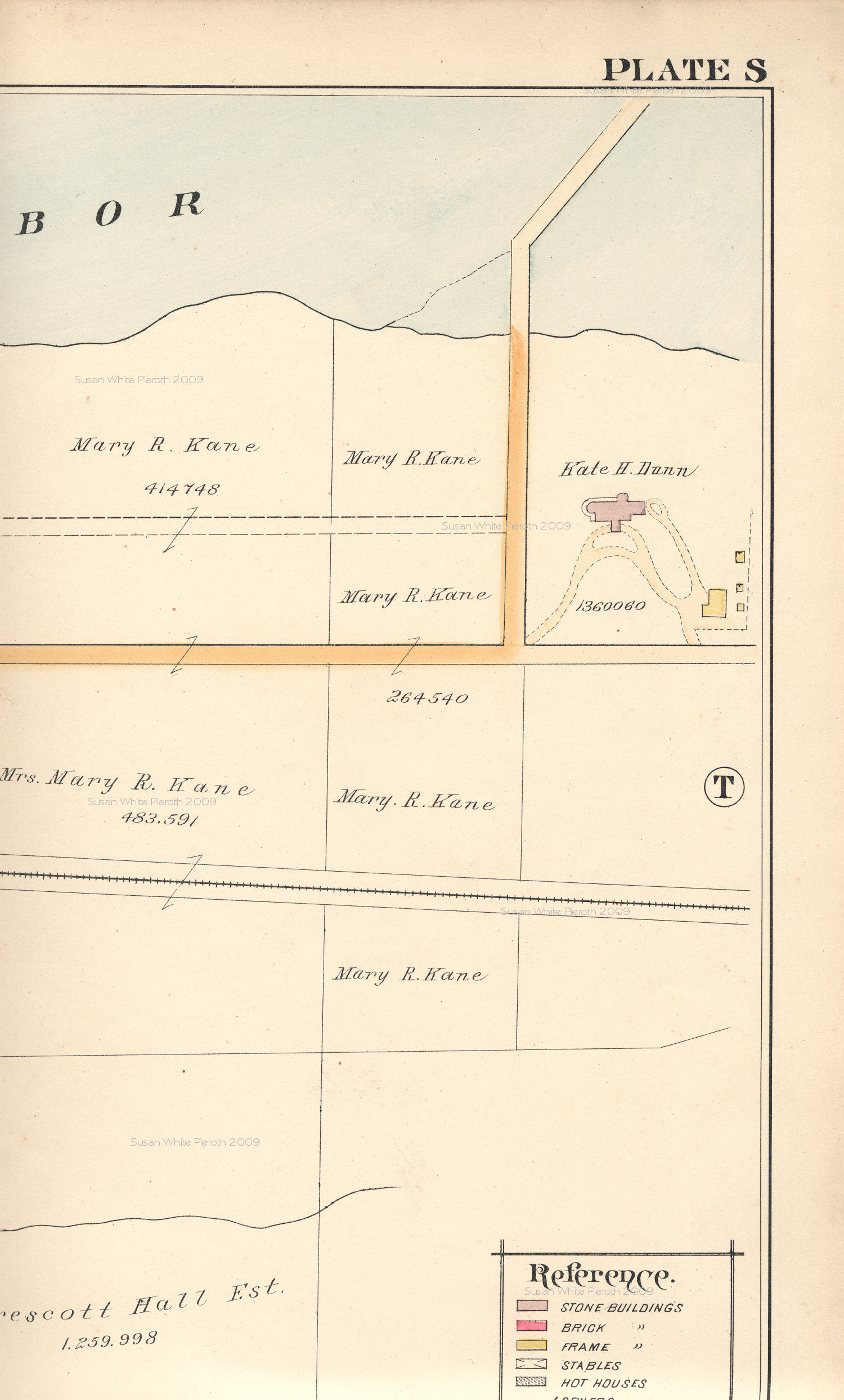
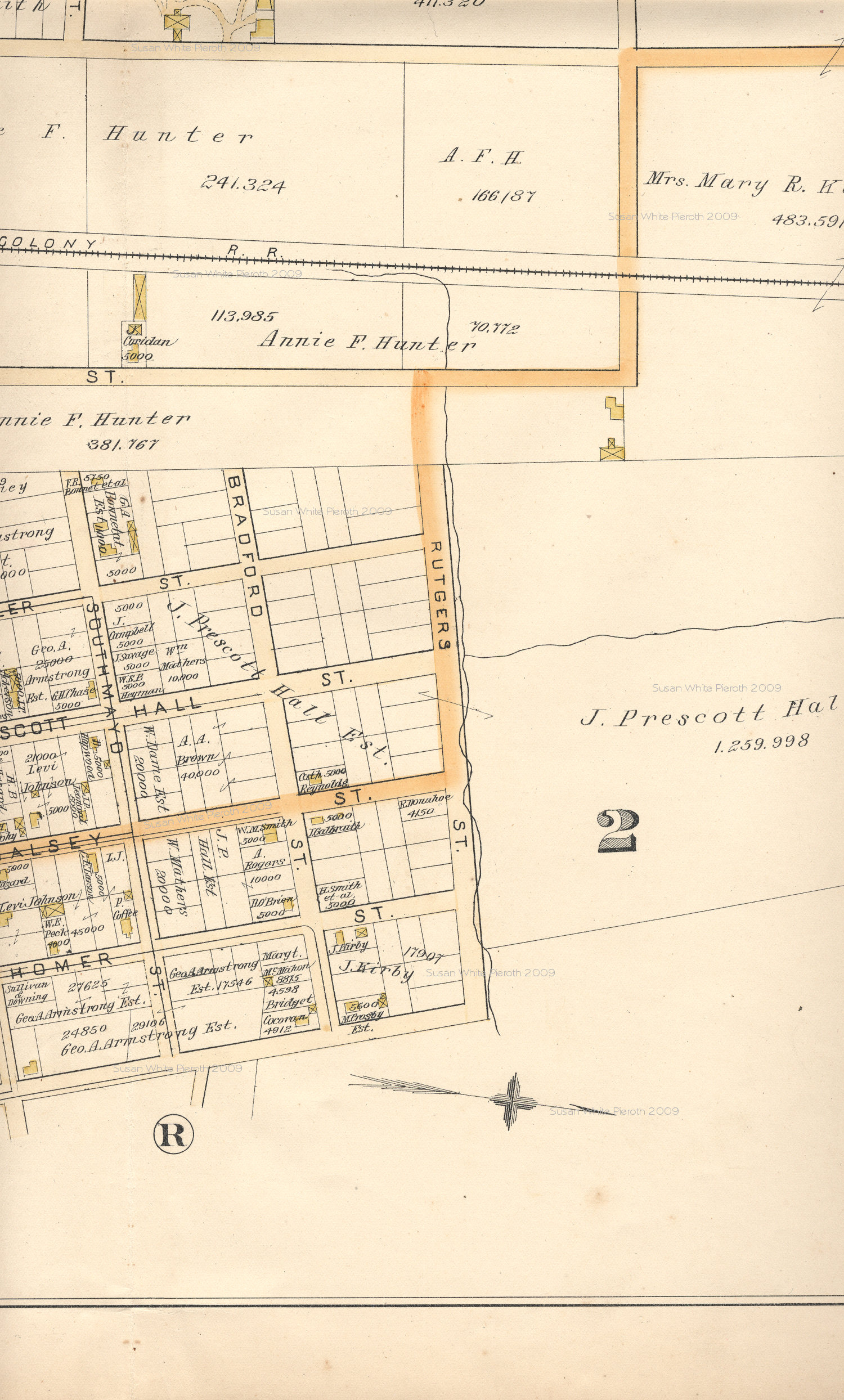
Plate S:
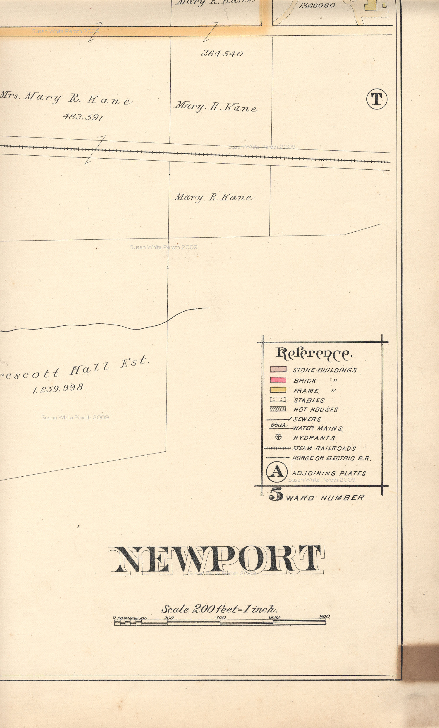
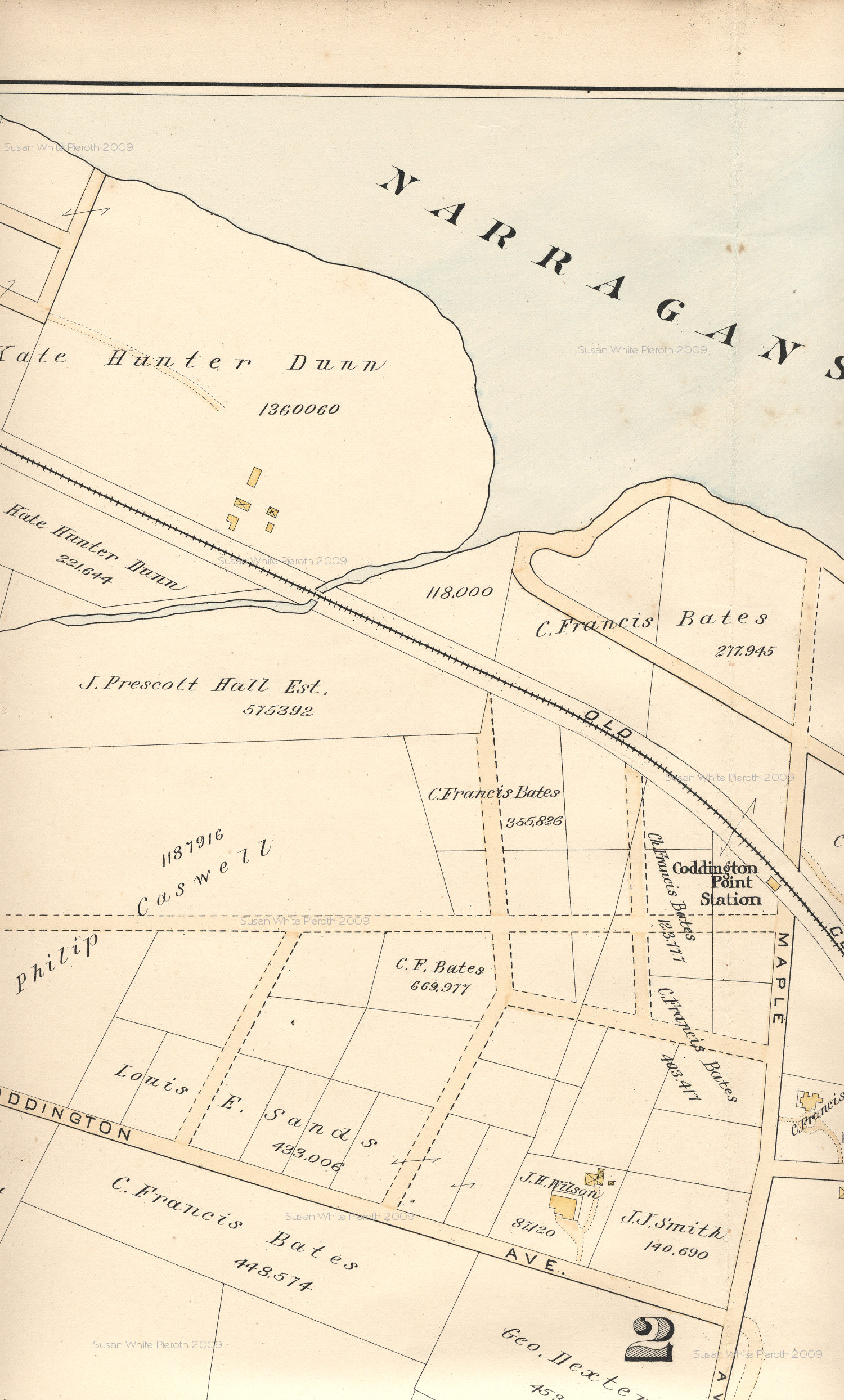
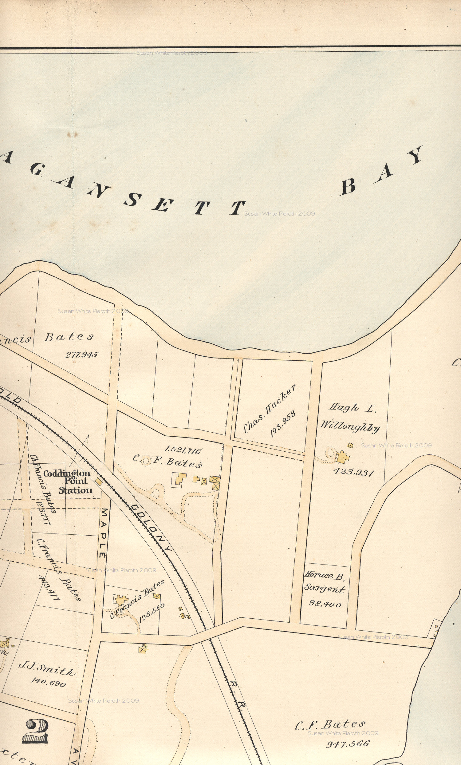
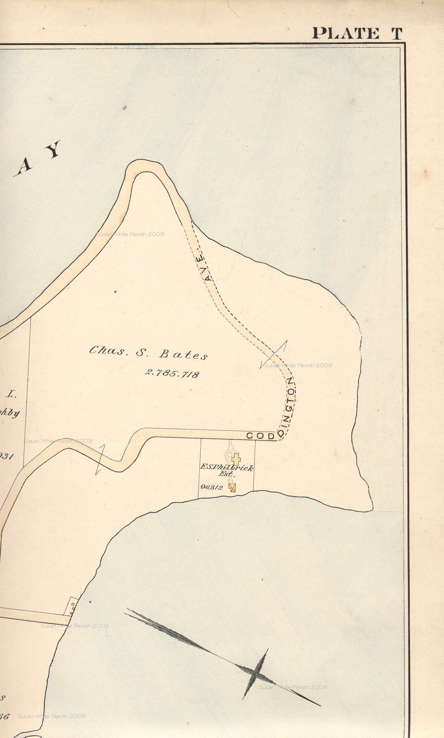
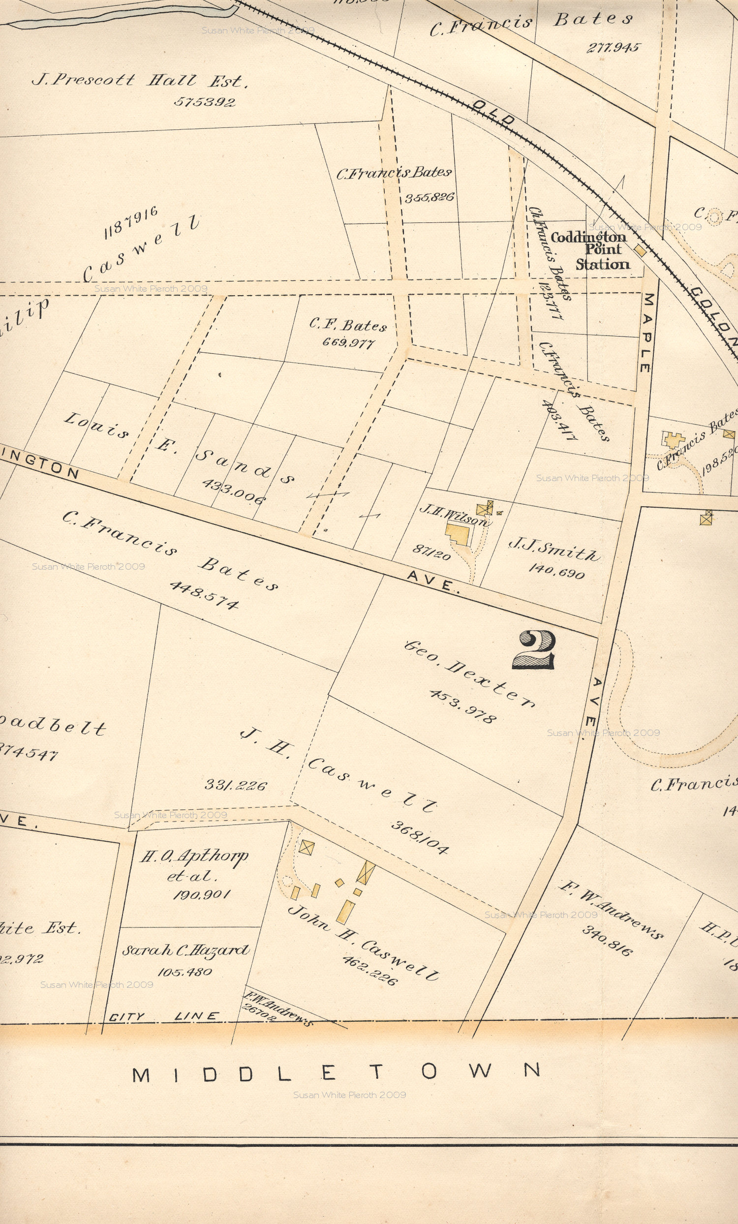
Plate T:
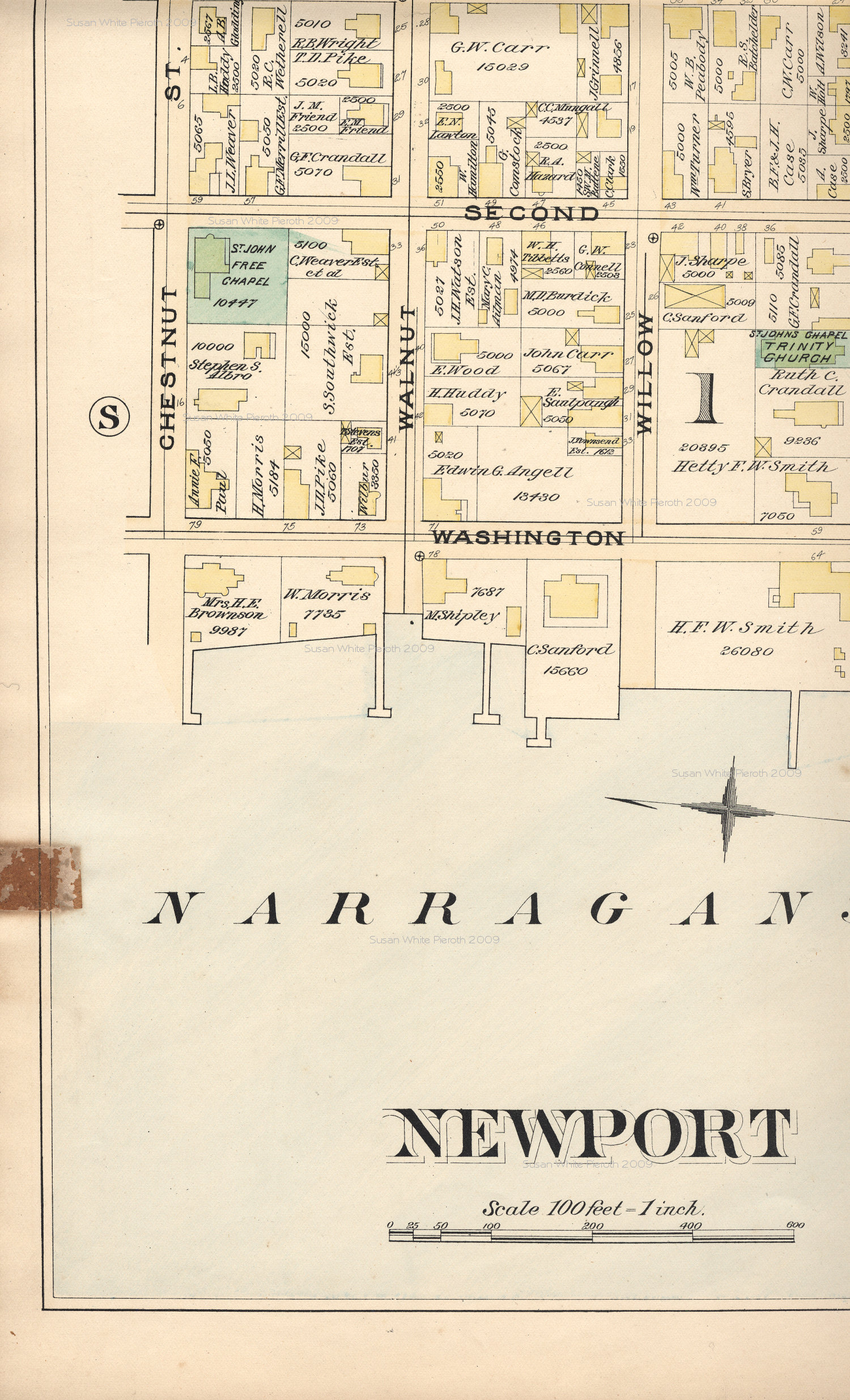
Map scans copyrighted by Susan
White Pieroth, 2002-9. These maps are made available to the public for
non-commercial purposes. If you wish to incorporate this document, or
any
scanned image, into any published work (including an internet page),
you
must first obtain permission from Susan White Pieroth.
To the 1893 Middletown and
Portsmouth Map
Back to the Map Index Page