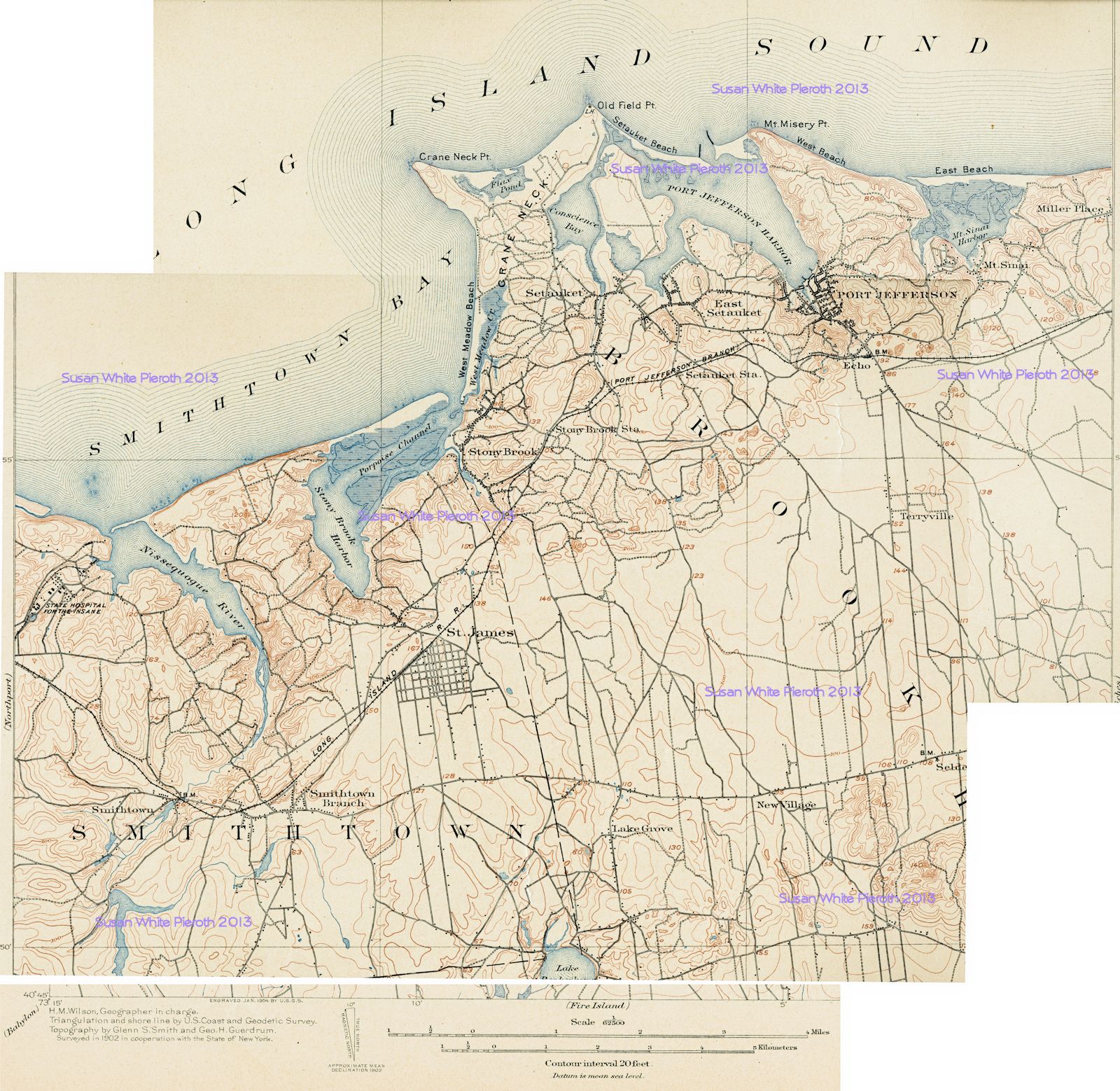
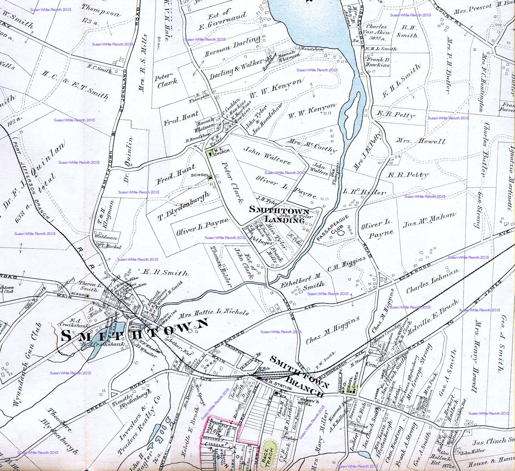
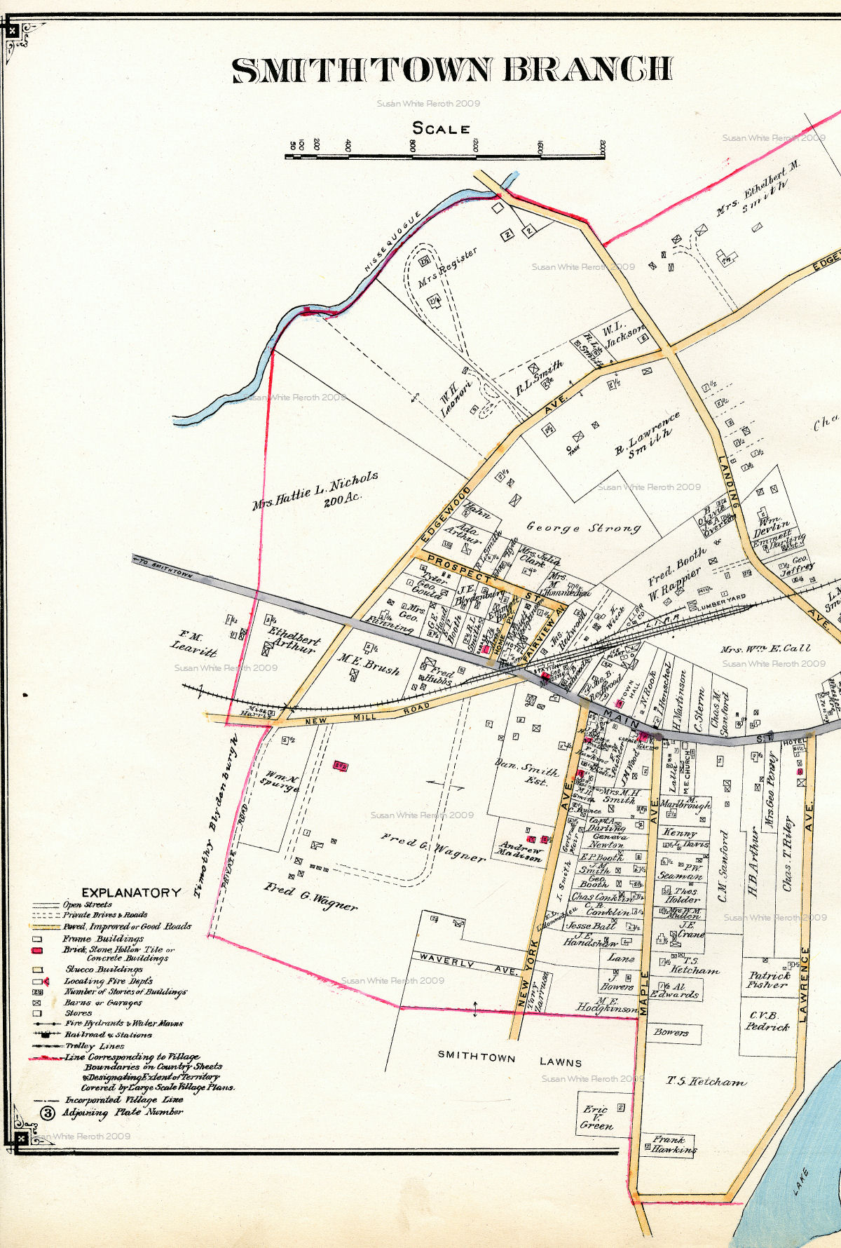
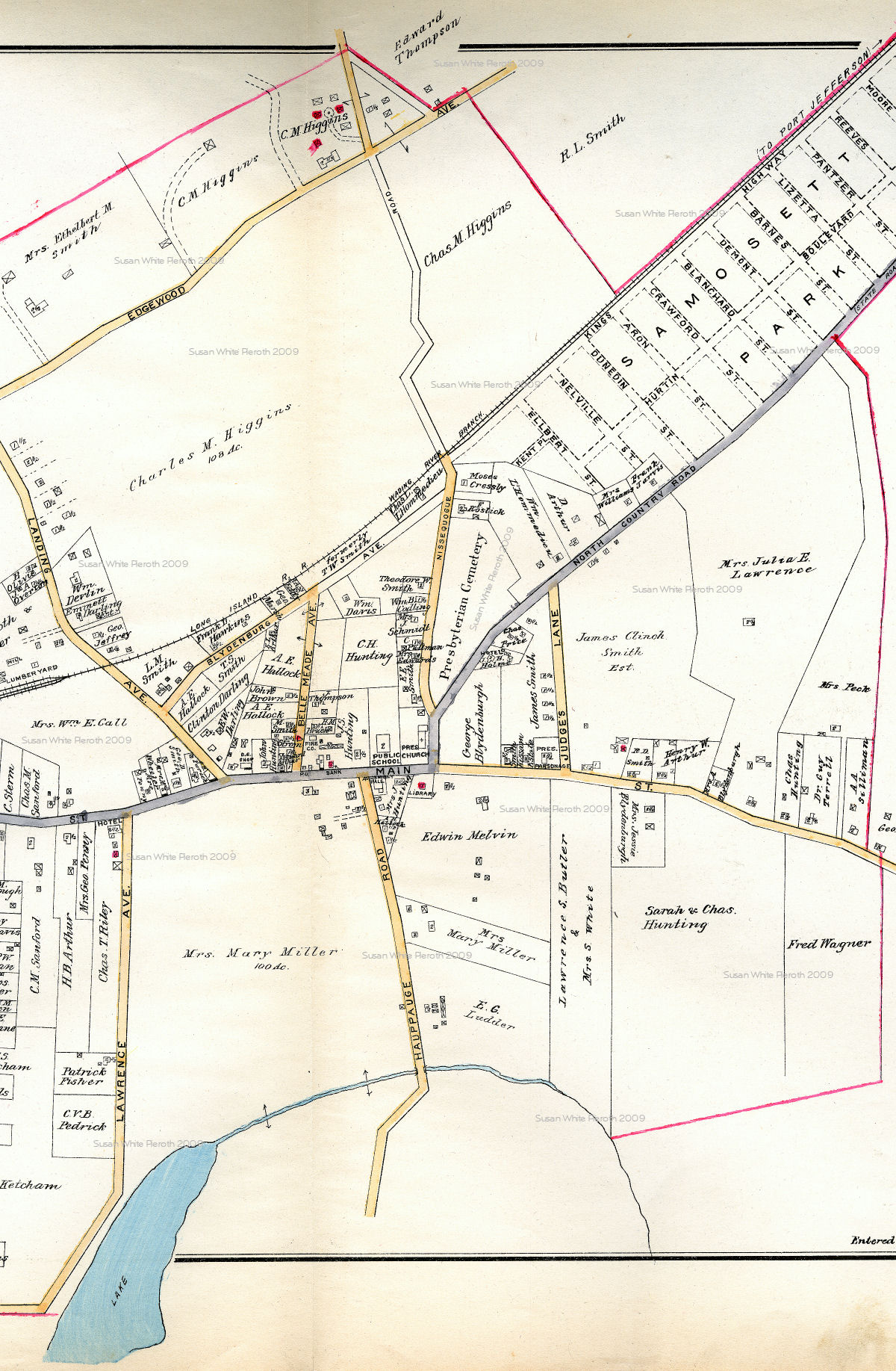
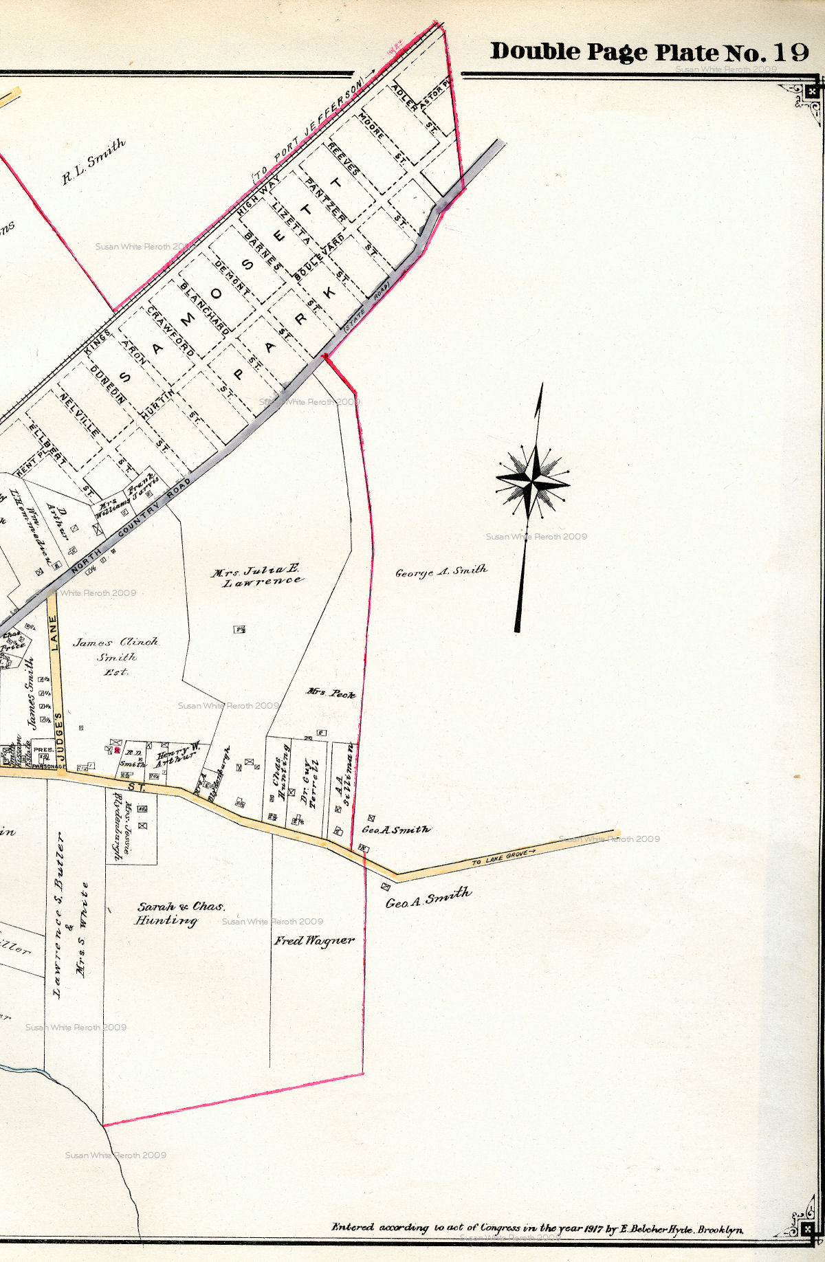
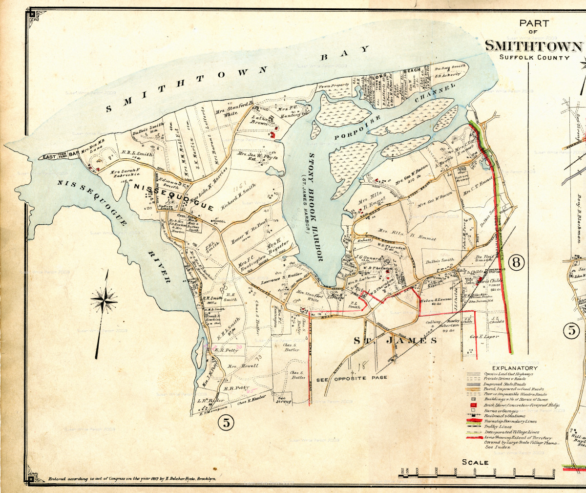
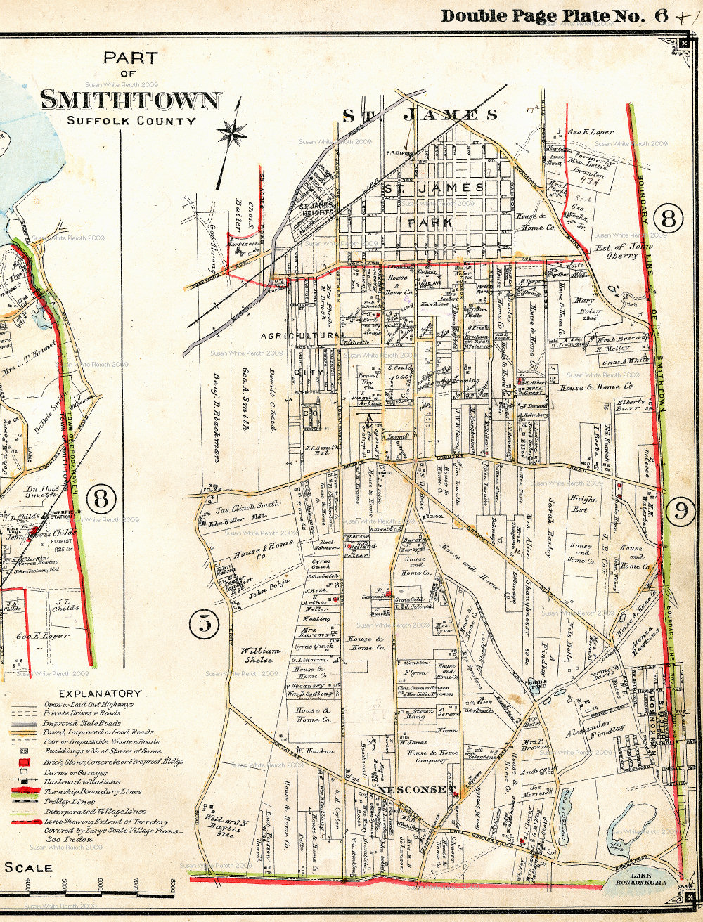
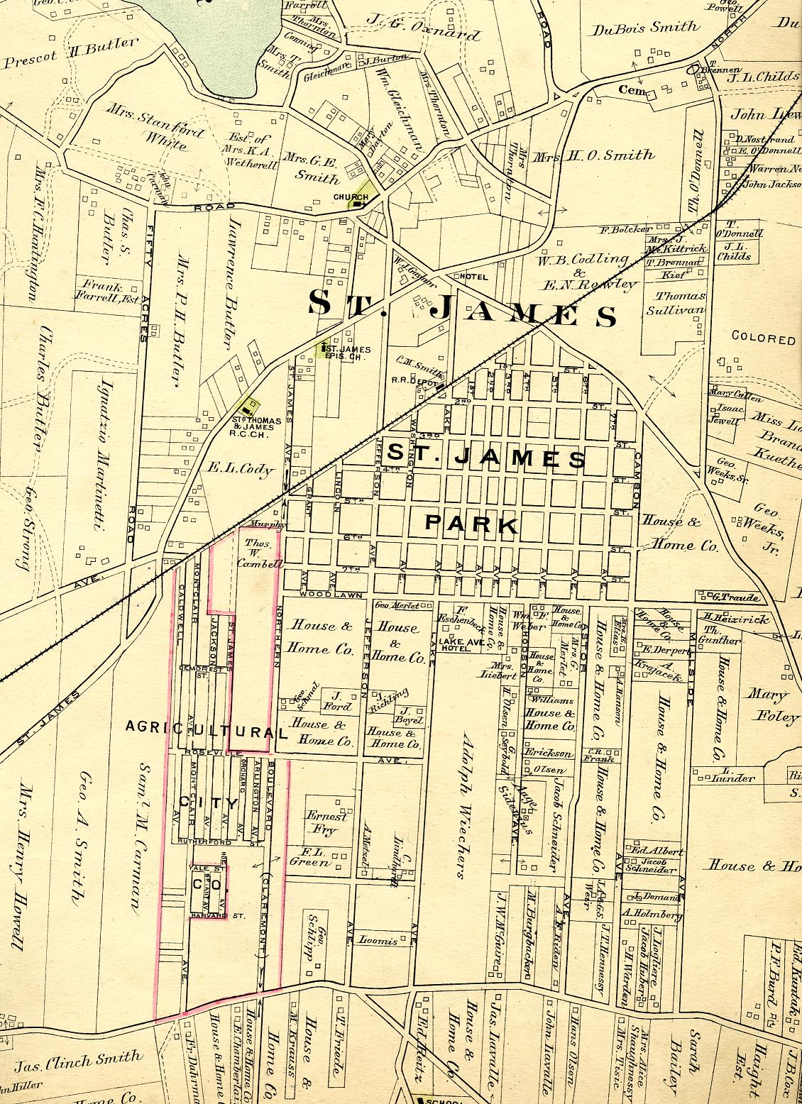
Scans of old maps I have collected of places I have lived and liked.
All images and text Copyright © 2001-13 Susan White Pieroth
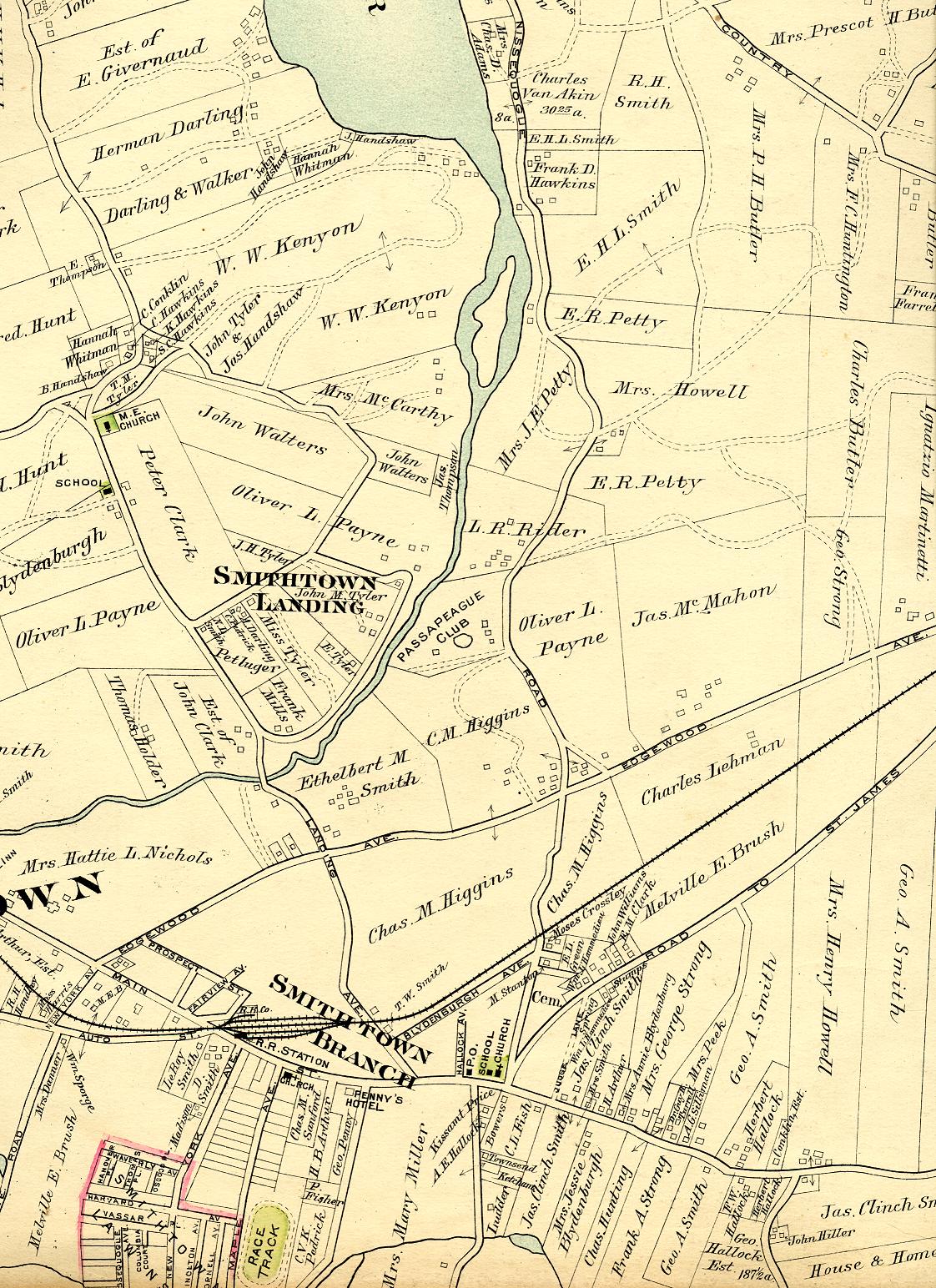
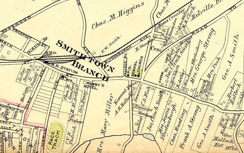
1873 Beers Maps
|
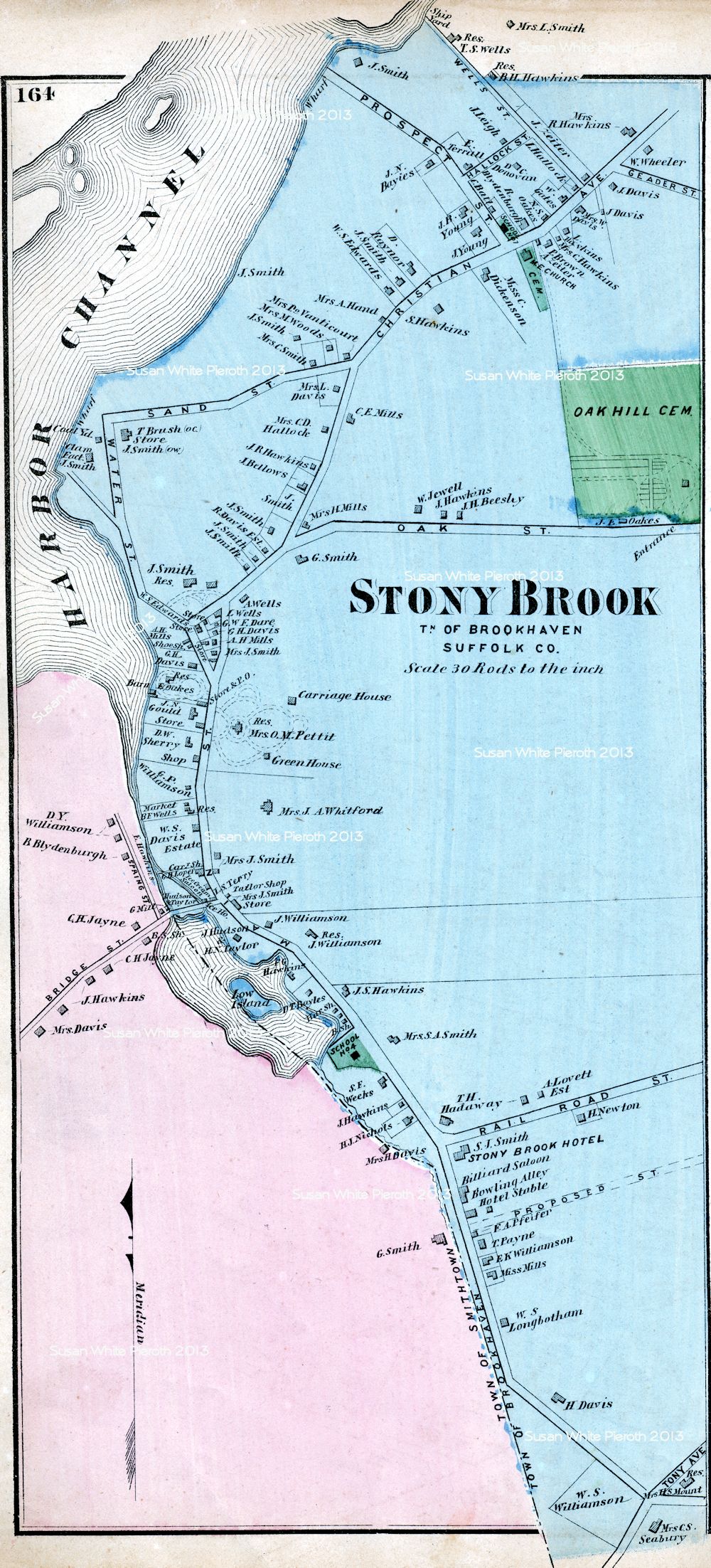
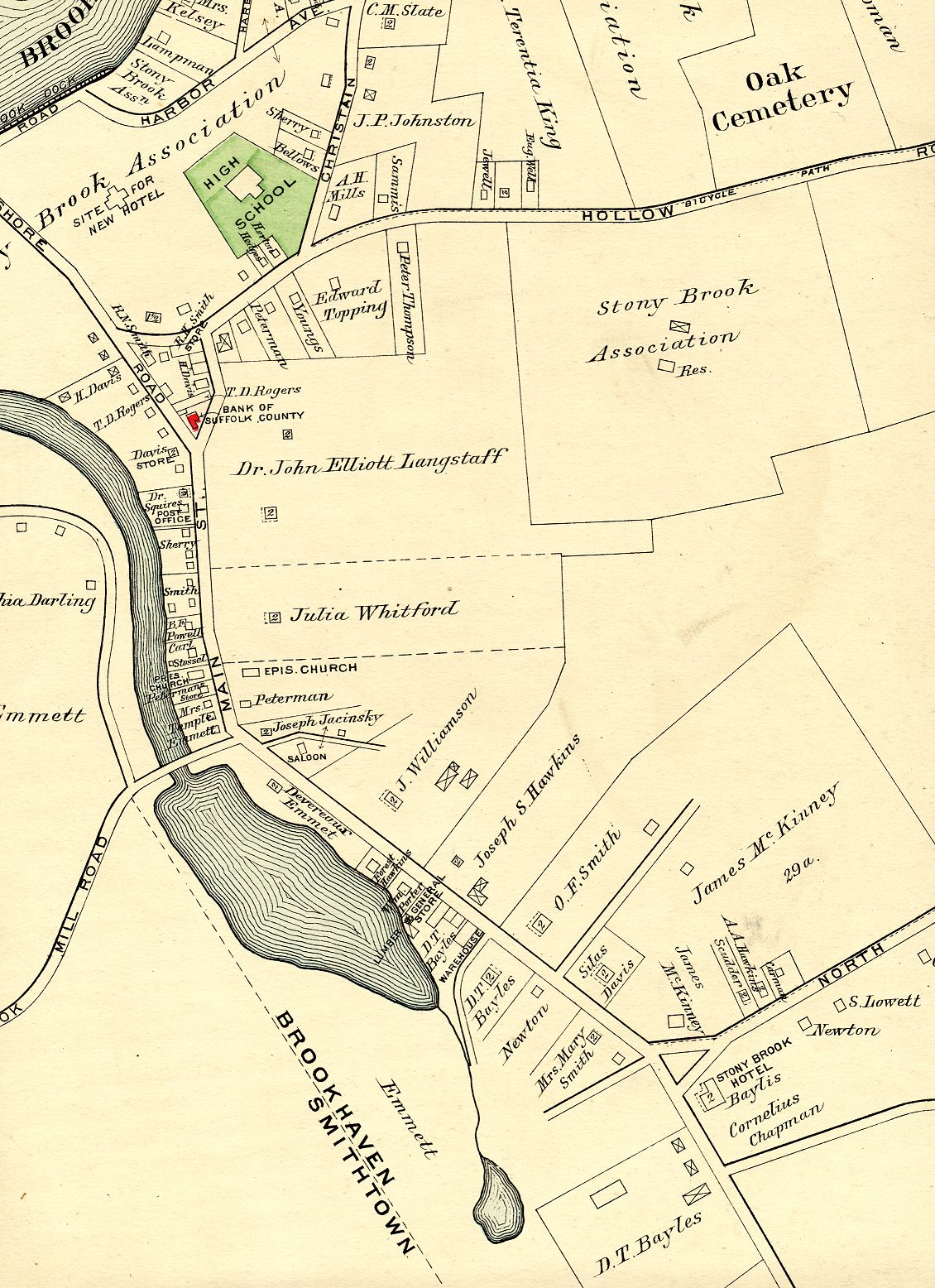
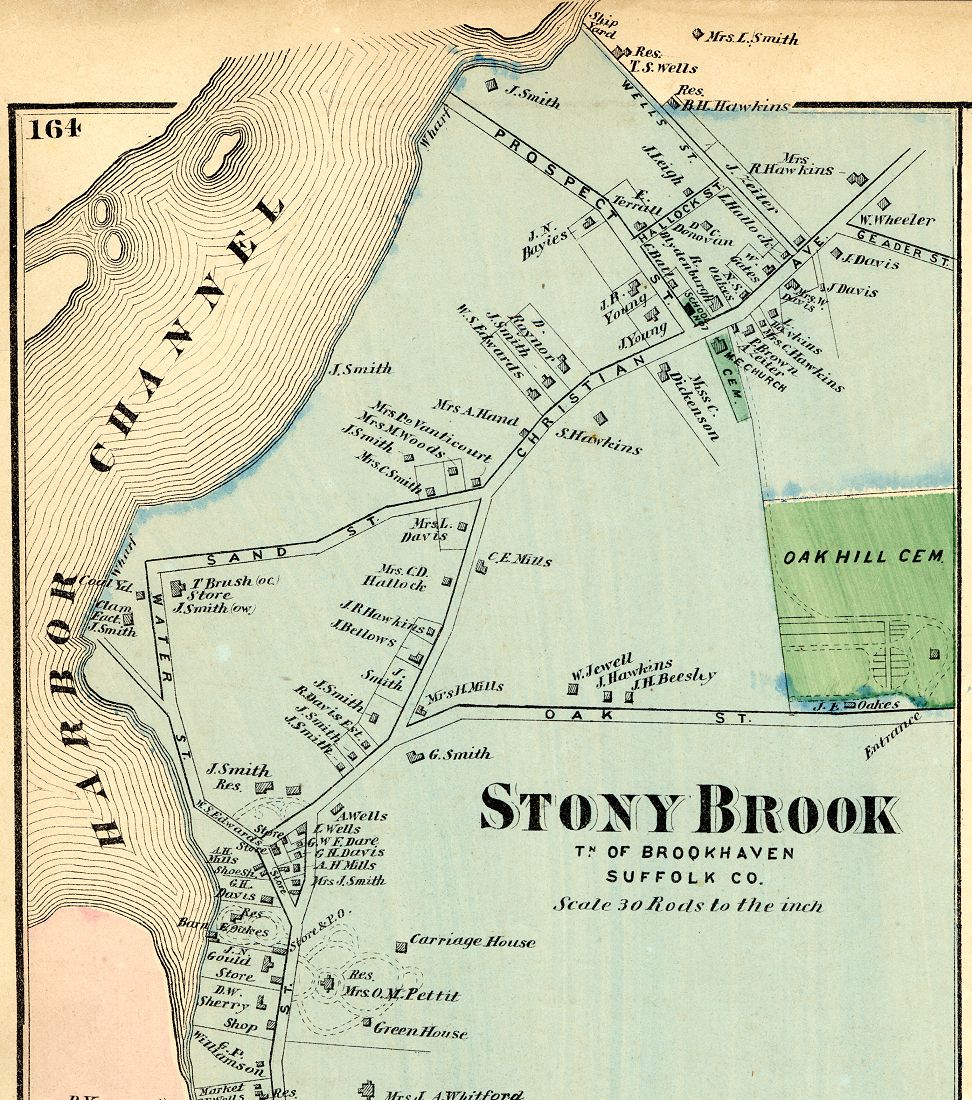
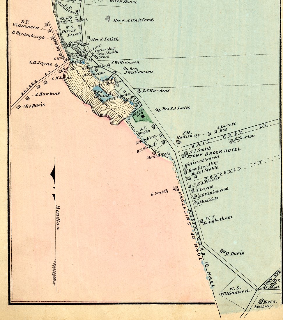
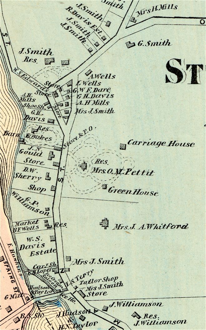
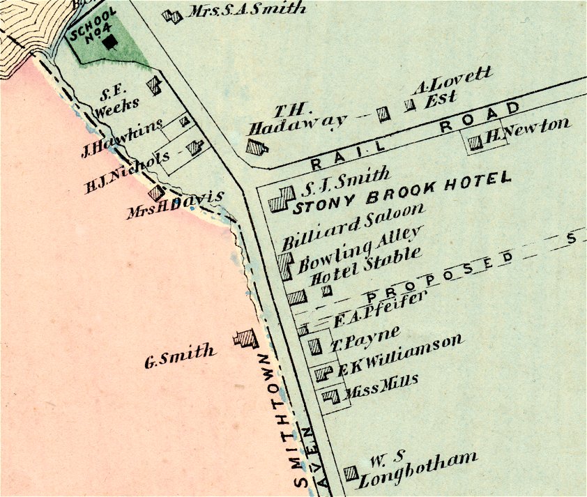
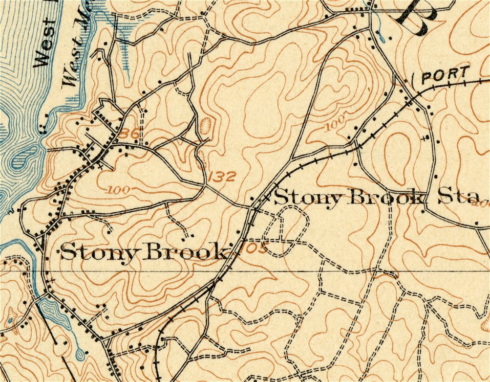
Stony Brook 1873 StonyBrook1873top.jpg StonyBrook1873bottom.jpg StonyBrook1873center.jpg - enlarged detail StonyBrook1873hotel.jpg - enlarged detail around hotel |
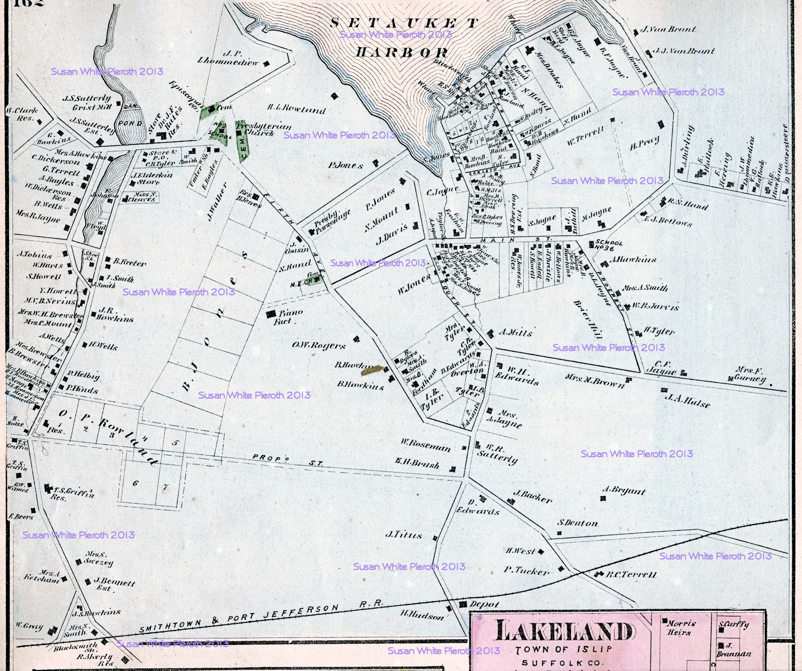 |
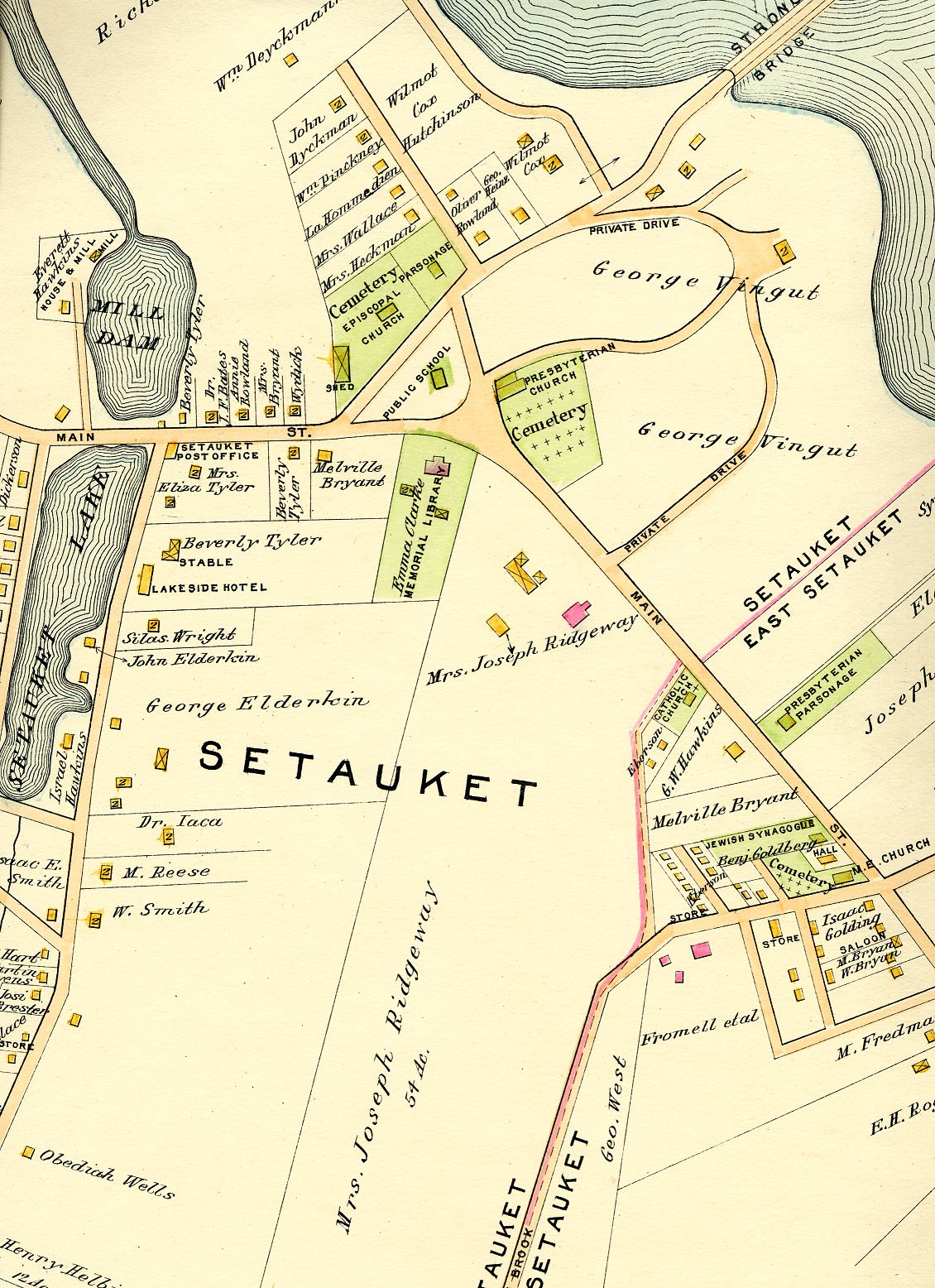
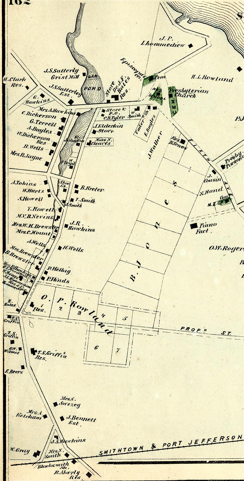
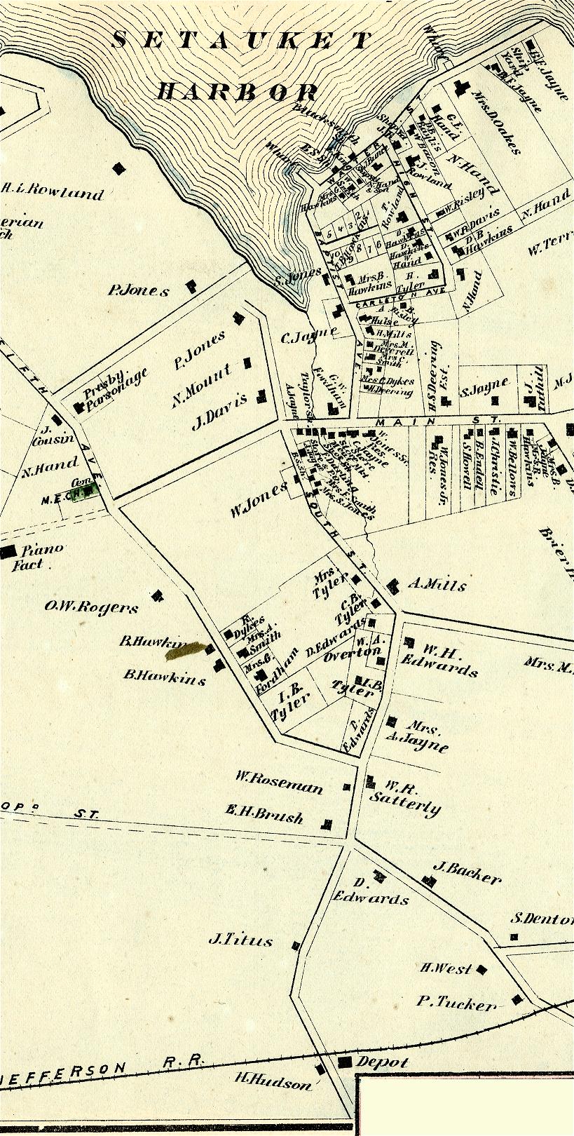
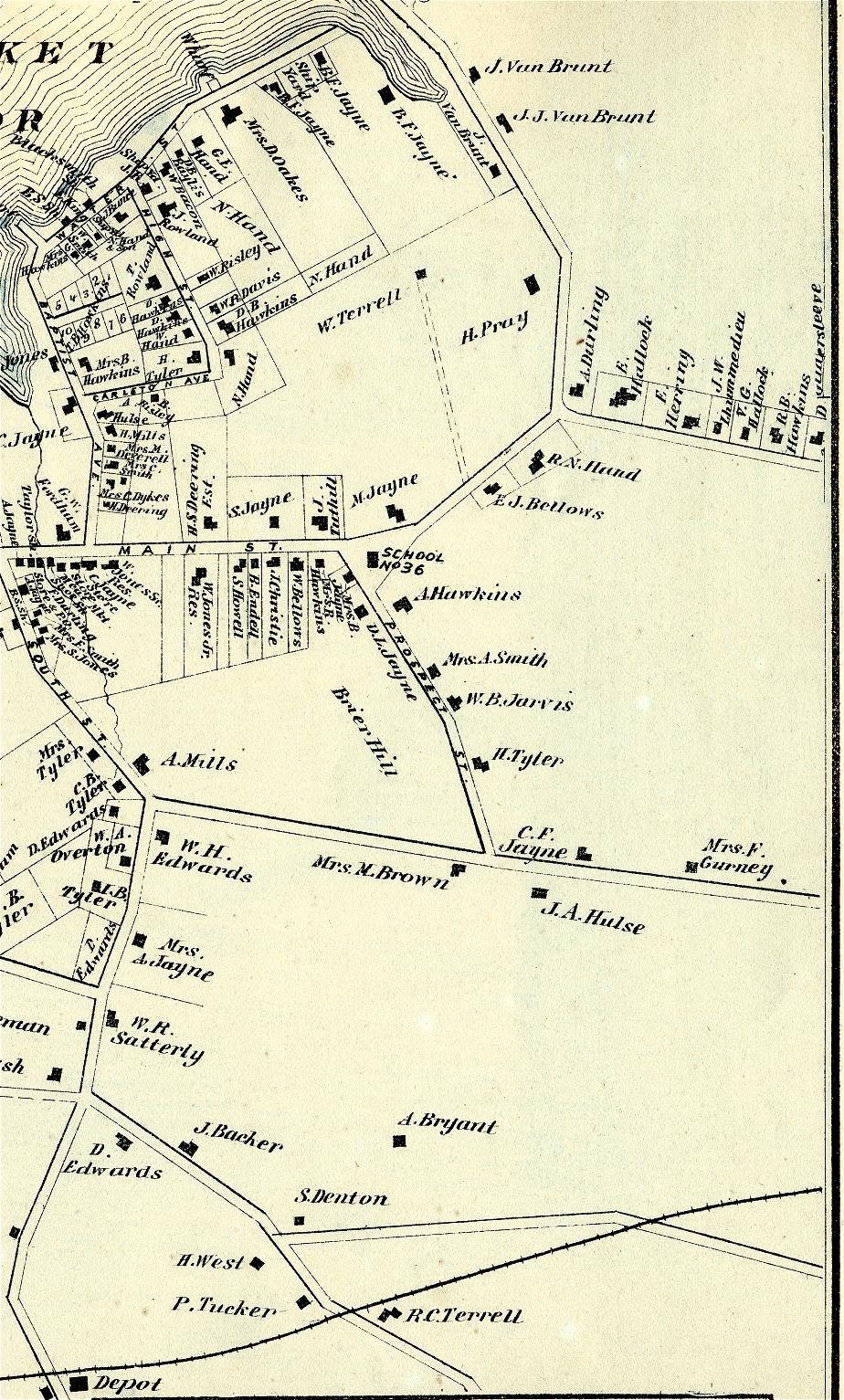
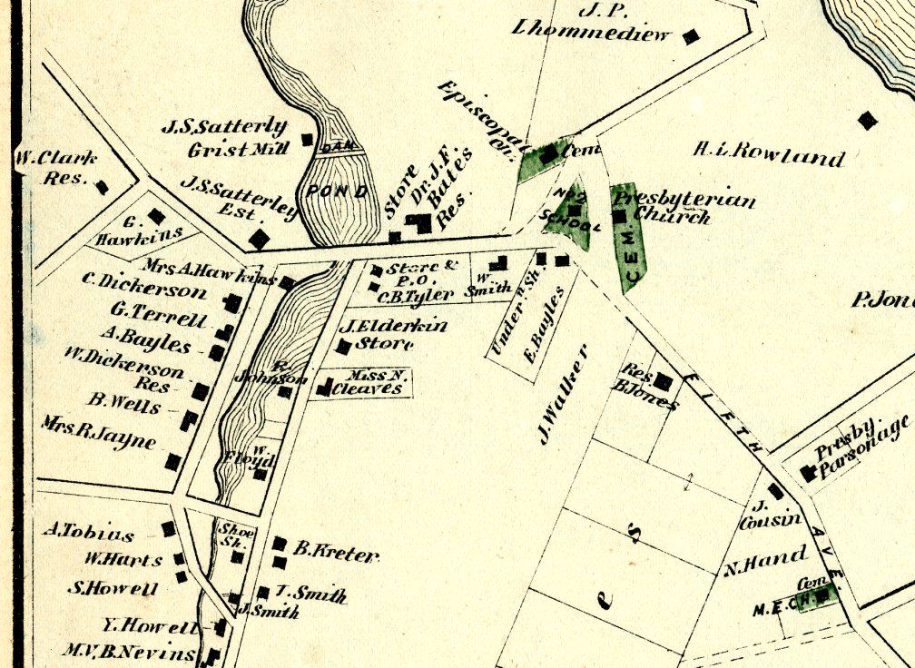
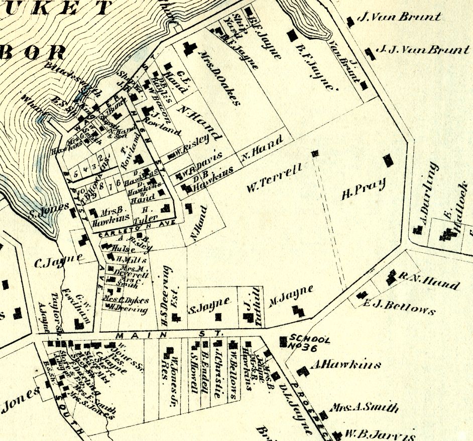
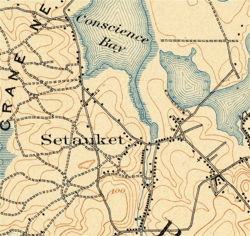
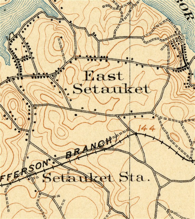
Setauket and East Setauket 1873 SetauketsMap1873Left.jpg SetauketsMap1873Middle.jpg SetauketsMap1873right.jpg SetauketLakeGreenMap.jpg - detail from Lake to Green in Setauket CenterEastSetauketMap.jpg - enlarged detail East Setauket |
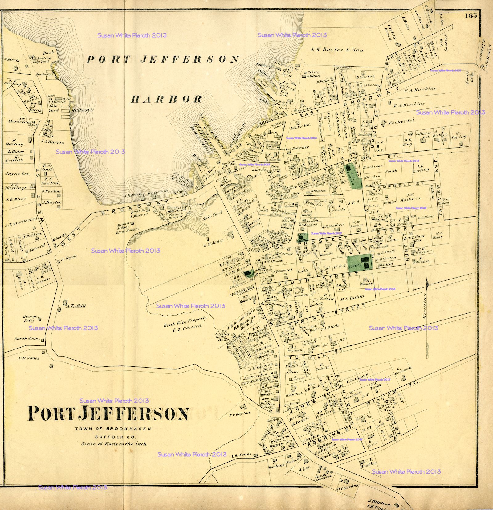 |
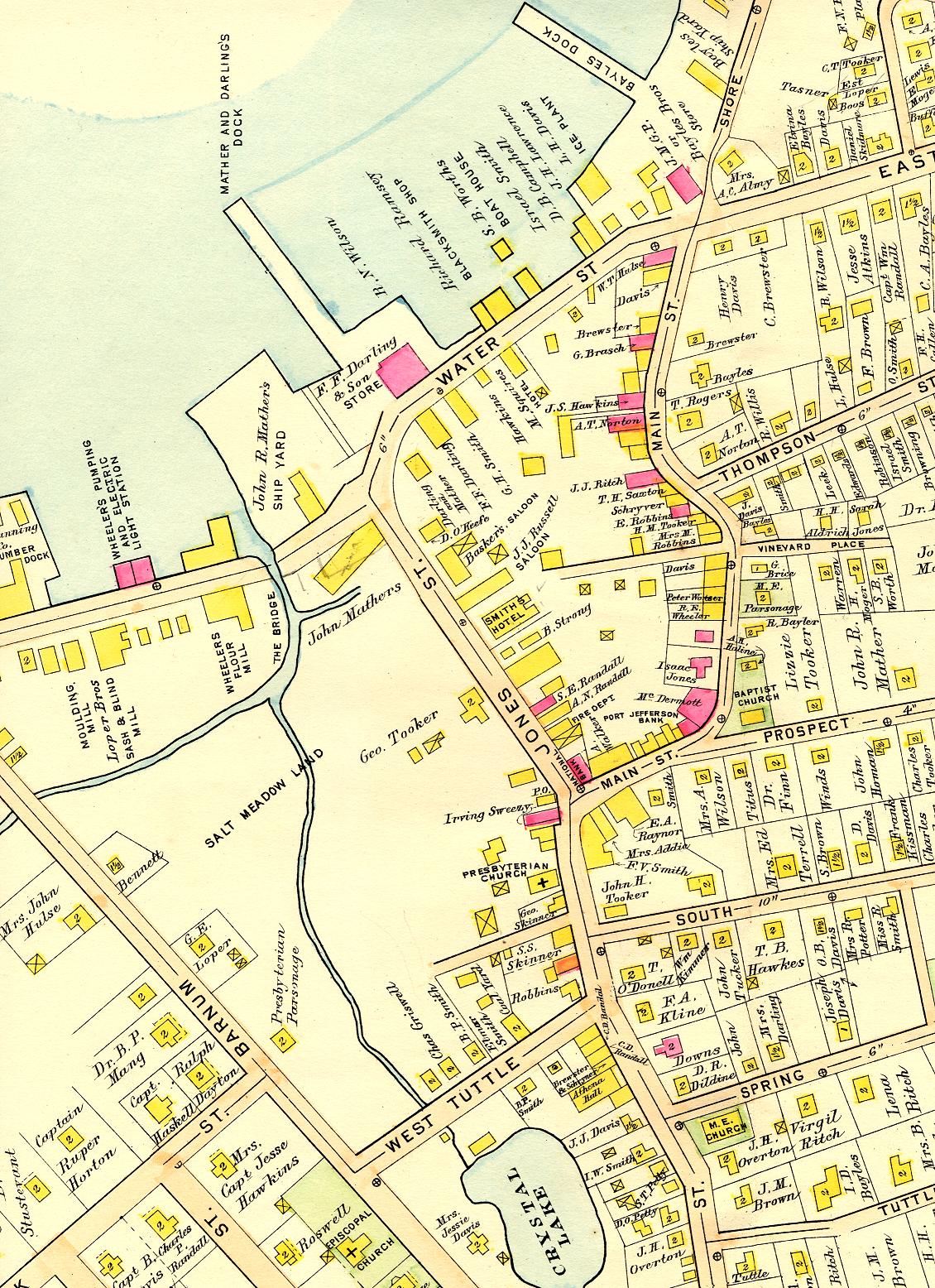
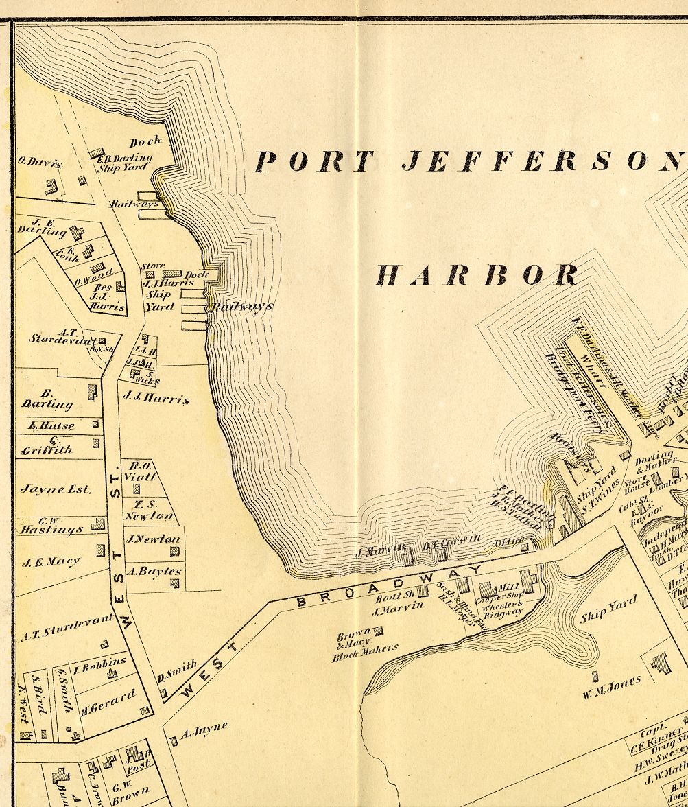
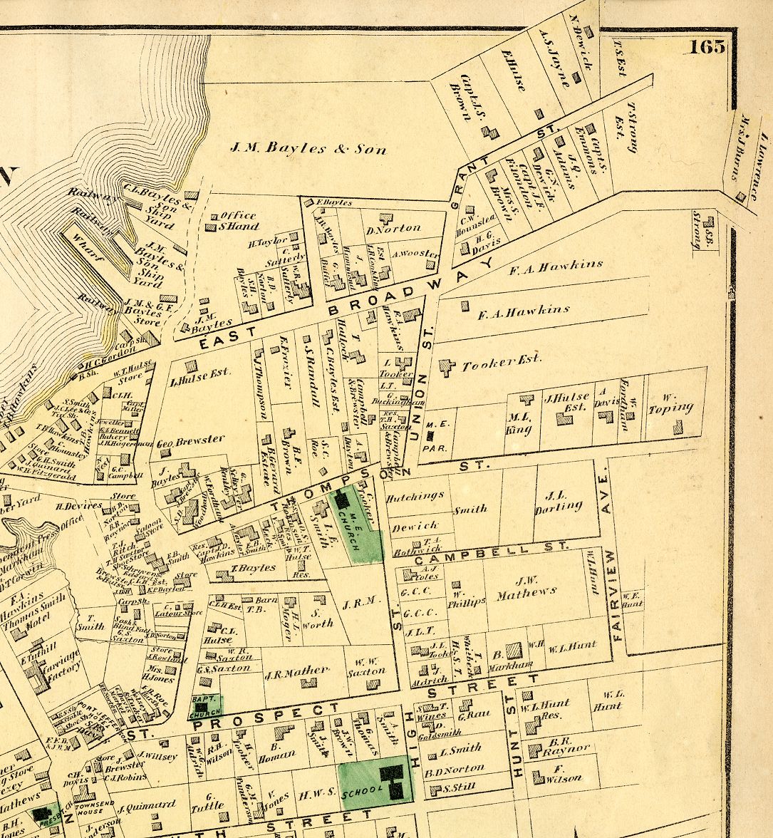
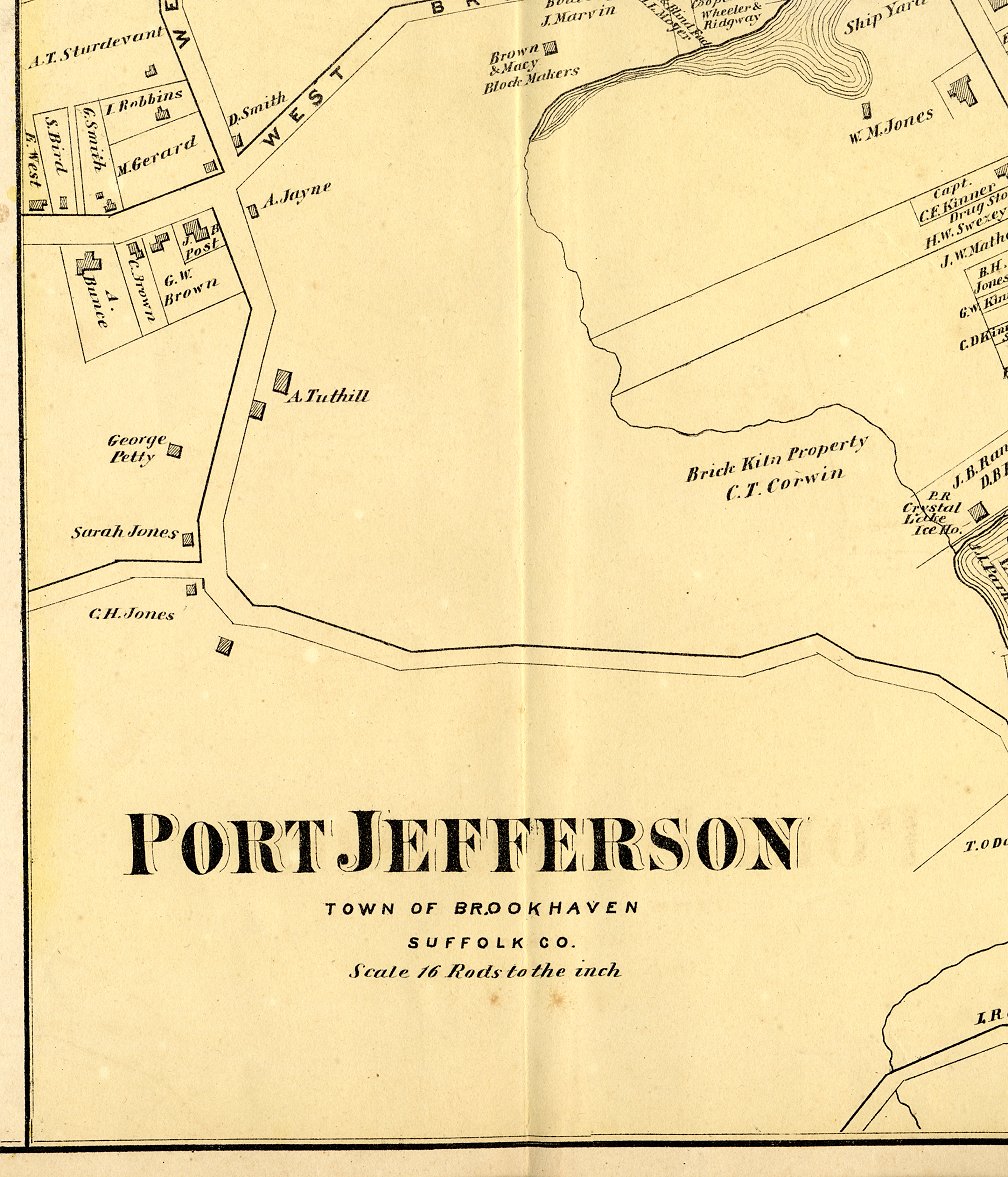
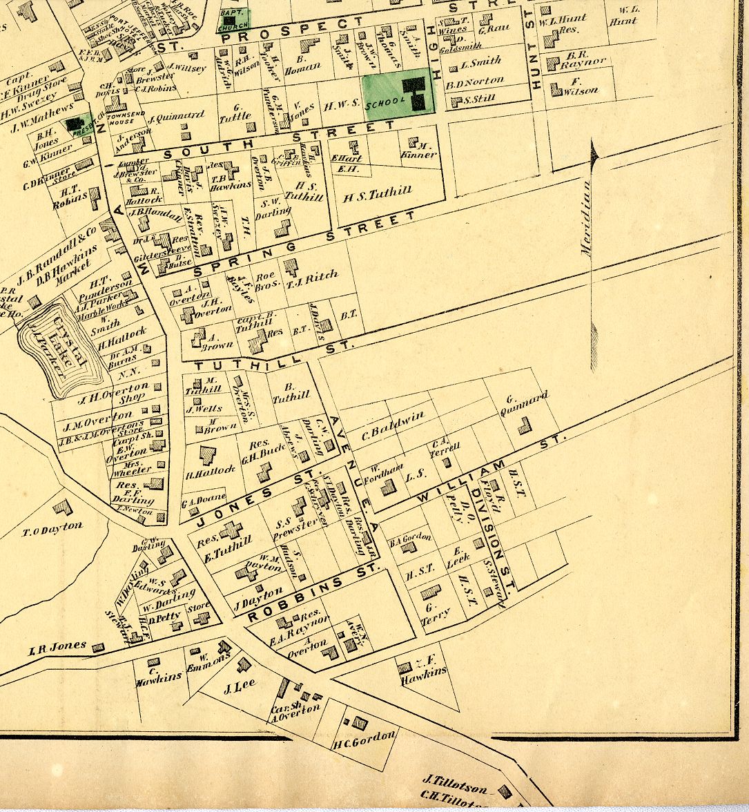
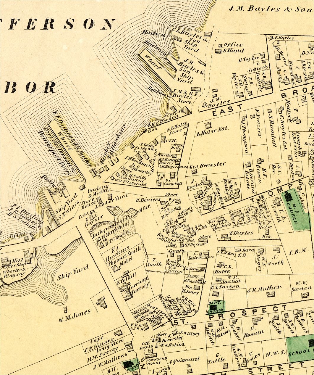
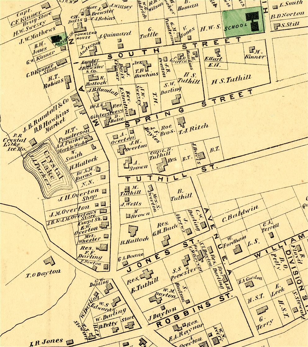
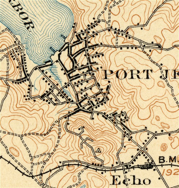
Port Jefferson 1873 PortJeff1873topleft.jpg PortJeff1873topright.jpg PortJeff1873bottomleft.jpg PortJeff1873bottomright.jpg PortJeff1873centerPlain.jpg - enlarged detail PortJeff1873southPlain.jpg - enlarged detail |
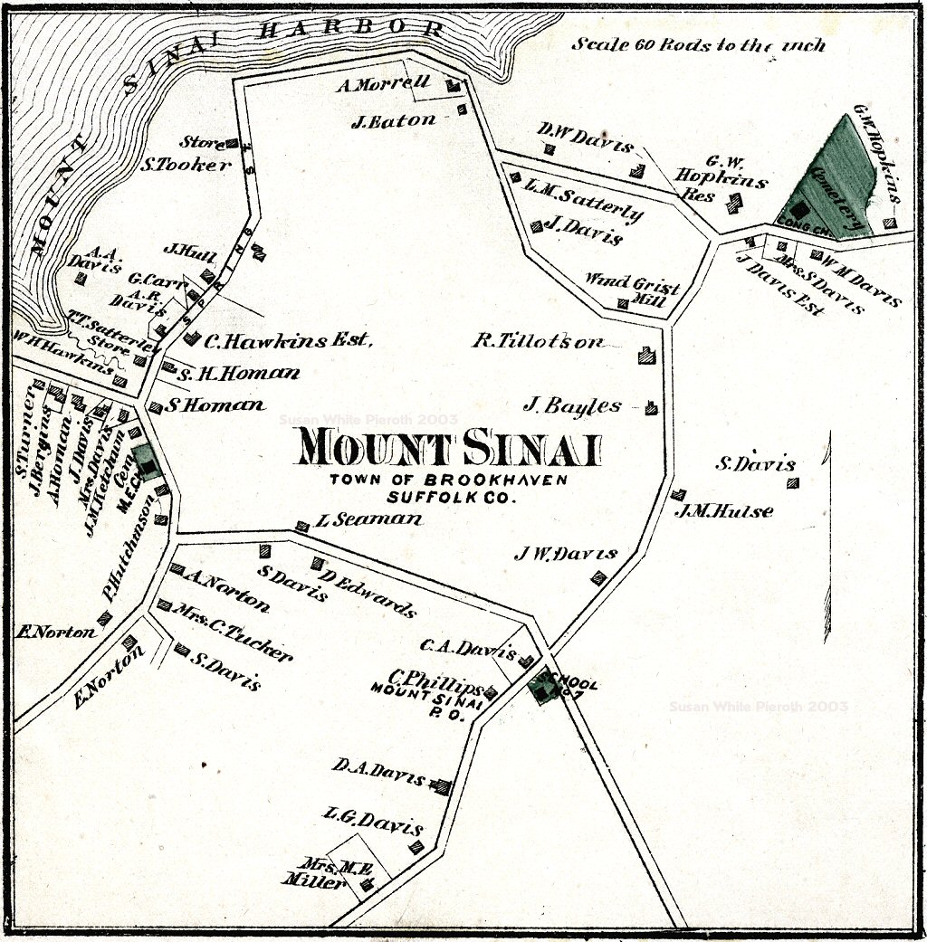 |
Mount Sinai 1873 |