-
Old Maps of
Long Island,
New York
Scans of old maps I have collected of places I have lived and liked.
[Click on an image for an enlarged view]
All images and text Copyright © 2001-2013 Susan White Pieroth may not be used in any form without permission.
"Long Island Maps and Their Makers" by David Yehling Allen
Three Villages 1917, NY
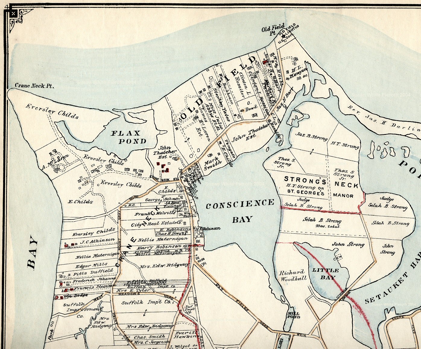 |
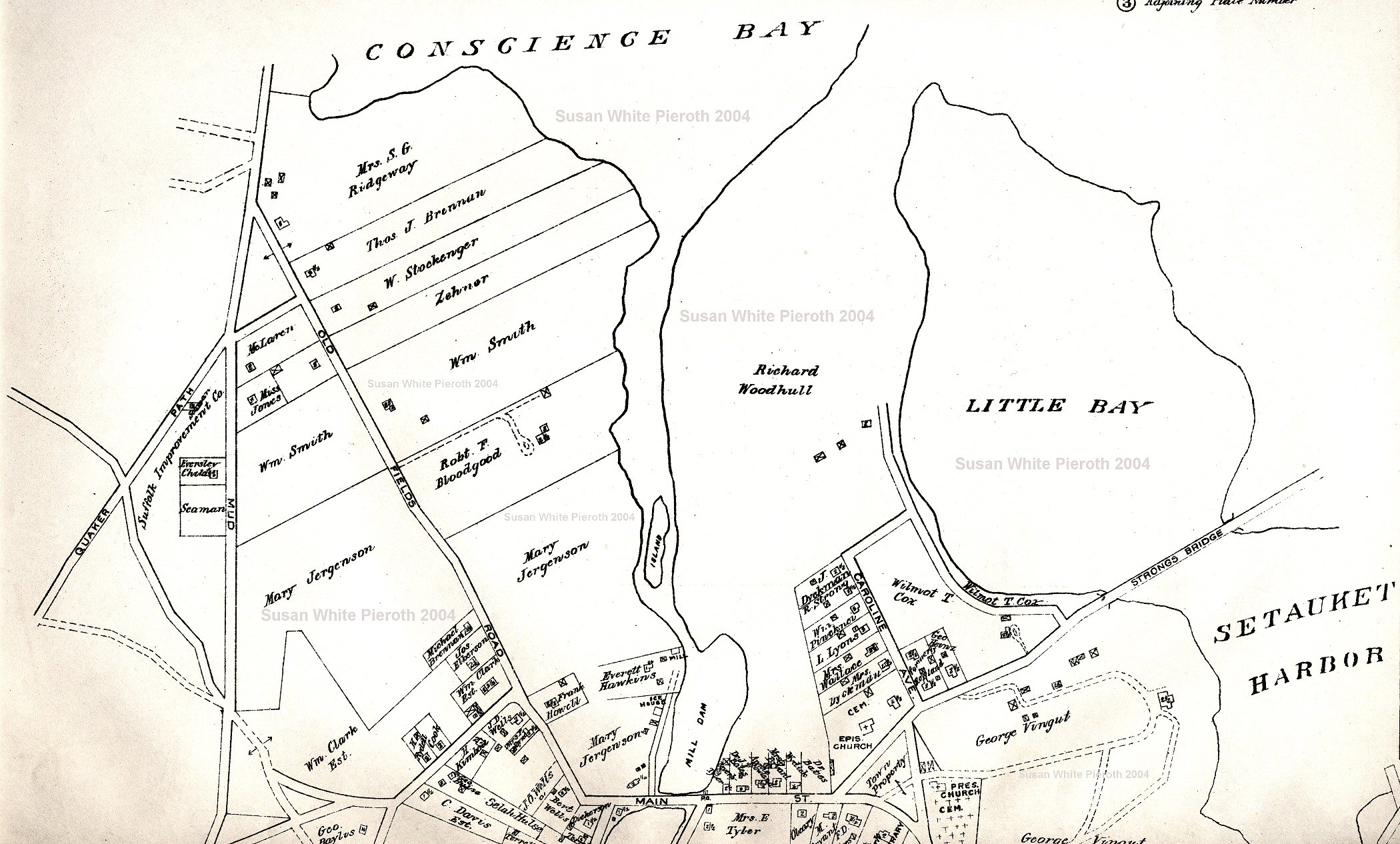
The top section of the 1917 Three Villages, Brookhaven, Suffolk County, New York, Plate 7 by E. Belcher Hyde, Brooklyn. The full size (click on the image) of this scan is 581 kb. For the left half (287 kb) click here, the right half (306 kb) click here, and the lower portion of Setauket click here. |
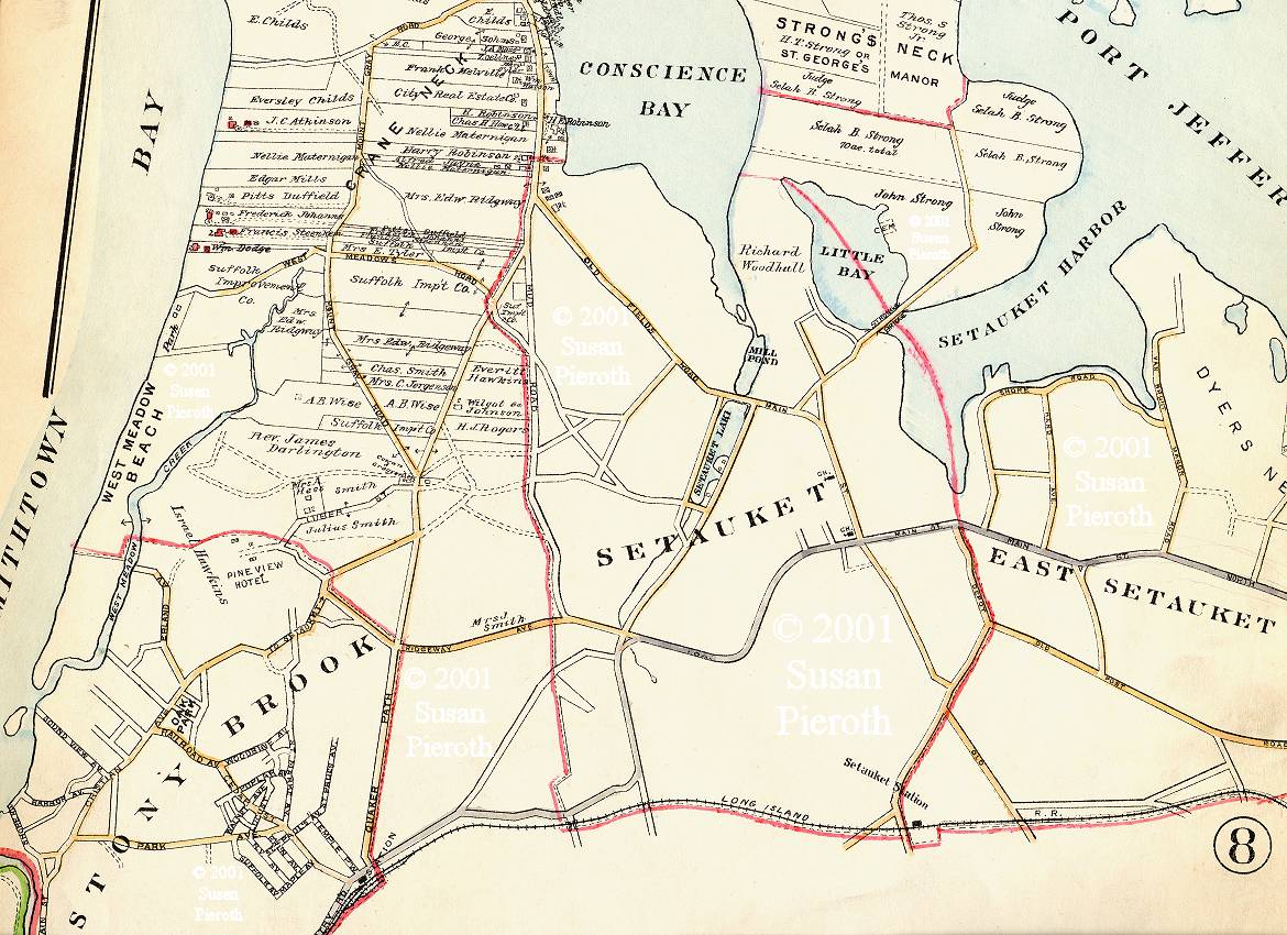 |
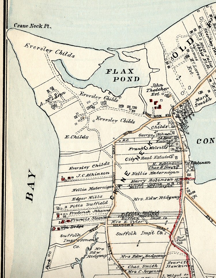
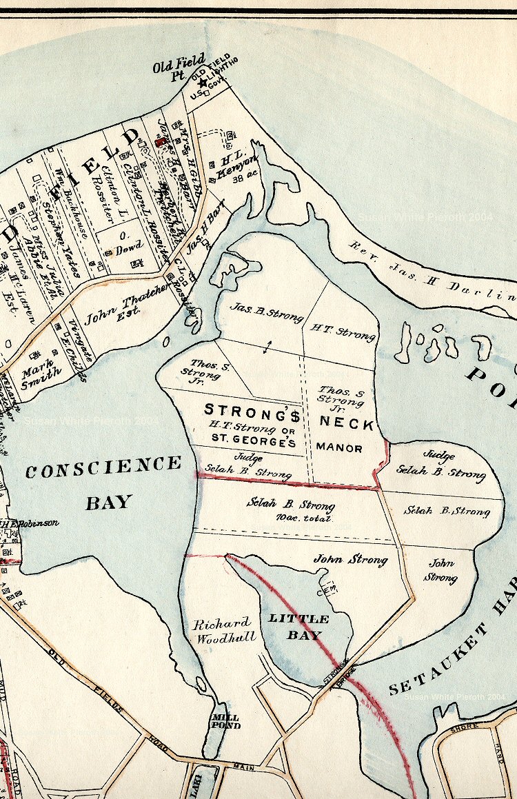
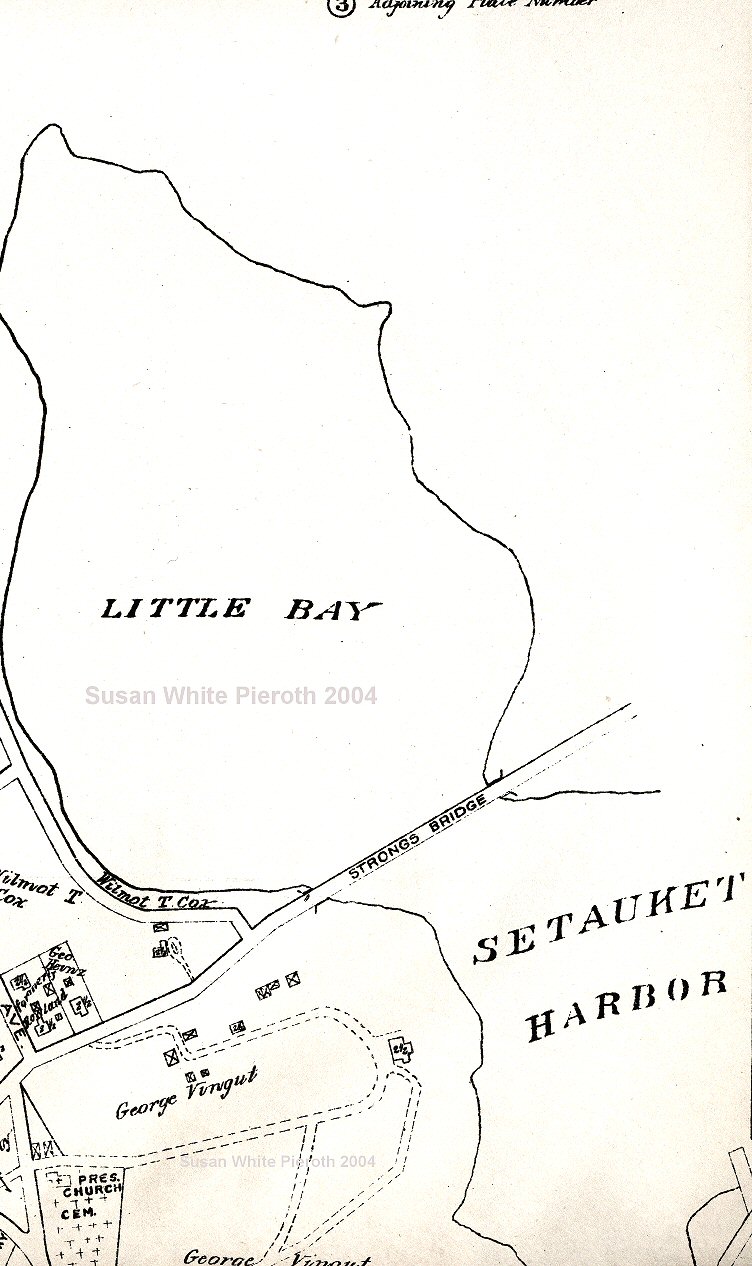
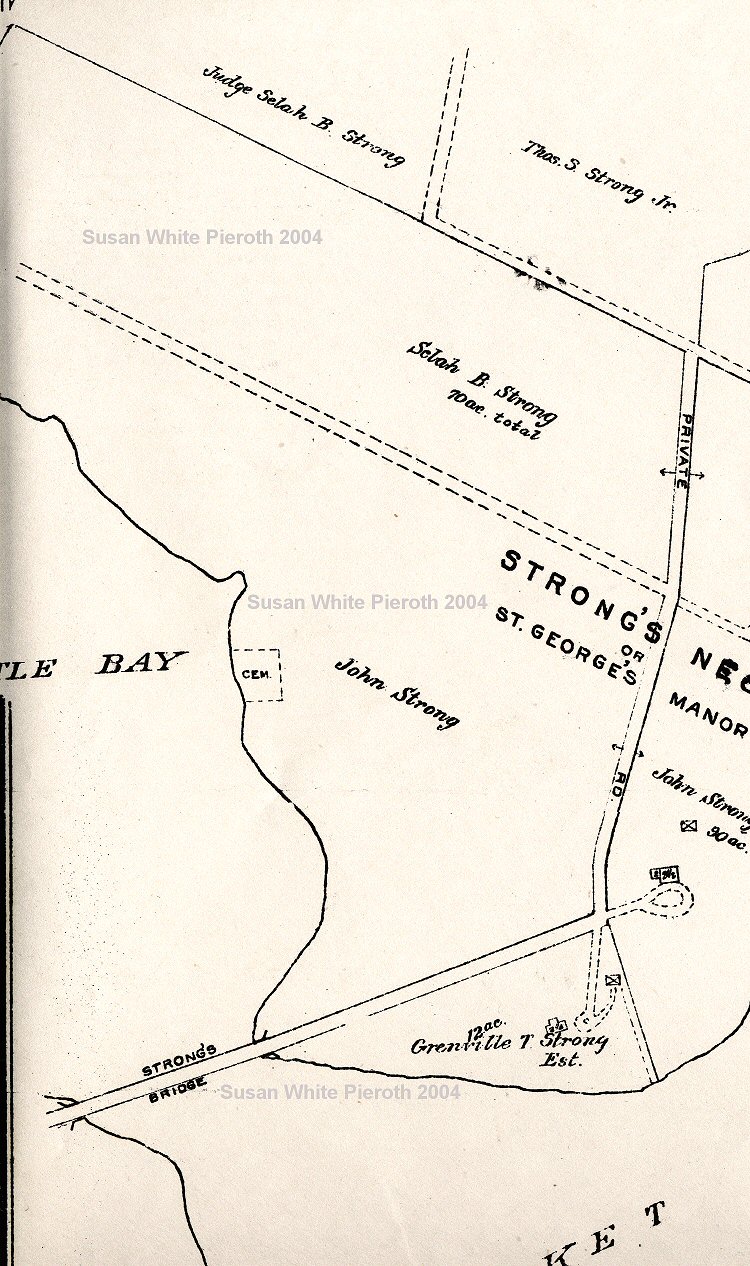
This 1917 Map of the Three Villages is Plate 7 by E. Belcher Hyde, Brooklyn. It does not have all the residents in all areas. The sections outlined in red are on separate maps that I do not have. Along the top of the map, either side of Conscience Bay, are parts of Crane's Neck (Old Field) and Strong's Neck. |
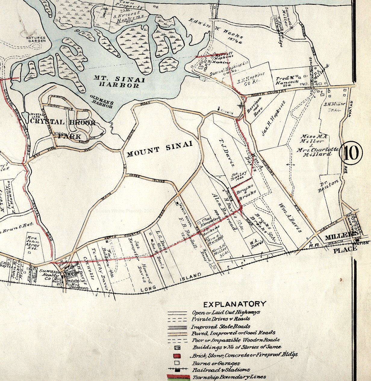 |
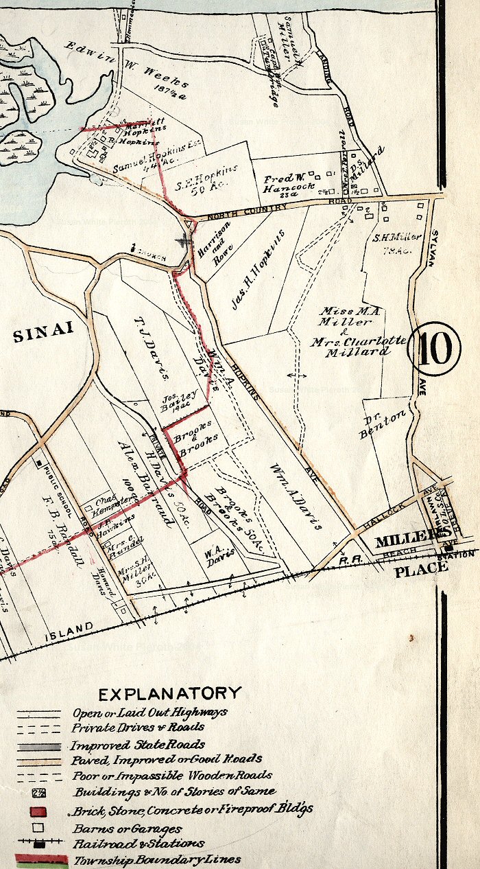
The Mount Sinai portion of Plate 7 of the 1917 E. Belcher atlas has much of the detail. Click the image for the large size. The left side and right side overlap slightly. |
 |
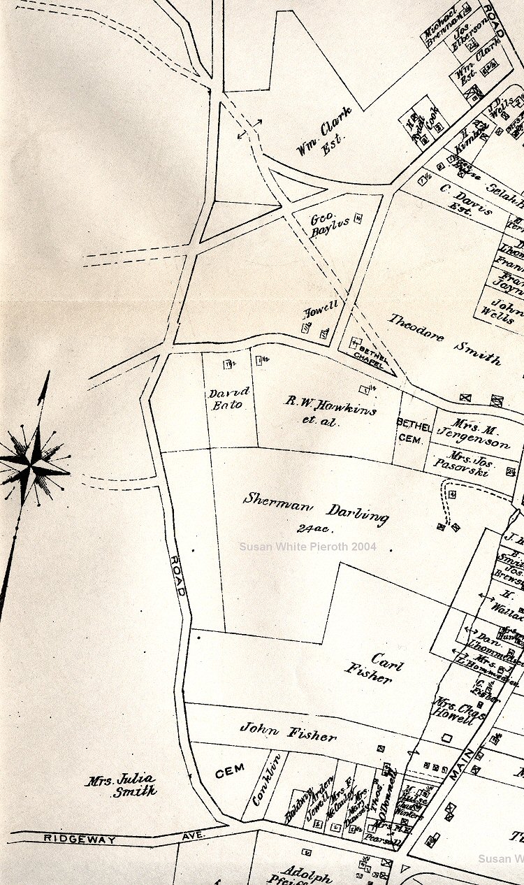
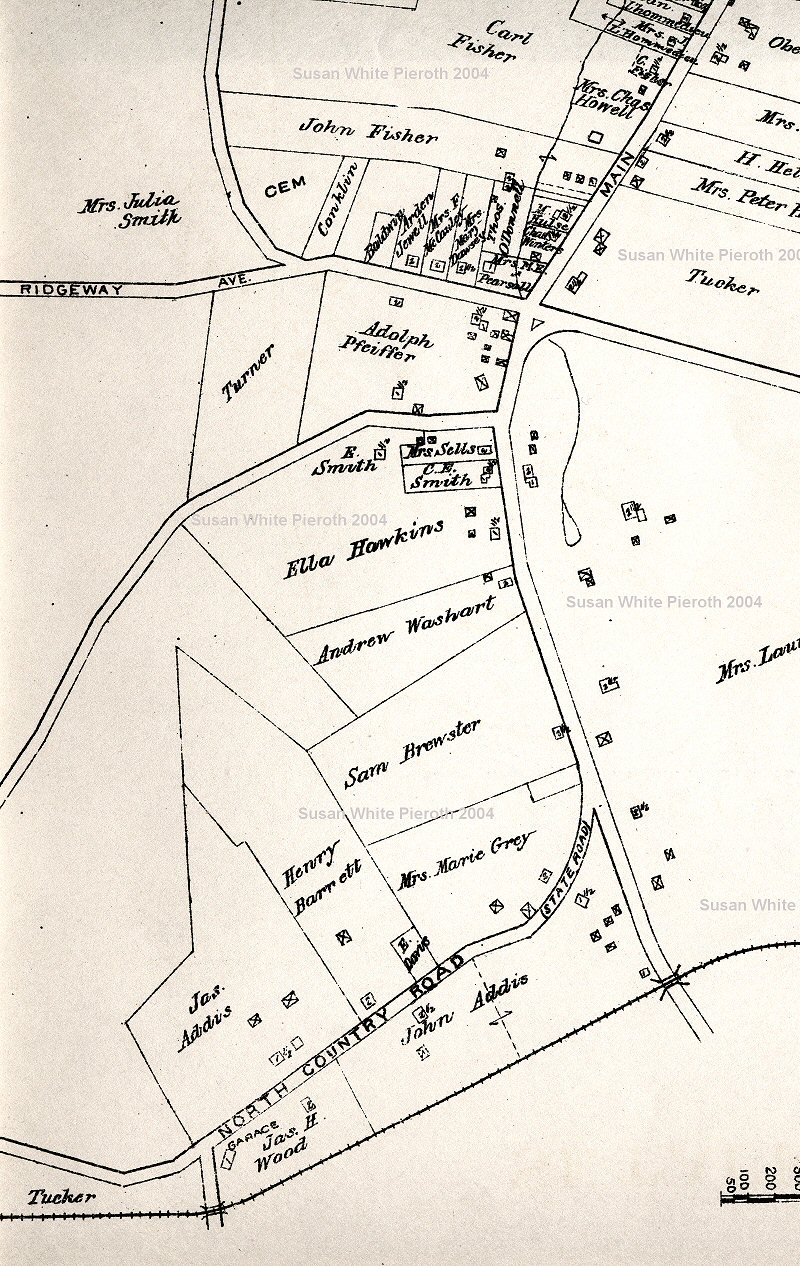
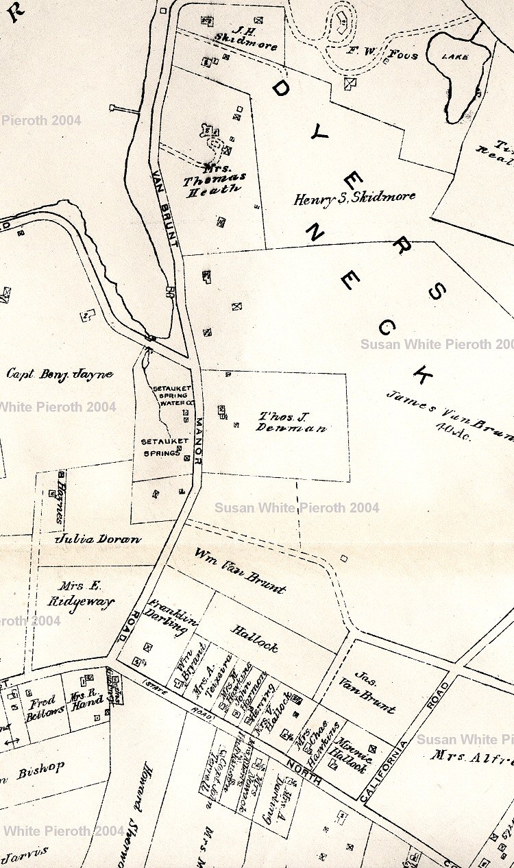
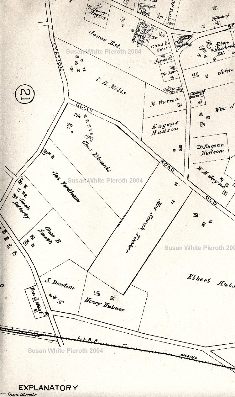
The top of detail map Plate 21 showing the Setauket property owners not shown on Plate 7. These are all large scans. This has also been split into left, middle, and right sections. |
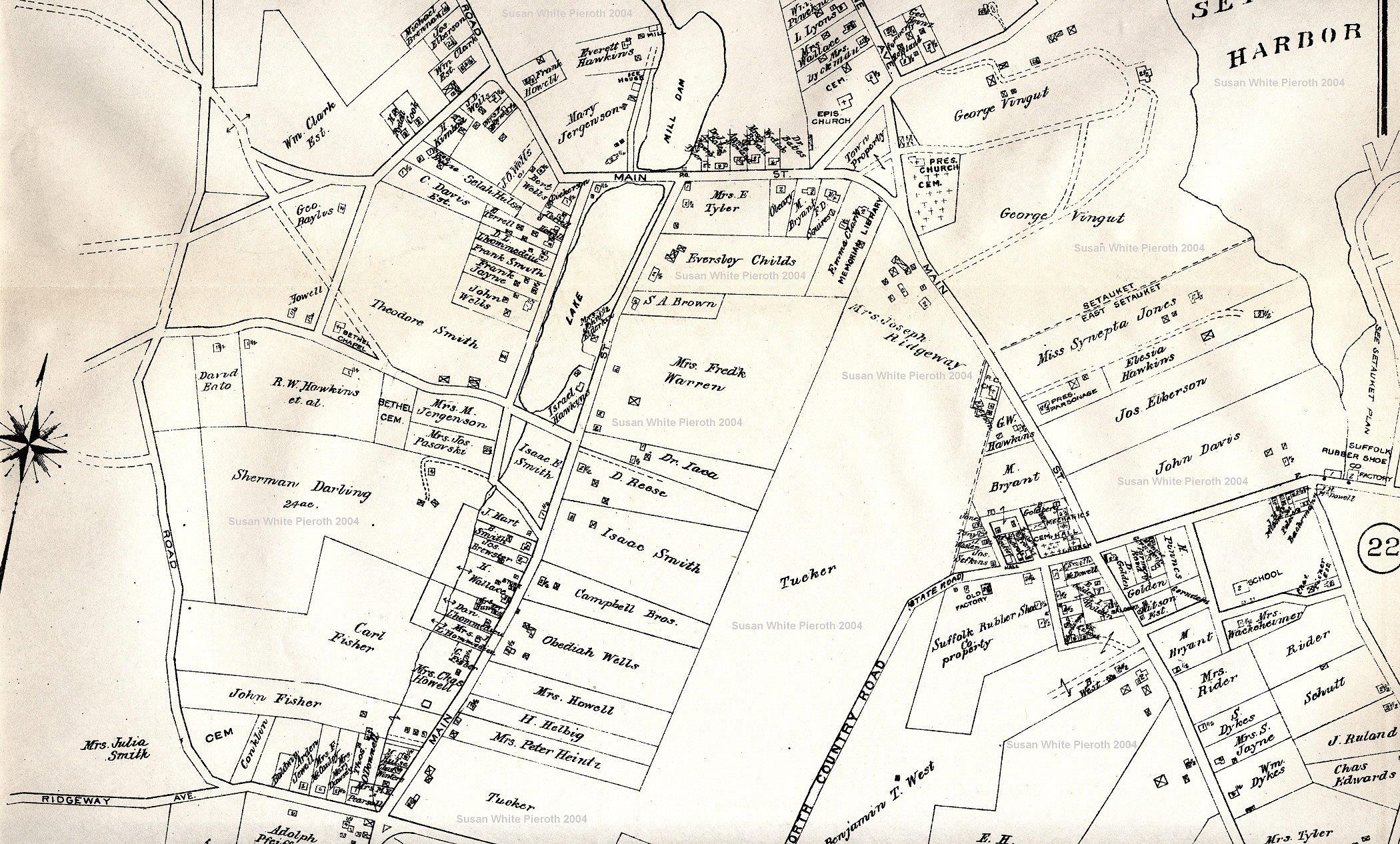 |
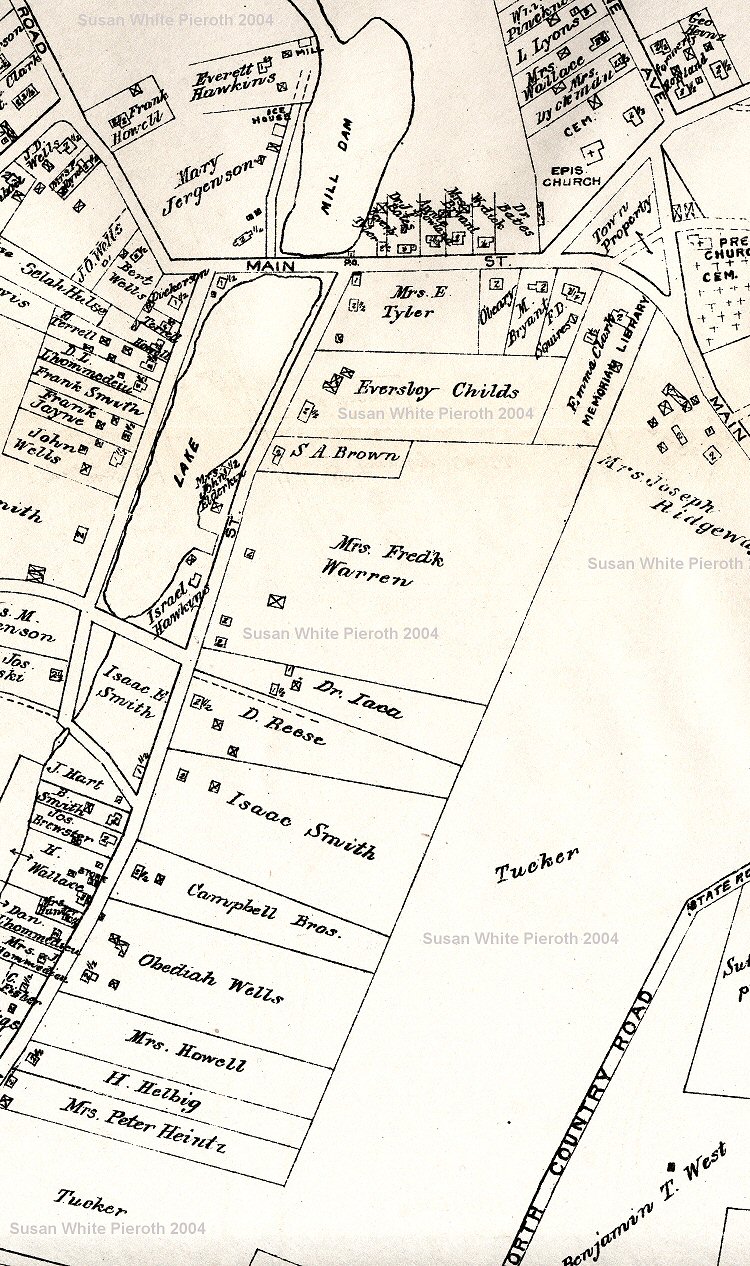
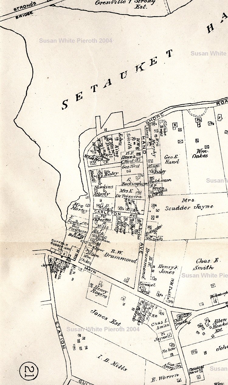
The middle of detail map Plate 21 showing the Setauket, and some East Setauket, property owners. These are all large scans. This has also been split into left, middle, and right sections. |
 |
The top of detail map Plate 21 showing the Setauket, and some East Setauket, property owners. These are all large scans. This has also been split into left, middle, and right sections. |
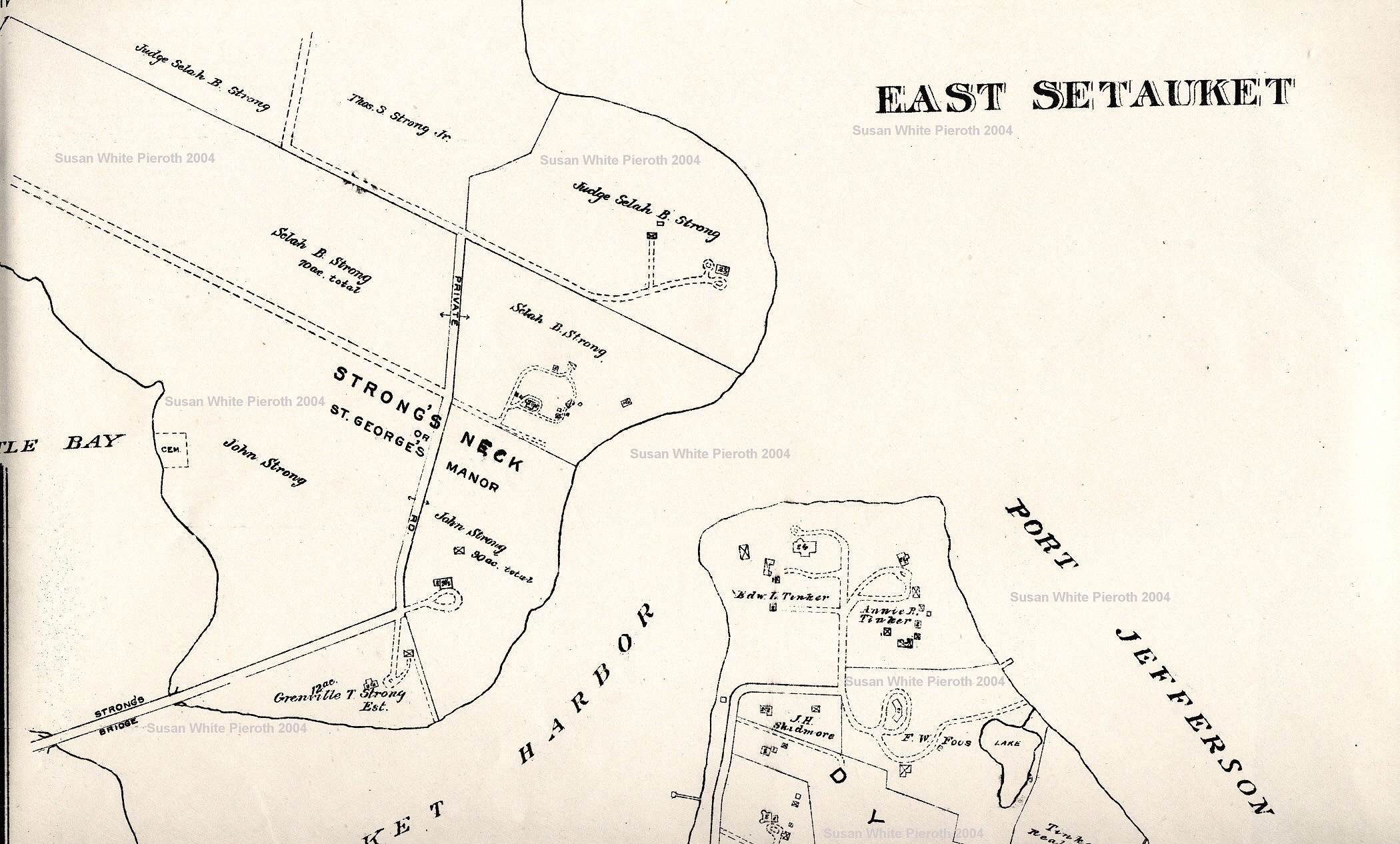 |
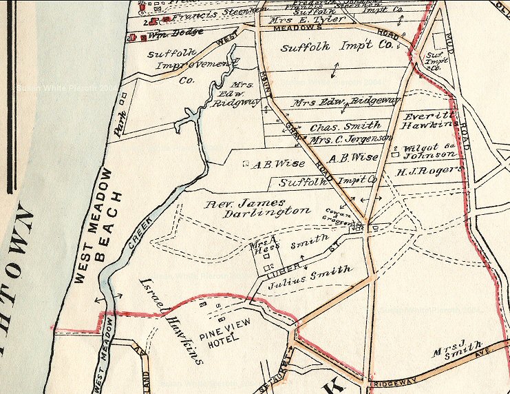
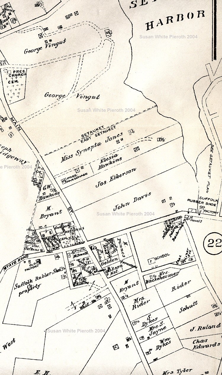
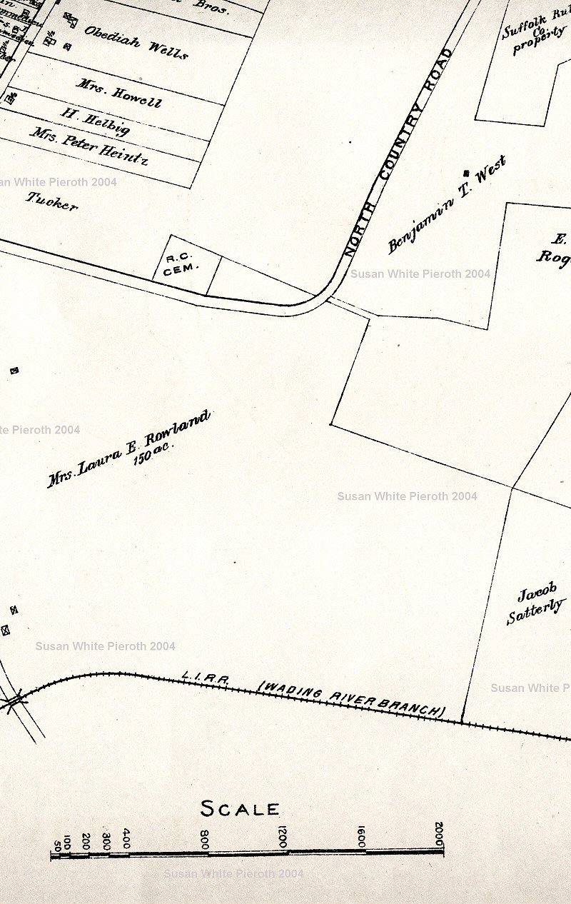
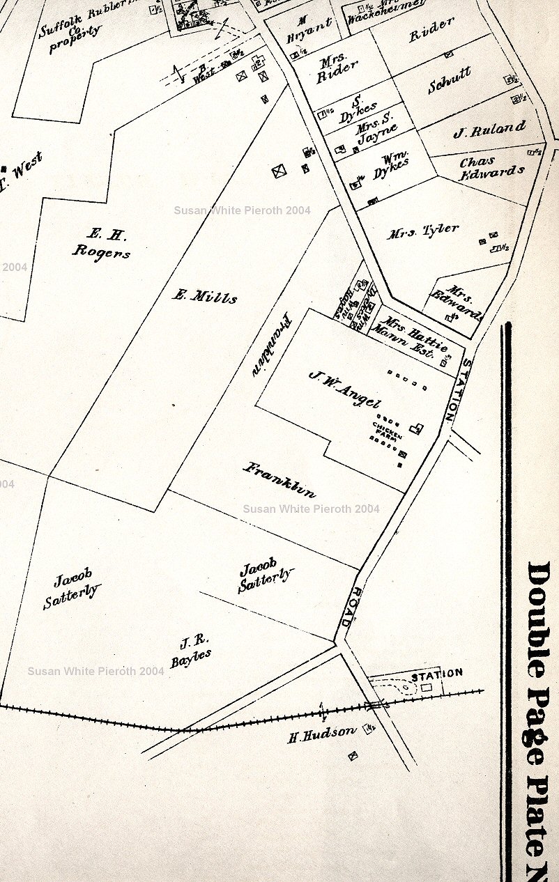
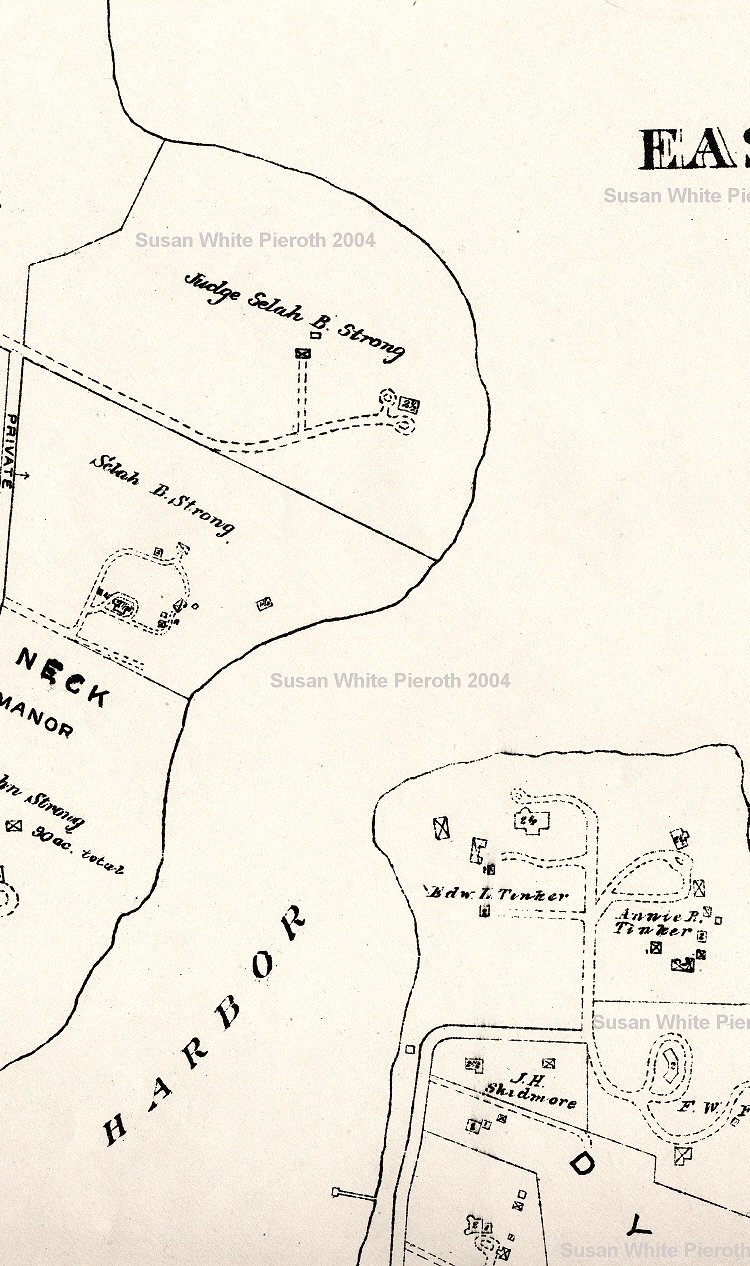
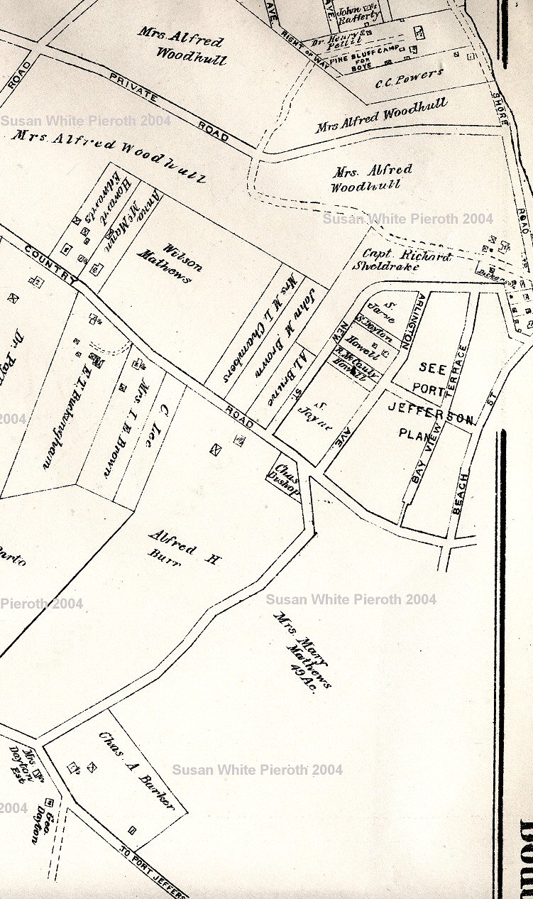
The top of detail map Plate 22 showing the East Setauket, and some Strong's Neck, property owners not shown on Plate 7. These are all large scans. This has also been split into left, middle, and right sections. |
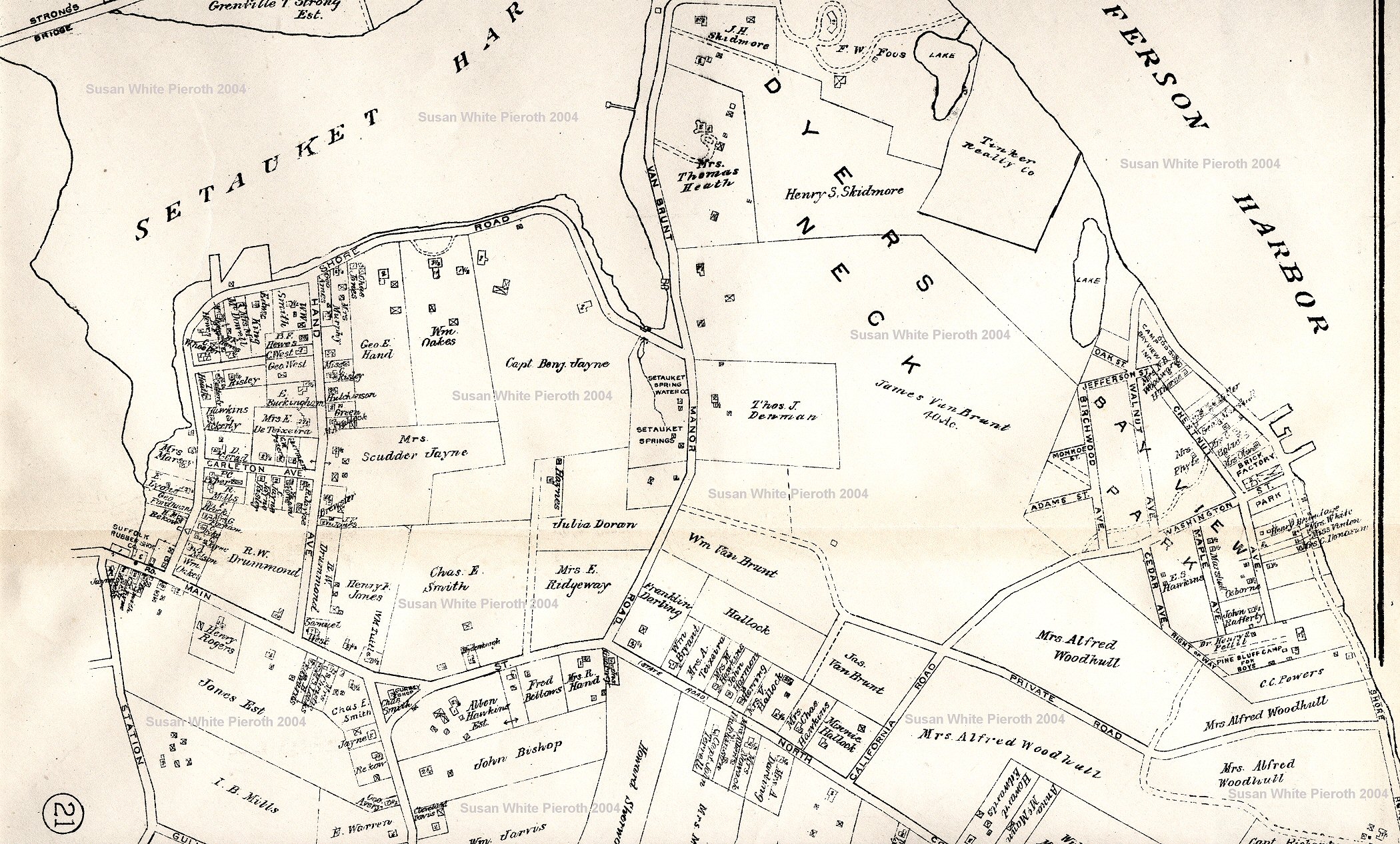 |
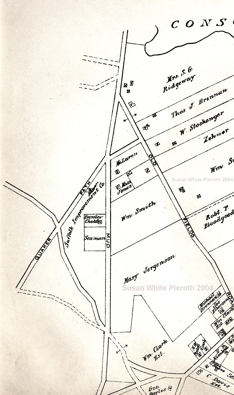
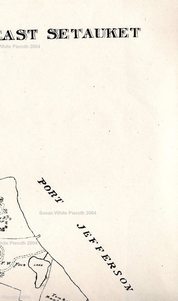
The top of detail map Plate 22 showing the East Setauket property owners not shown on Plate 7. These are all large scans. This has also been split into left, middle, and right sections. |
 |
The top of detail map Plate 22 showing the East Setauket property owners not shown on Plate 7. These are all large scans. This has also been split into left, middle, and right sections. |
Stony Brook 1917, NY
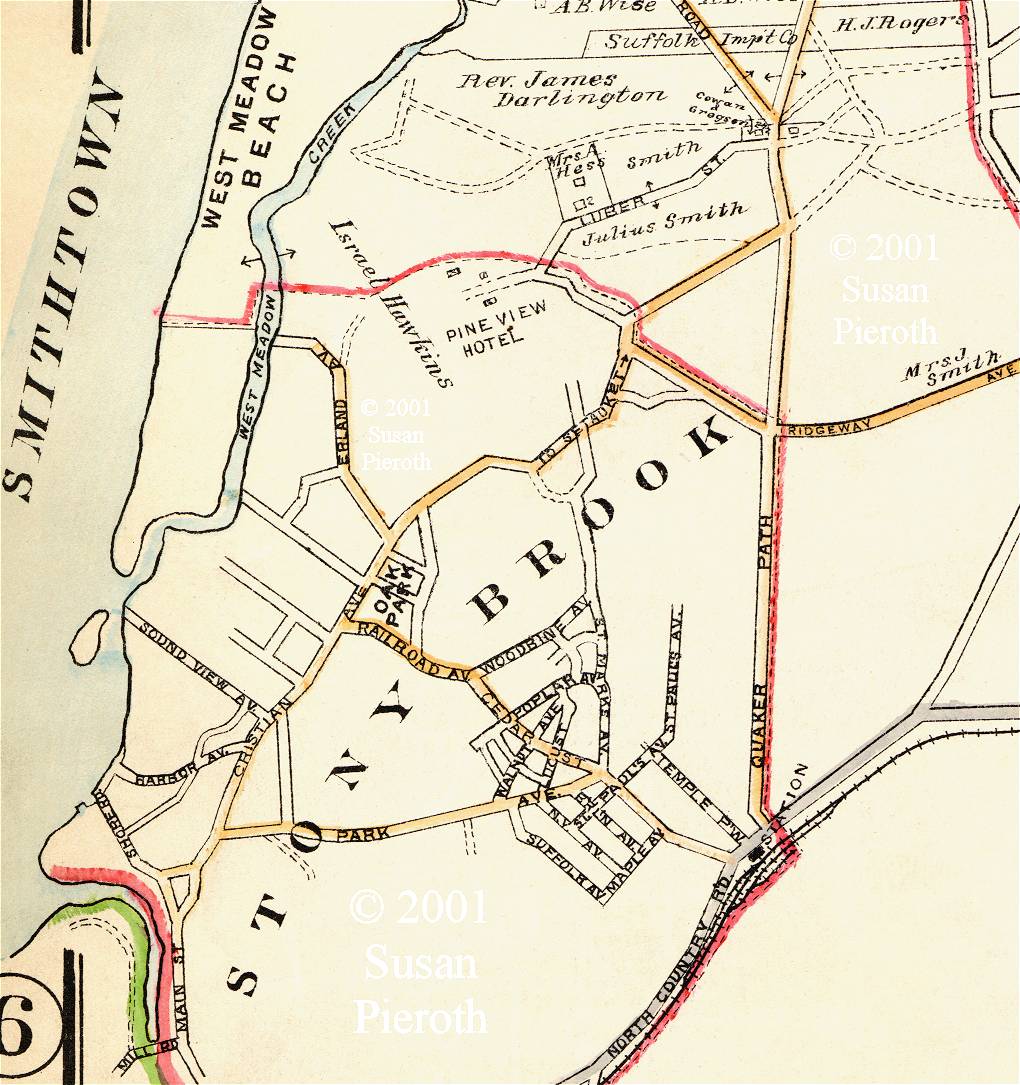 |
Stony Brook, 1917. At the bottom left Main Street enters the town. The triangle opposite the 'T' is where the community center built by Ward Melville is located. Past that the name changes to Christian Avenue. The road to the right labeled Park Avenue is now Hollow Road. Railroad Avenue had it's name changed to Cedar Street, thus making that one long street. West Meadow Beach is at the top left. |
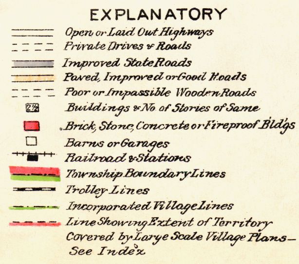 |
This is the Explanatory for 1917 Map Plate 7. It shows that the buildings colored in red are "Brick, Stone, Concrete or Fireproof Bd'gs;" the gold colored roads are "Paved, Improved or Good Roads;" and outlined buildings containing numbers are for "Buildings & No. of Stories of Same." Click on the image to view the complete list. |
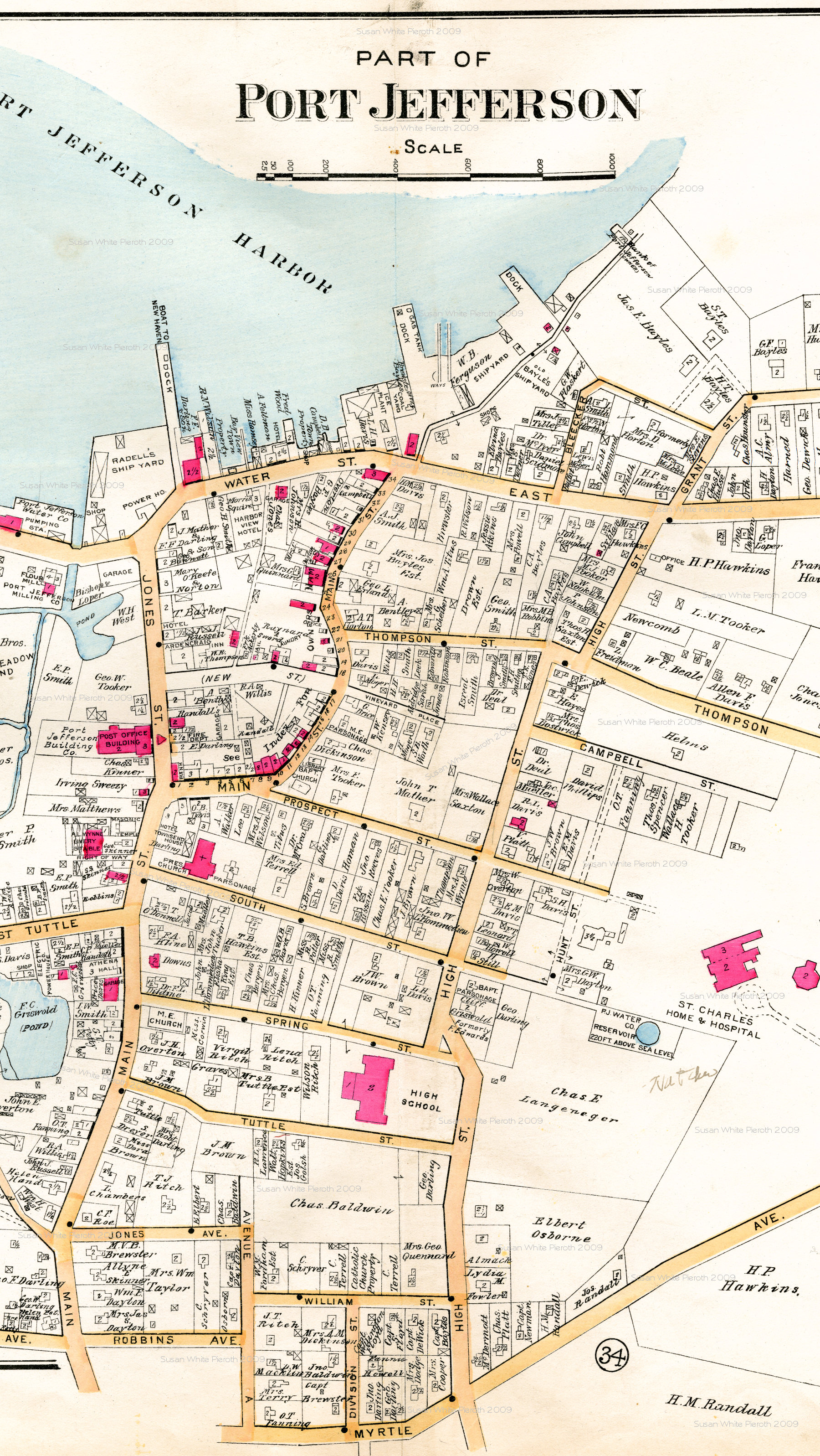
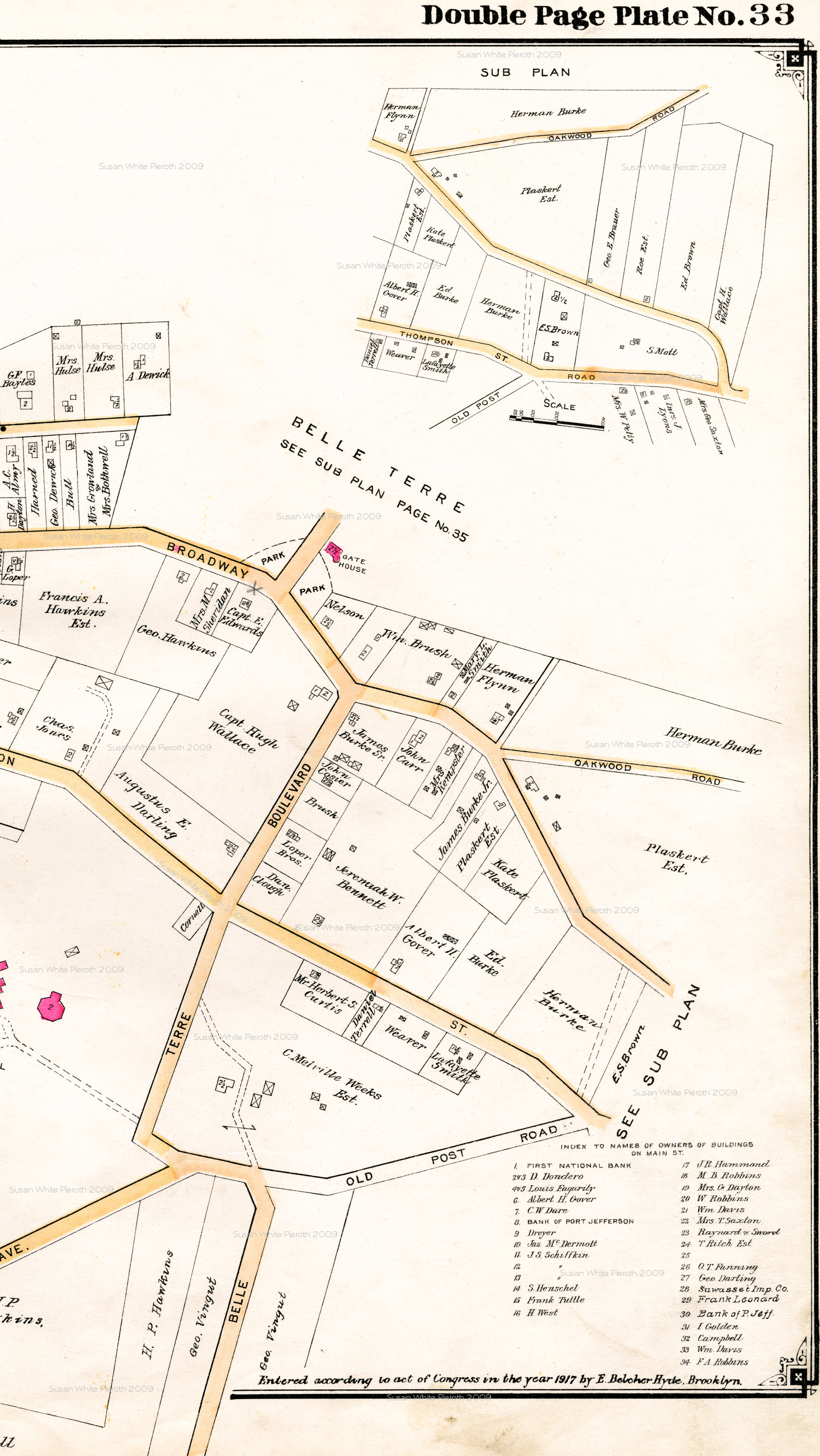
Port Jefferson 1917, NY
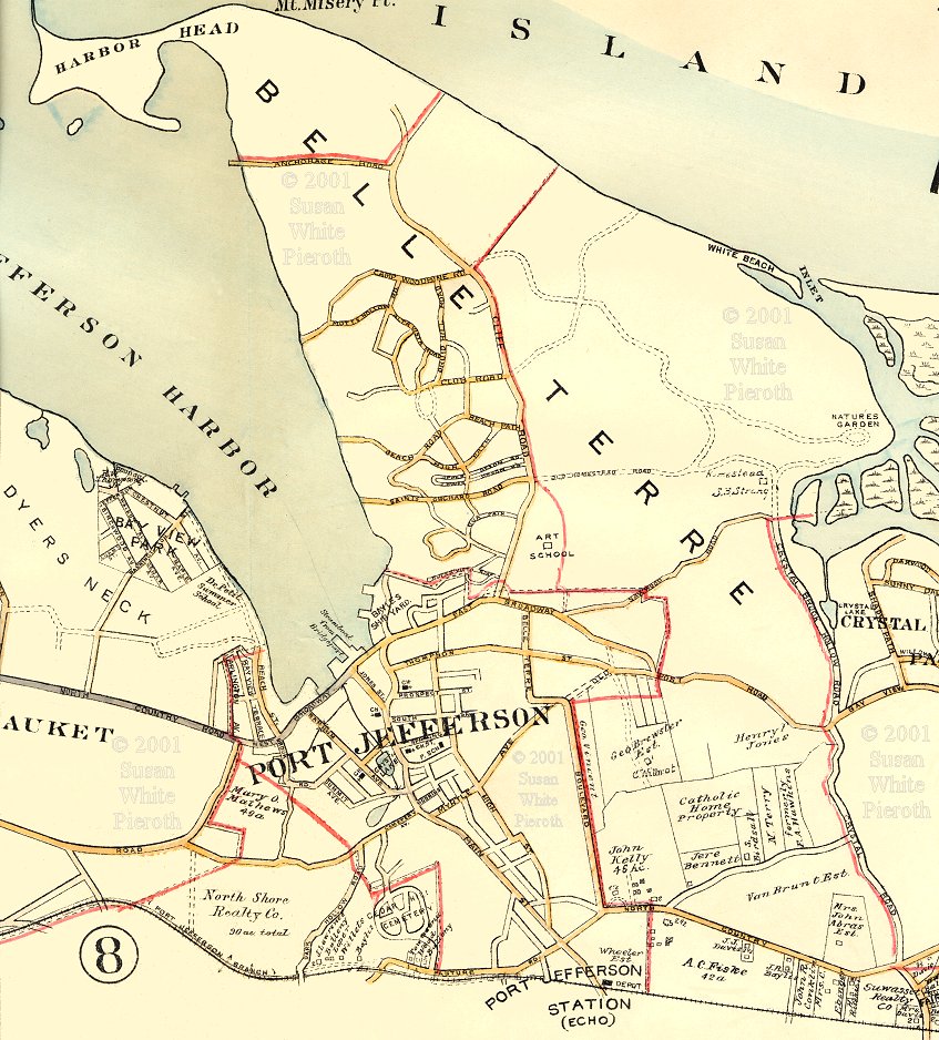 |
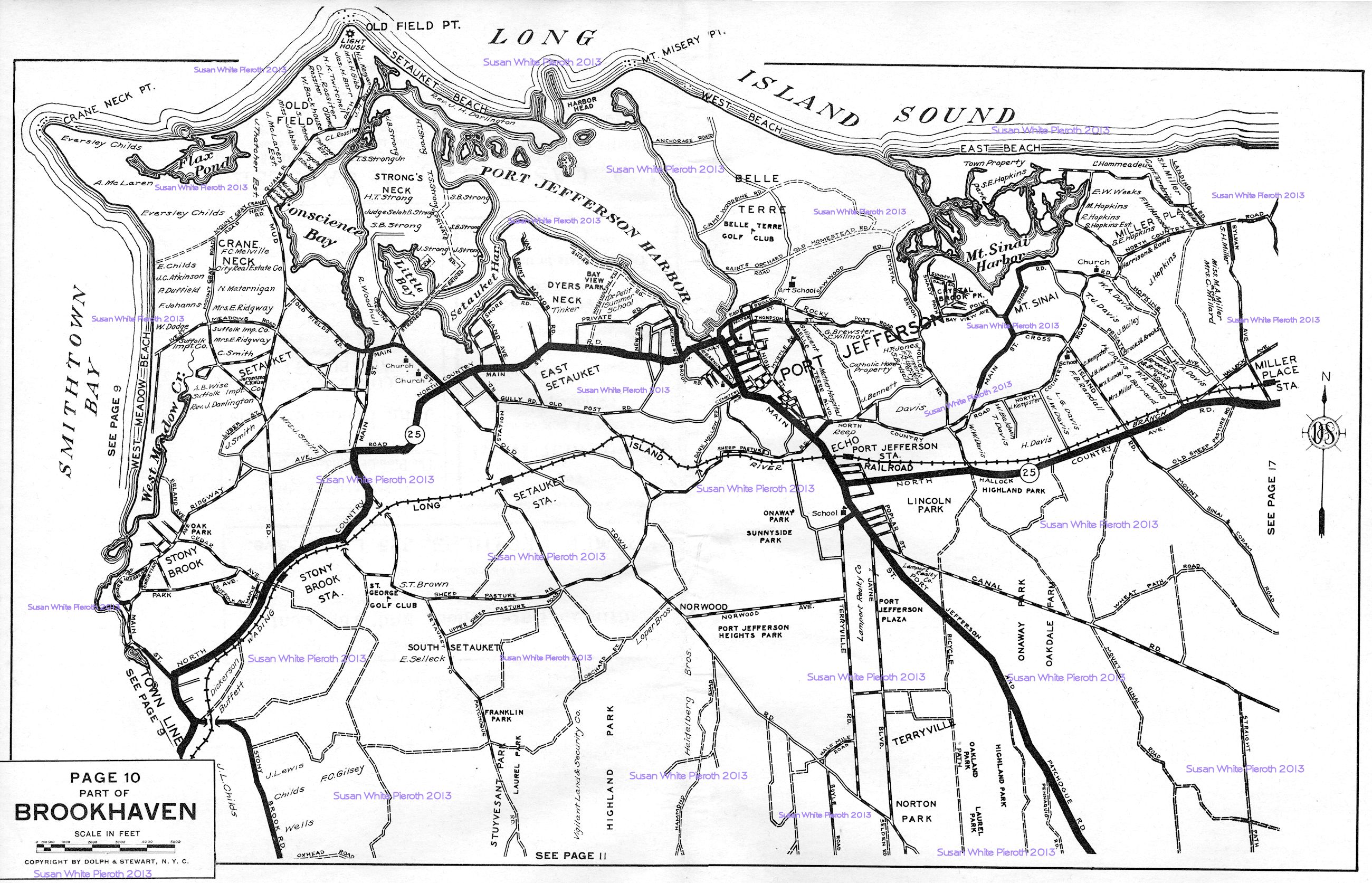
Port Jefferson, Belle Terre and Port Jefferson Station, 1917, by E. Belcher Hyde, Brooklyn. This map provides the overview of the area. The map shown next is the companion detail map. Note that Port Jefferson Station has "Echo" in paraphrases. The area was reportedly called 'Echo' after a famous thoughbred race horse that trained just east of Canal Road in the late 1800's. The current road is known as Echo Avenue. |
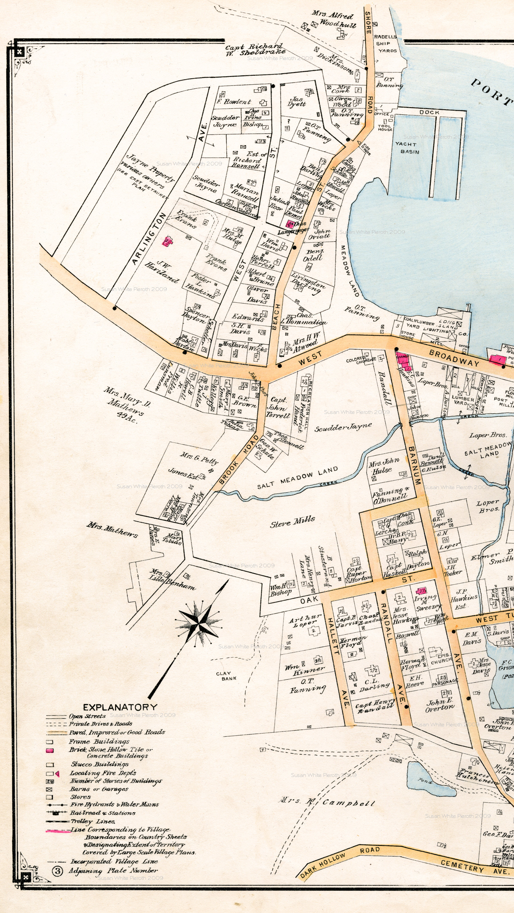 |
 Left: is the
left section of the Port Jefferson 1917 map by Belcher Hyde,
Brooklyn. There were some pencil marks on this copy that I
left in case they provide useful information. The three sections
overlap. Left: is the
left section of the Port Jefferson 1917 map by Belcher Hyde,
Brooklyn. There were some pencil marks on this copy that I
left in case they provide useful information. The three sections
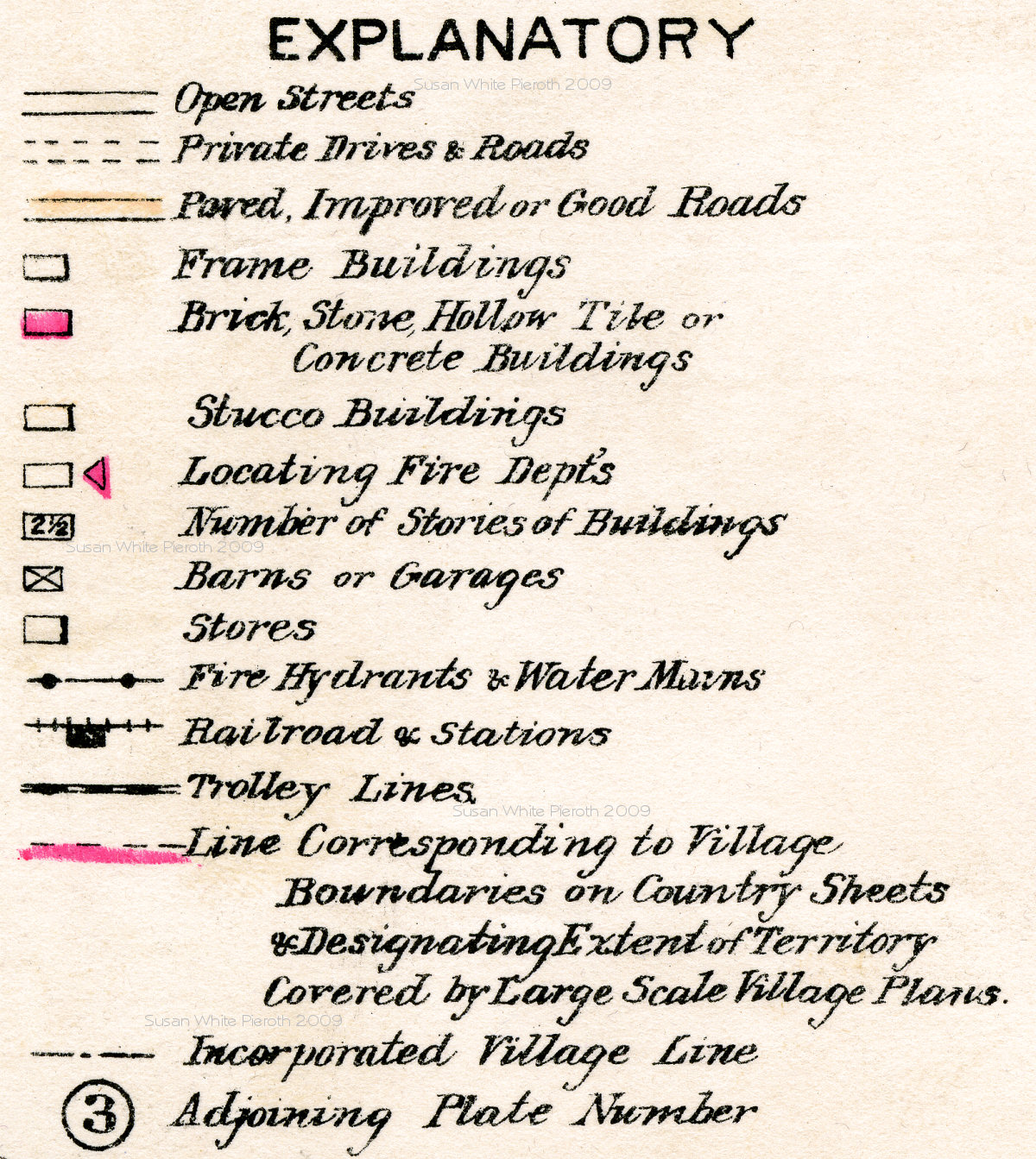
overlap.Right is the "Explanatory for the 1917 Port Jefferson maps. It shows that the buildings colored in red are "Brick, Stone, Hollow Tile or Concrete Buildings;" the gold colored roads are "Paved, Improved or Good Roads;" and outlined buildings containing numbers are for "Number of Stories of Buildings." |
