More From My Postcard Collection
More scans of old postcards I have collected of places I have lived and liked.

[Click on an image for an enlarged view]
Going east along the north shore of the Town of Brookhaven, Suffolk County, Long Island, is the town of Stony Brook.

Stony Brook, NY - Page 2

For a 1917 Three Village area and Stony Brook map, click here
Sources of history include The Three Village Guidebook, by Howard Klein, Three Village Historical Society, 1976; Echoes of the Past, by Kathleen Fullam, 1962; and Stony Brook Secrets, by Edward A. Lapham, 1942; Images of America, Stony Brook, 2003, Three Village Historical Society

Stony Brook Main Street 1884 
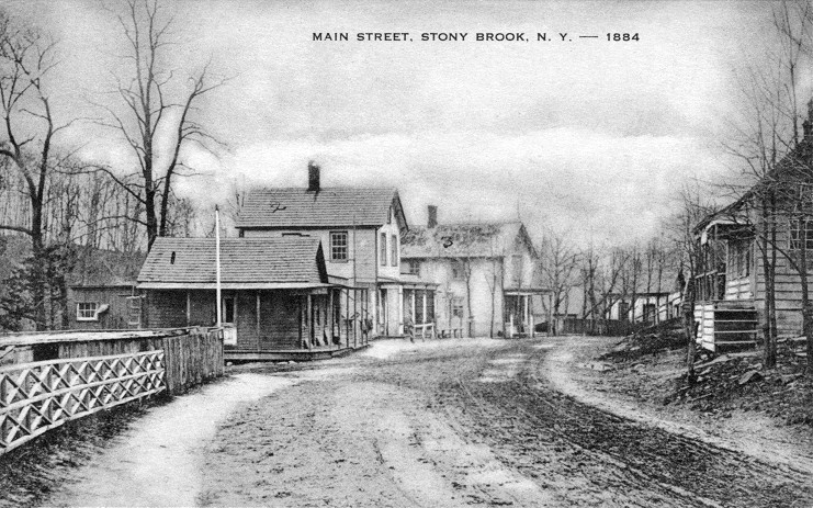
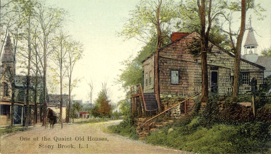
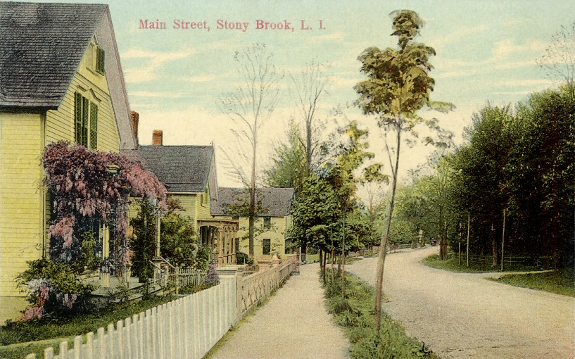
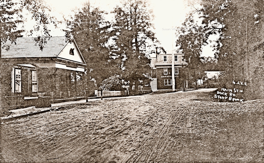
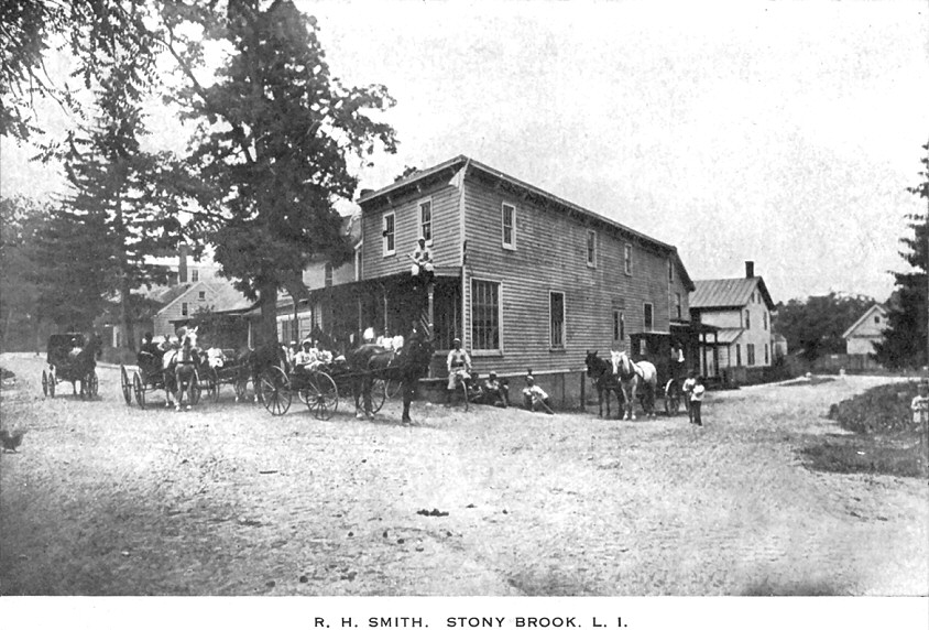
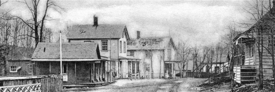
"Main Street, Stony Brook, N. Y. -- 1884." This is a view of Main Street going north toward the Shopping Crescent (see below). A left at the end of the fence takes you to the mill. The house on the right is the "Quaint" old house in the card below. The Presbyterian church replaced one building. For an enlargement of the middle, click here.
Stony Brook 2002 
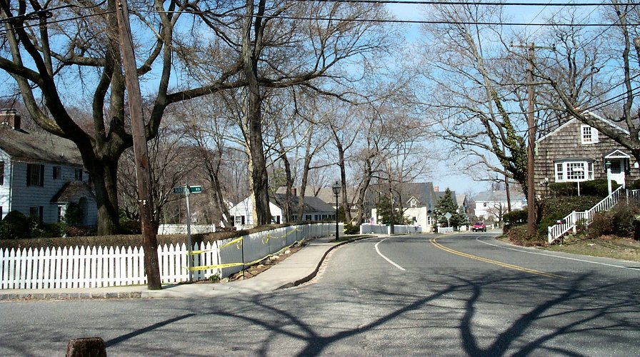
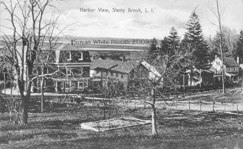
Taken from approximately the same location in March of 2002. The road at the left, Harbor Road, goes to the mill. In the distance, approximately in the center, is a two story white house with small dormers. This house can be seen in the card below.

Stony Brook, NY prior to World War I Main Street, Stony Brook"One of the Quaint Old Houses" prior to World War I, and a real photo of the same view. The c. 1760 house on the right, the church behind it, and some of the homes are still there. The Presbyterian church, left, was torn down in 1954.
Quaint Old House Now
This is a photo taken in March, 2002, of the "Quaint Old House." There have been changes, but the basic design is the same. The steeple, of the All Souls Episcopal Church, designed by Stanford White, can be seen. Across the street is the mill pond and the Stony Brook Grist Mill.

Main Street, Stony Brook "Main Street, Stony Brook, L. I." Not mailed, but printed well before World War I. The first two houses are still there. The first house, seen to the right of the Presbyterian Church below, now has a bay window in place of the porch. 

Episcopal Chapel Left: "Episcopal Chapel, Stony Brook, N. Y." The All Souls Episcopal Church was built in 1889. It was designed by Stanford White and originally called St. James Chapel.
Stony Brook Presbyterian Chapel The "Presbyterian Chapel." For an enlargement of just the church and carriage in front, click here. Built in 1886, the church was torn down in 1954 and a modern home was built on the property. For another view, see below.

Stony Brook Presbyterian Church 1908 Stony Brook Presbyterian Church, mailed in 1908. The sign on the building at left says, "Repairing of All Kinds". The house to the right is still there. The property to the left, at the intersection of Harbor Road is also occupied by a home. See photographs above. Right: I.O.O.F. (Independent order of Odd Fellows) car decorated for Encampment 27.

Old Brick House
Bank of Suffolk c1912"Old Brick House." This was on the south point of the triangle approximately where the gas station is now located. The tall pole in front is the original village Liberty Pole. Right: The Liberty Pole is still in front of the remodeled Old Brick House (Odd Fellows Hall). Shore Road is to the left (Harbor Road) and Main Street to the right.

Stony Brook Main Street and Bank by Greene Bank of Suffolk CountyLeft: Main Street by Greene. It was demolished when the Crescent Shopping Center was built. Right: "Bank of Suffolk County" This is before it was remodeled in 1957. It is the large white building down the street in the 2002 picture of the Quaint Old House.

Left: Labeled Main Street and Dock Road (to the left of the bank building). It was mailed at the end of 1908.

Right: "Store of H. E. Dickerson". This building is on the left in the card above left and on the left.
 

Stony Brook Harbor View From Town
Left: This view, with the Odd Fellows Hall and the Union Hall to it's right, shows the southern side of the "triangle block". Right: The Yellow Lantern Inn, Shore Road. The building to the right is the Union Hall.

Stony Brook Post Office before 1915Post Office, Stony Brook. This real photo card was printed before 1907 (undivided back). The building was located on the north side of Main Street, east of the mill pond. Some of the mailboxes can be seen through the window. Right: a view of the post office published a few years later by Chas. H. Mierow.

Left: Thomas Roulston's Grocery on Main Street. The sign "Drugs" is for Zimmerlein's. Many of the Stony Brook postcards were published by this drug store, and others. Right: The R. H. Smith General store is at the corner of the eastern (short) side of the triangle to the right. The back of the Davis house, marking the other corner, is on the right. 

More Stony Brook Postcards
Back to the First Postcard Page
Back to the Pieroth Page

Susan Carter White Pieroth
All images and text Copyright © 2001-2010  Susan White Pieroth