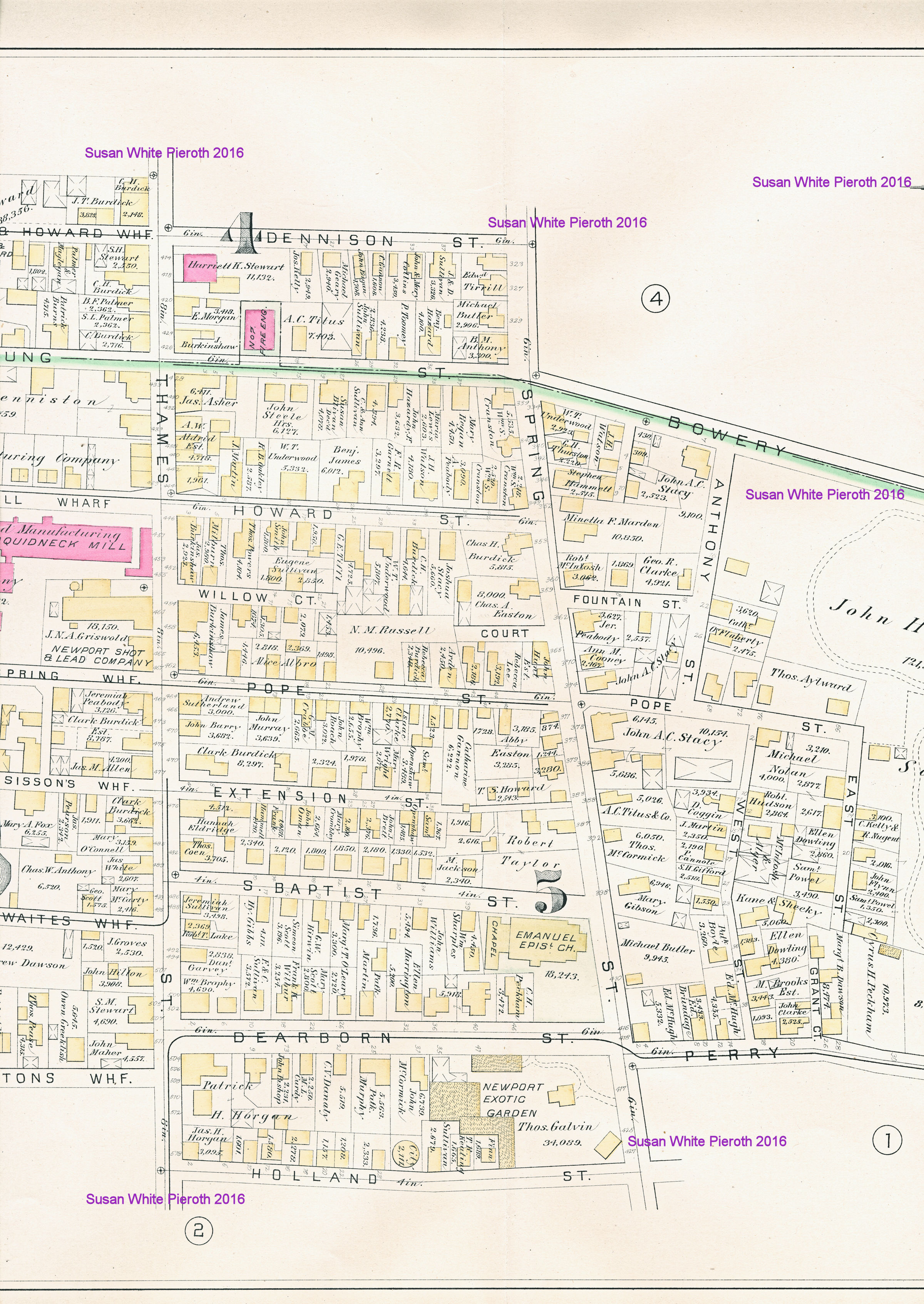
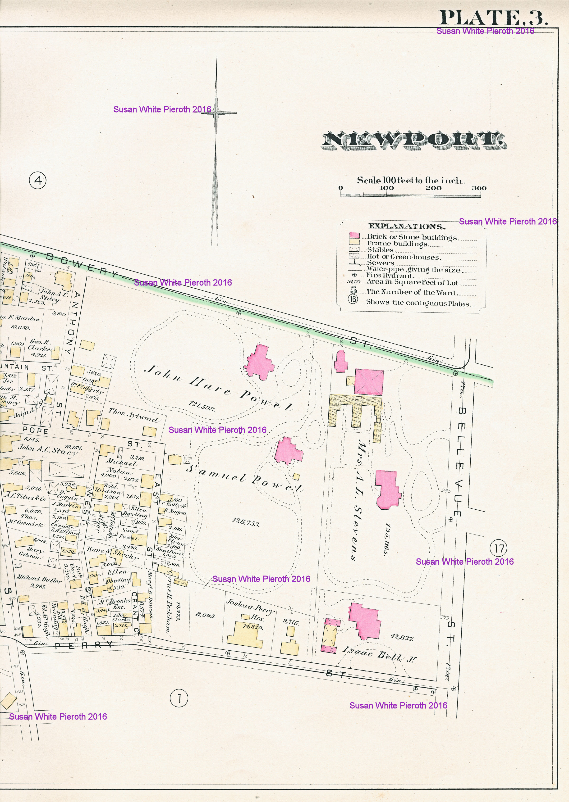
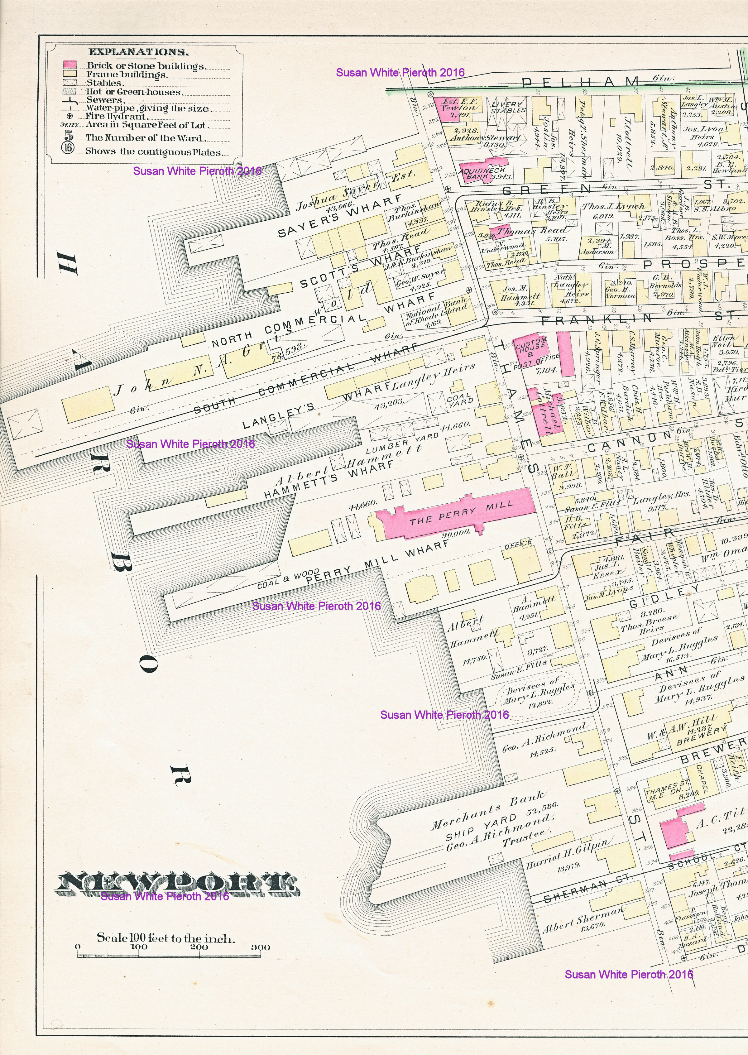
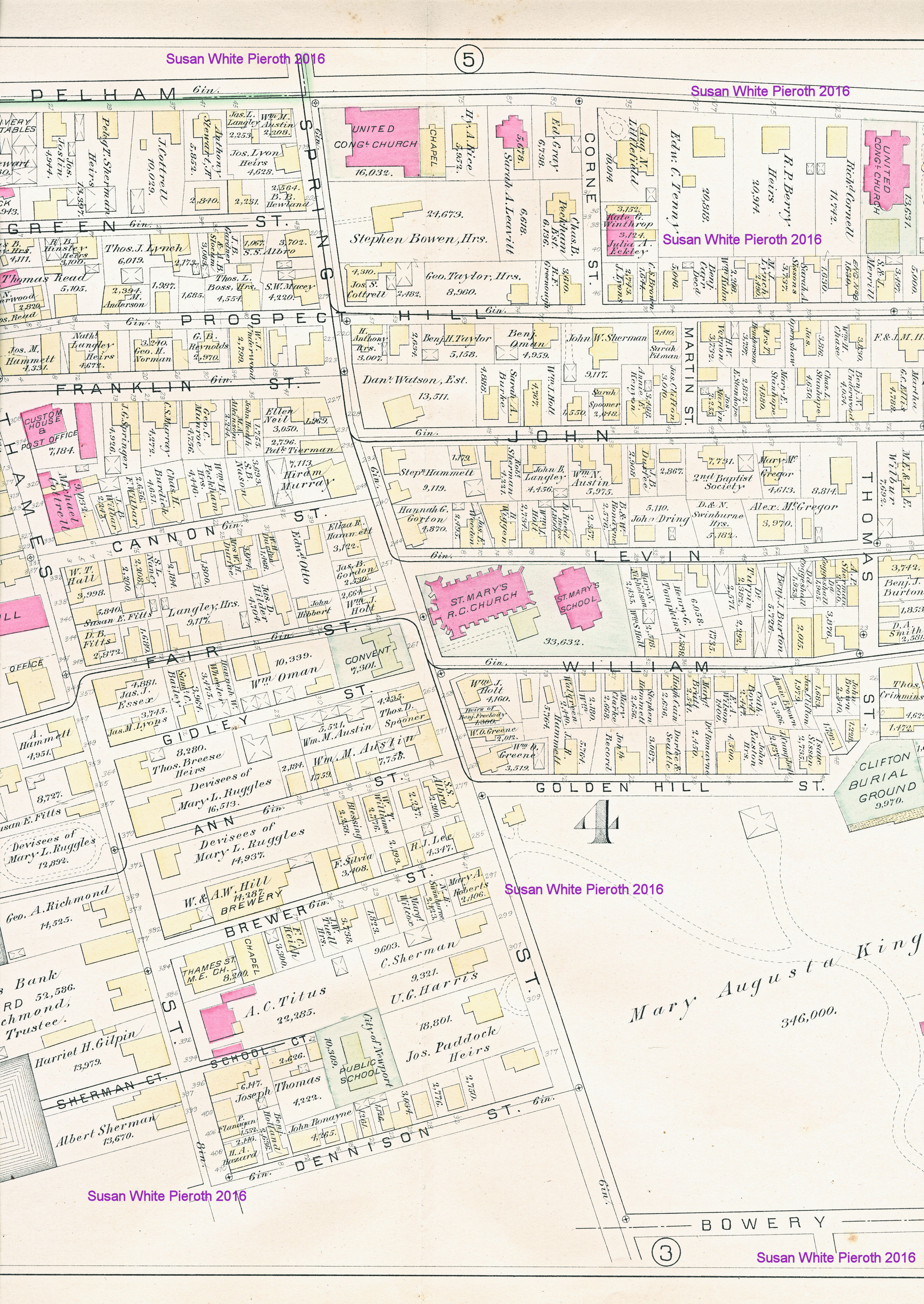
1883
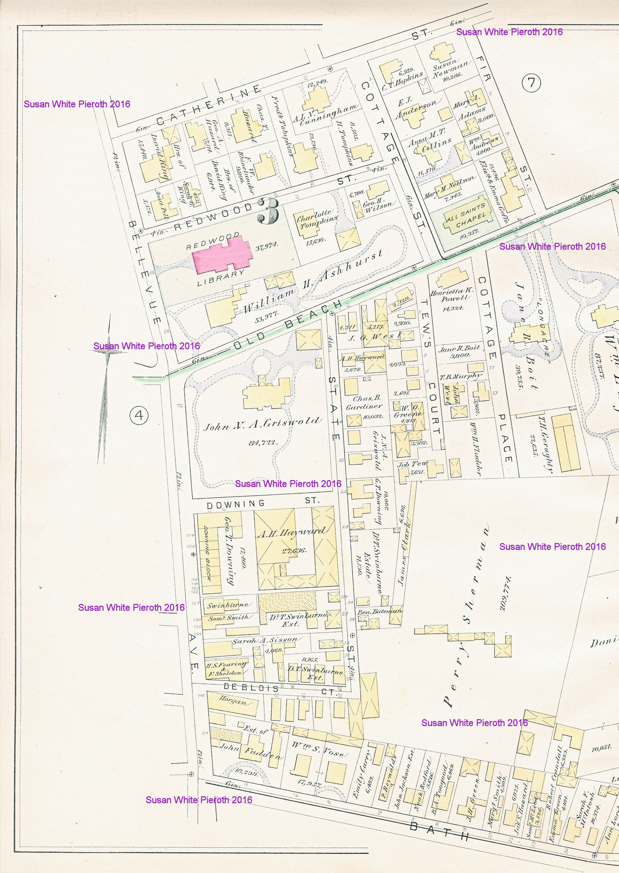
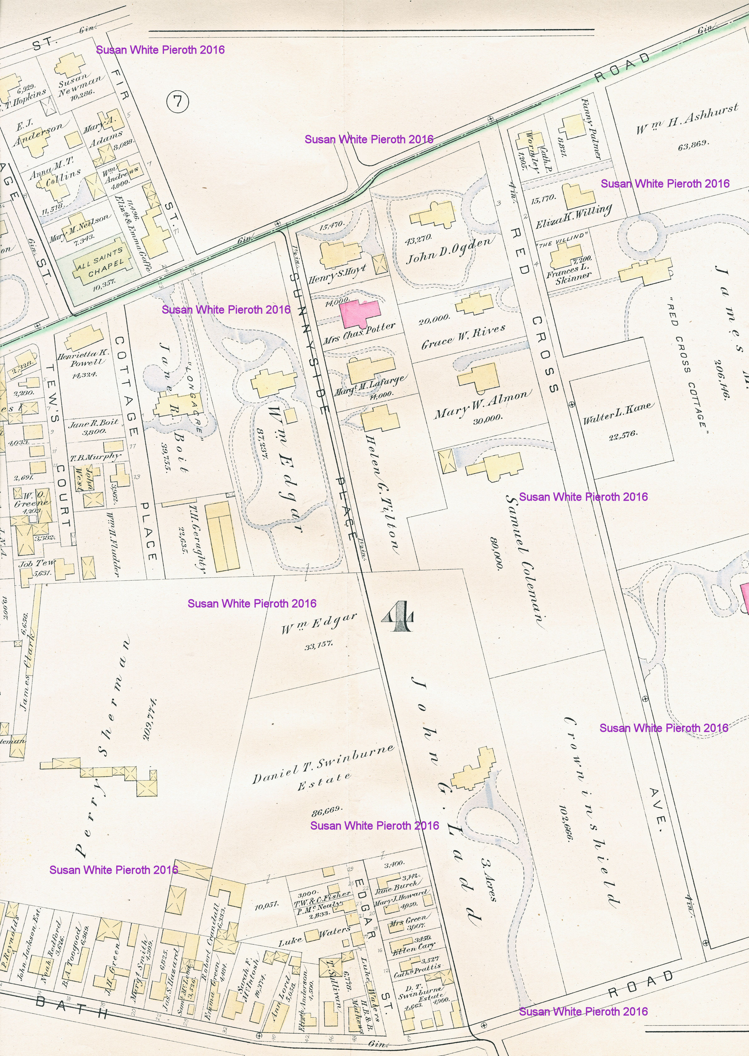
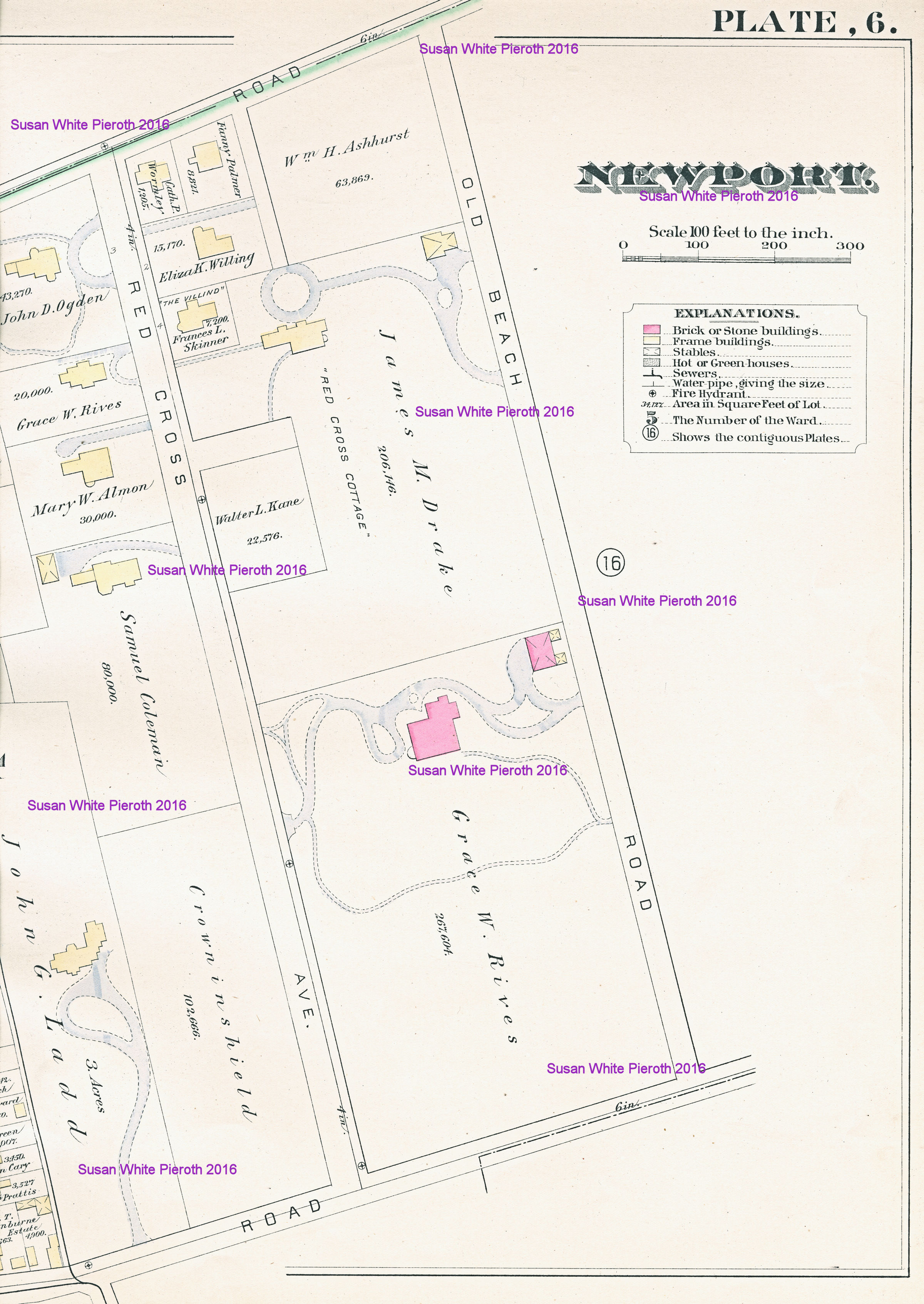
Atlas of the City of Newport, Rhode Island - Plates 1 to 6
Click the image to enlarge
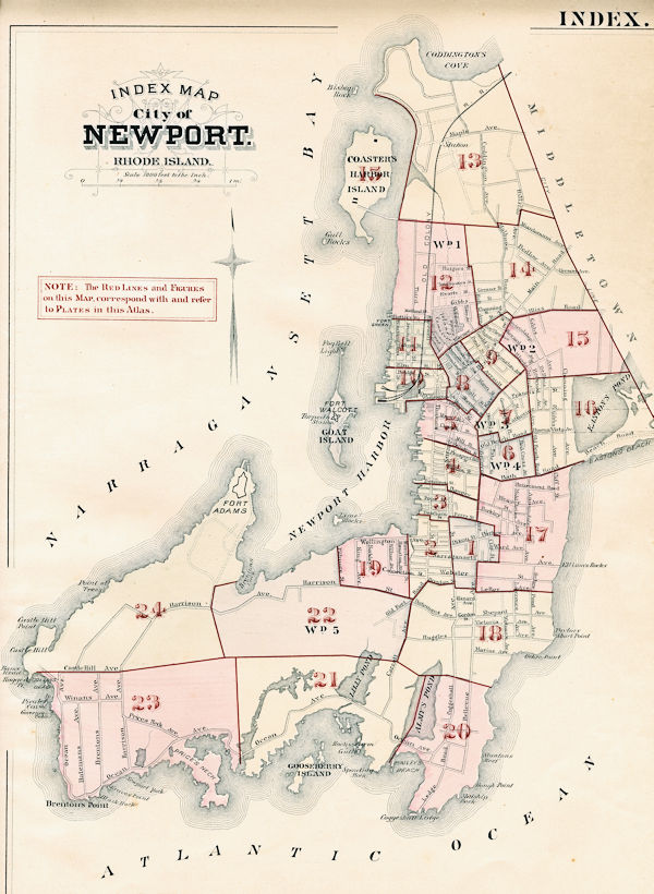
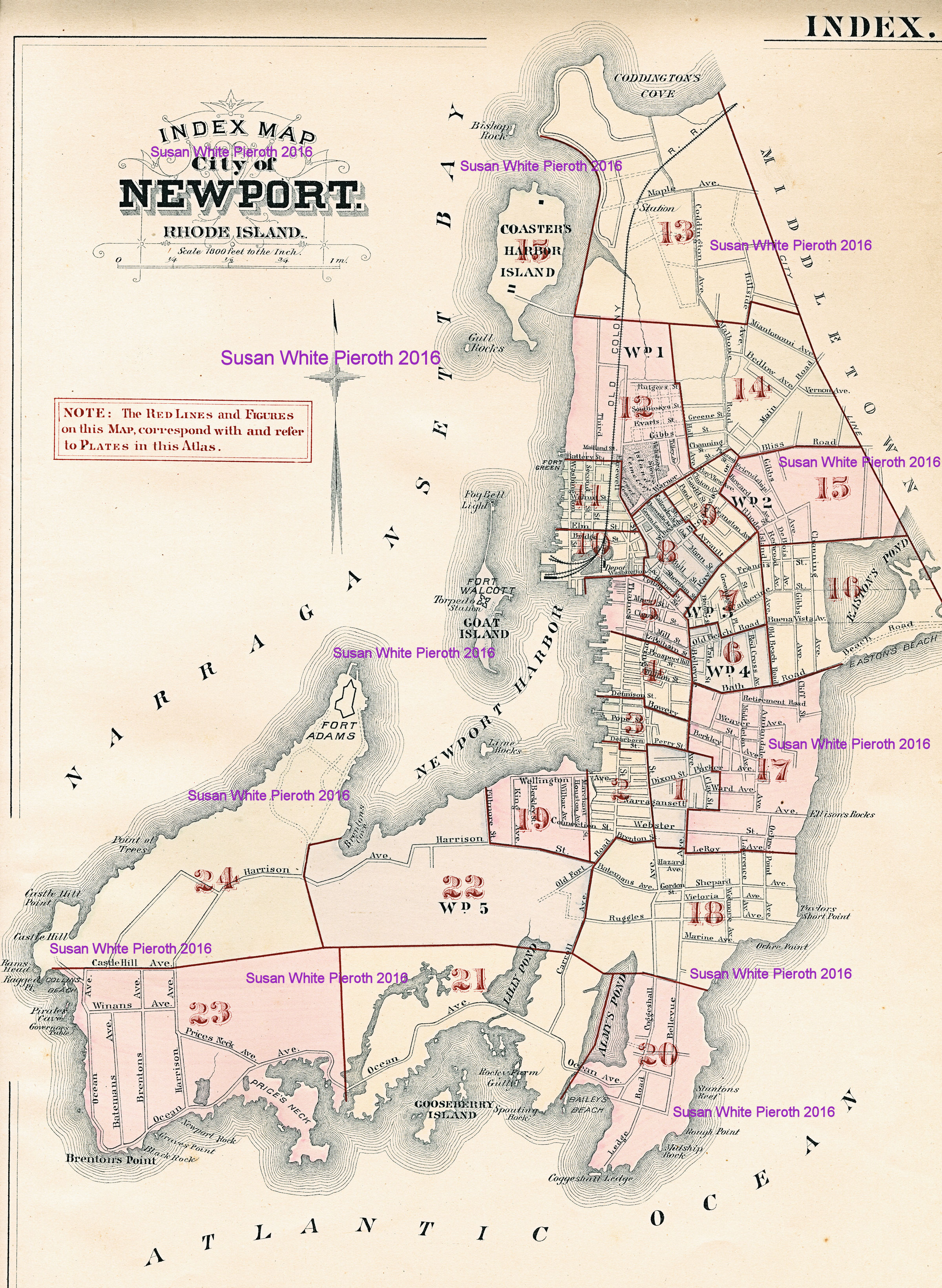
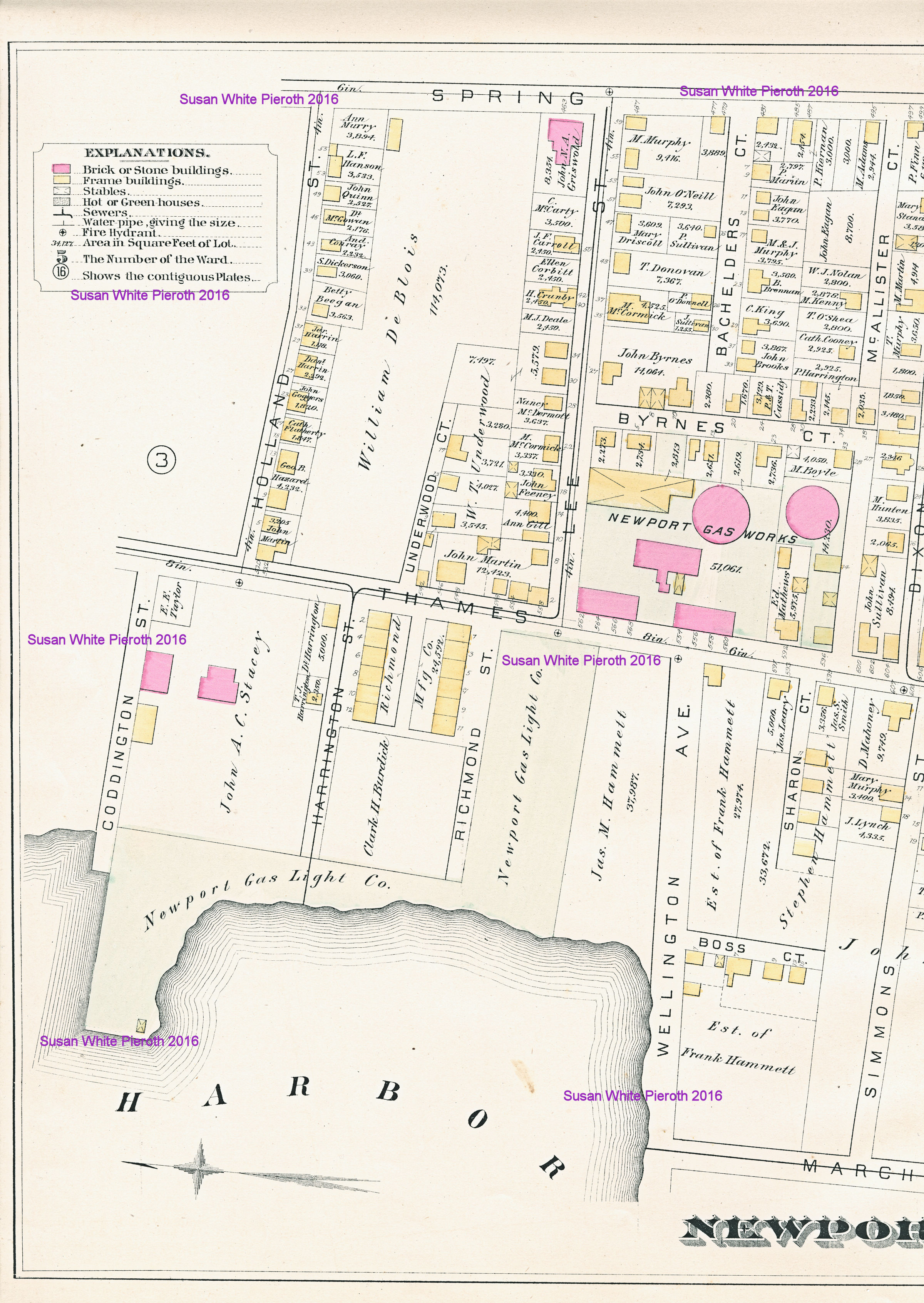
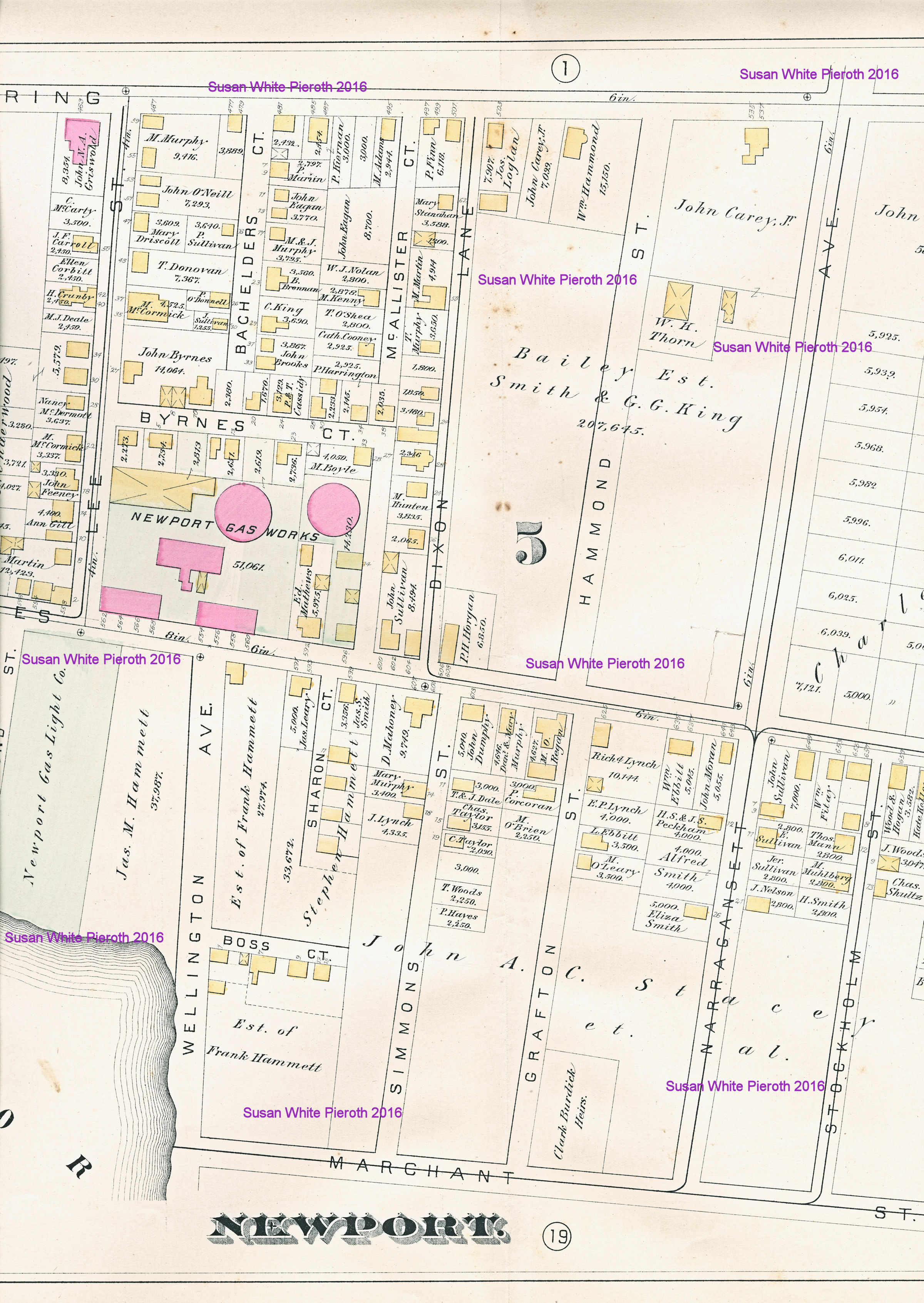
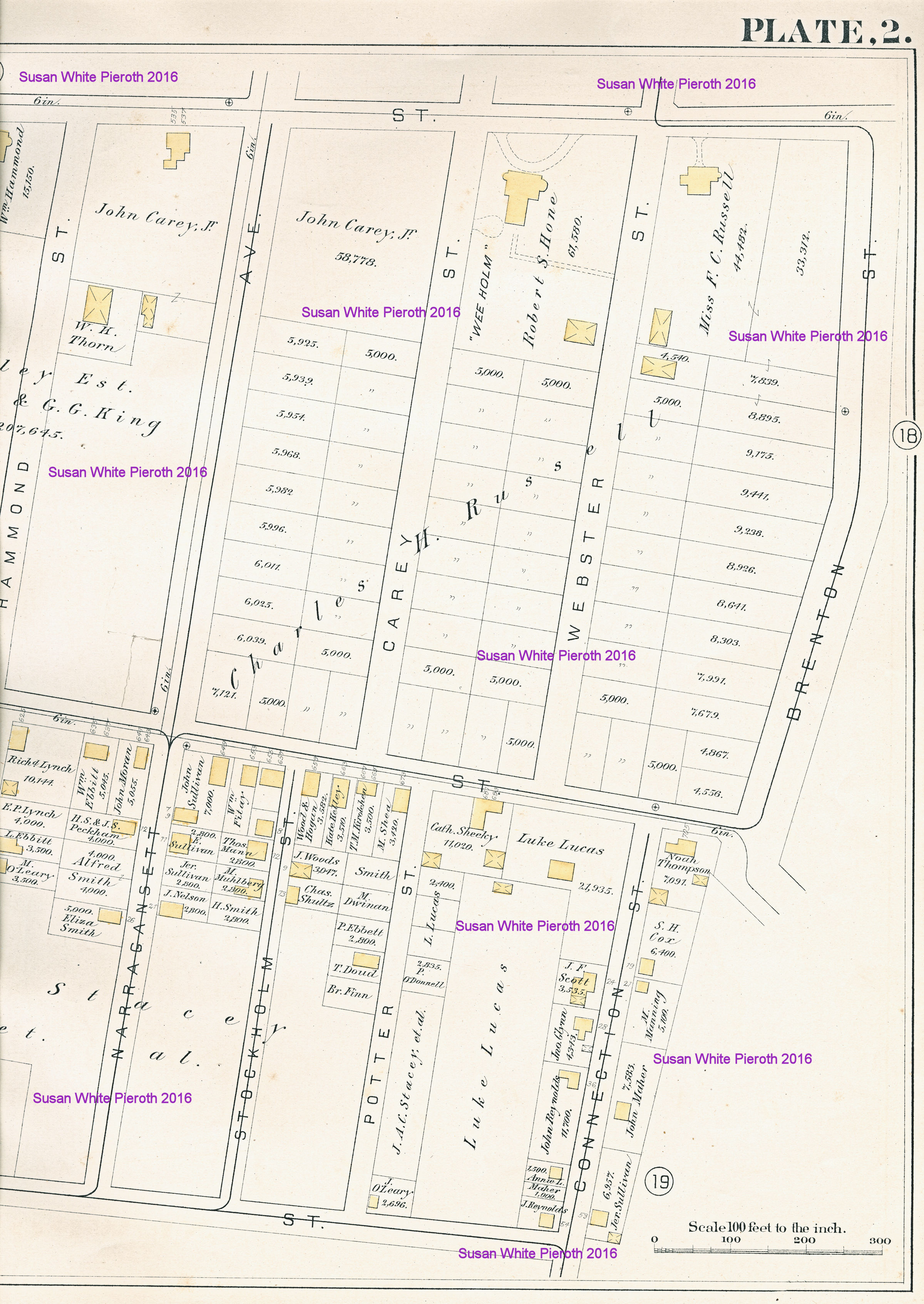
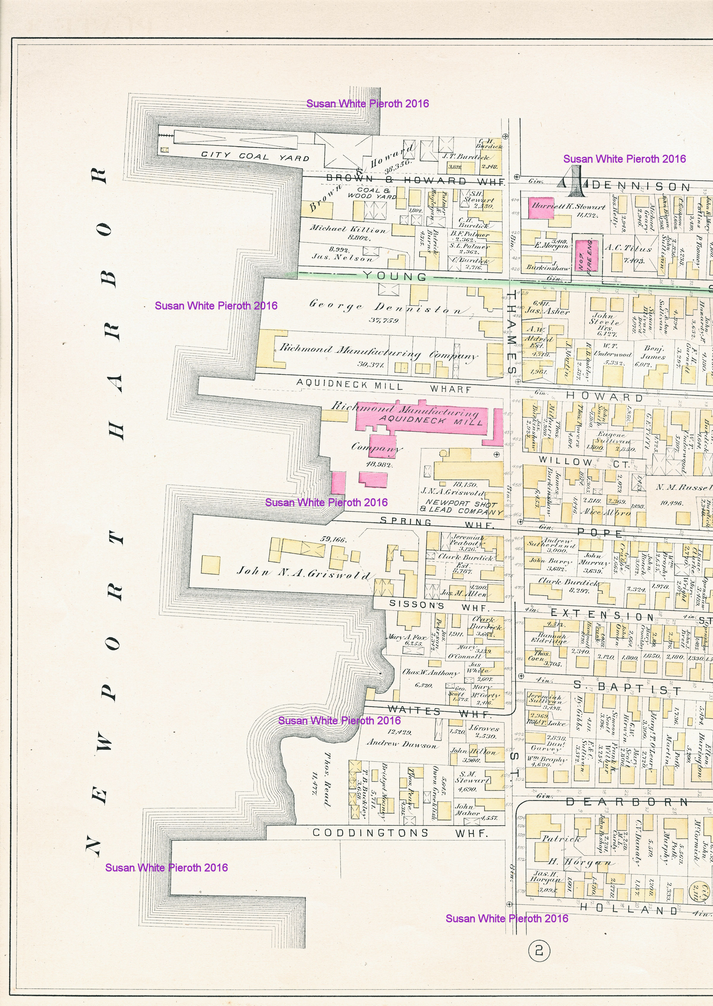
Above is the index map for the map plates. The RED numbers and
outlines are the keys to the plates in the atlas. Also
shown
are the Wards of Newport. Most plates are double pages and are scanned
in three overlapping sections.
NOTE: All scans are one to two
megabytes.
Links to Scans of Individual
Plates
| 1 | 2 | 3
| 4 | 5
| 6 || 7 | 8 | 9 | 10 | 11 |
12 || 13
| 14 | 15 | 16 | 17 | 18 || 19 | 20 | 21 | 22 | 23 |
24 |
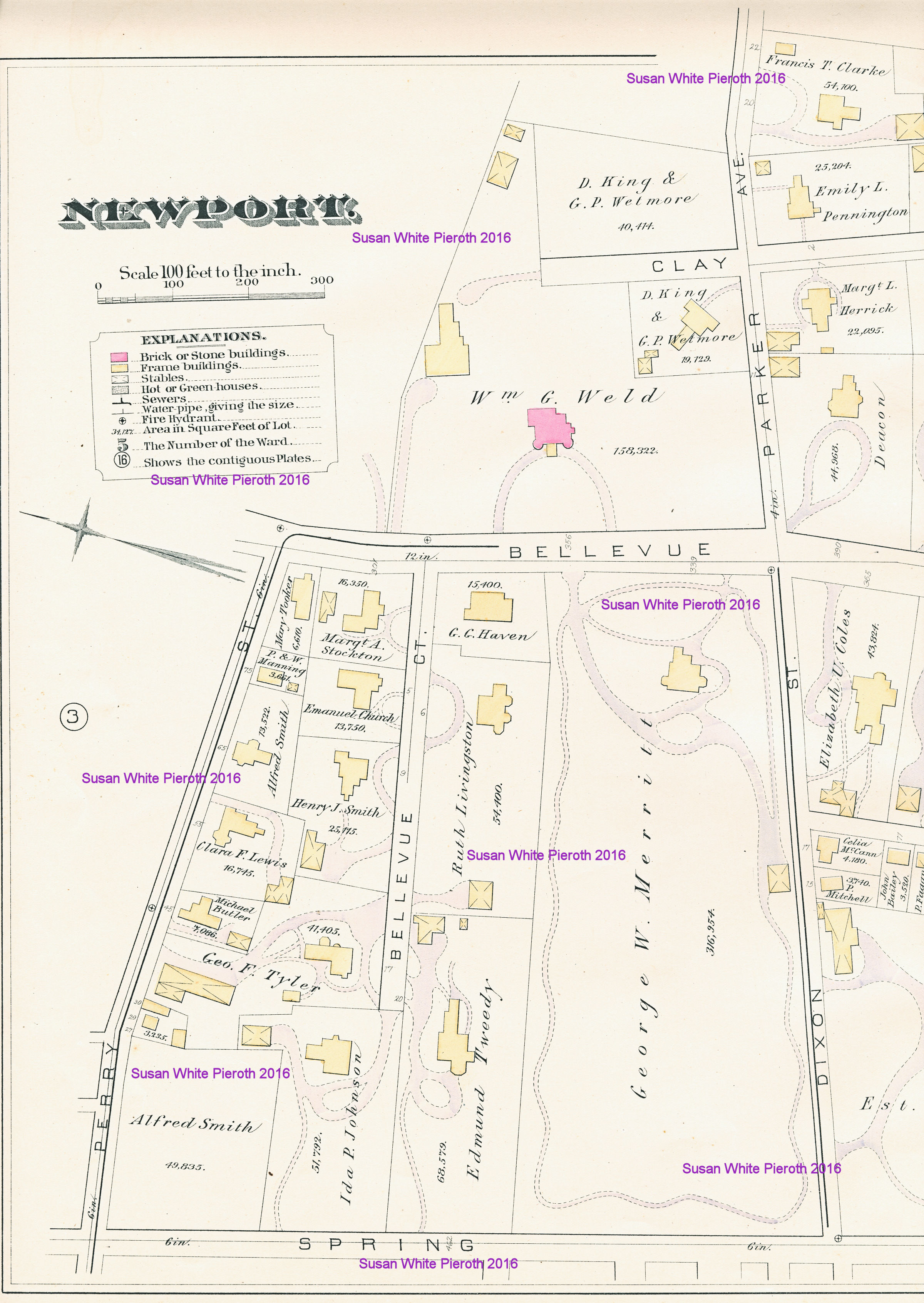
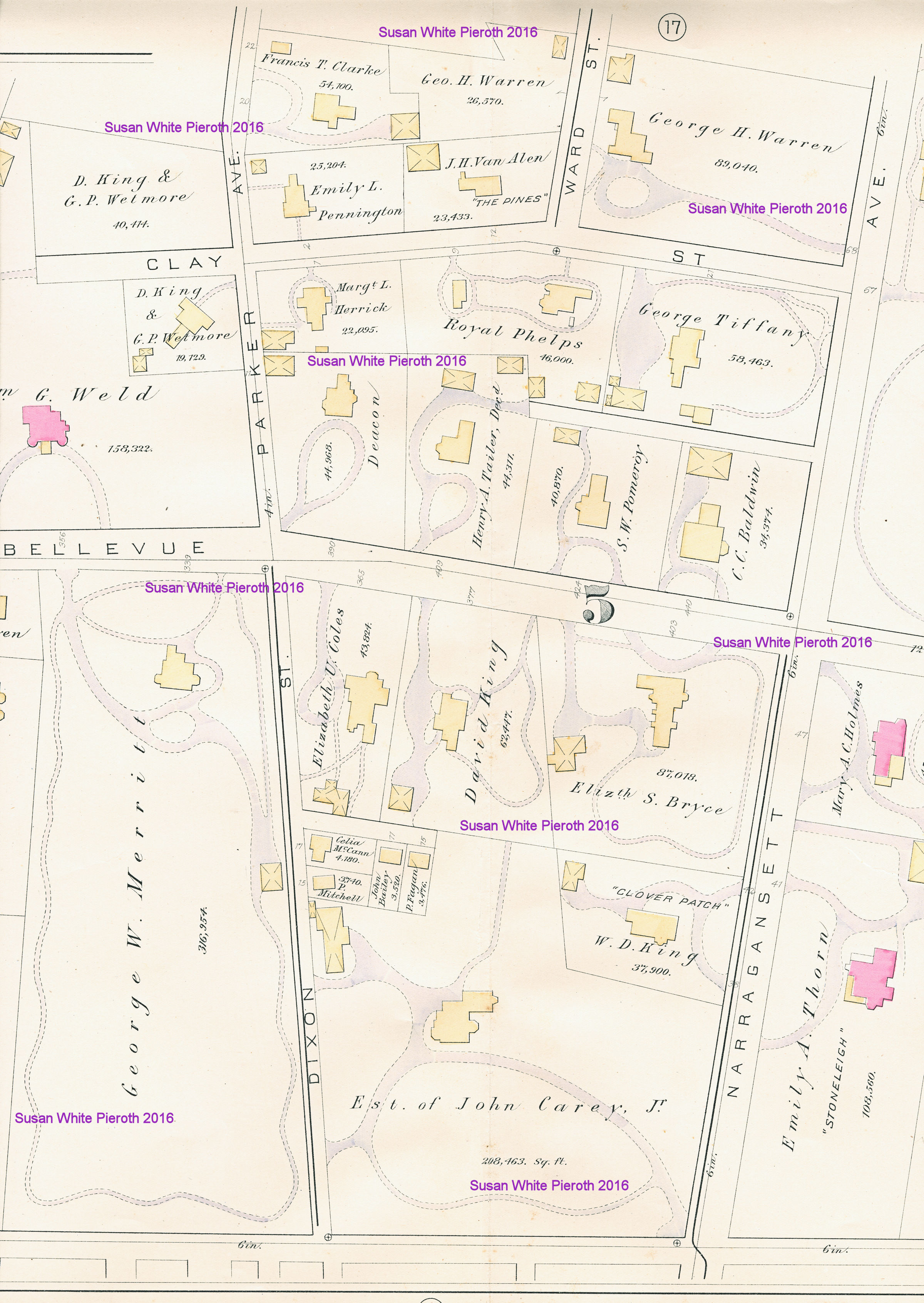
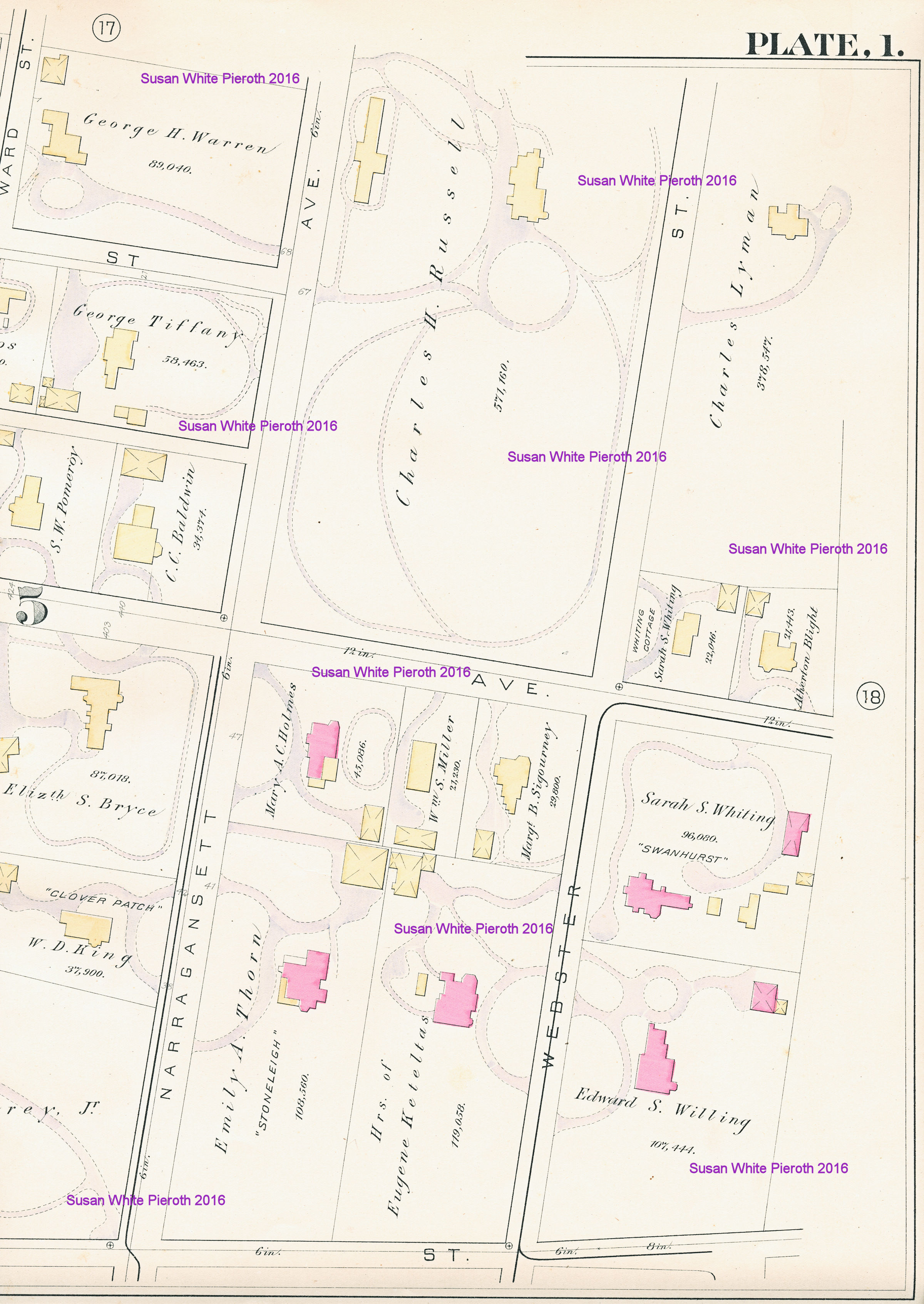
Plate 1:
Plate 2:
Plate 3:
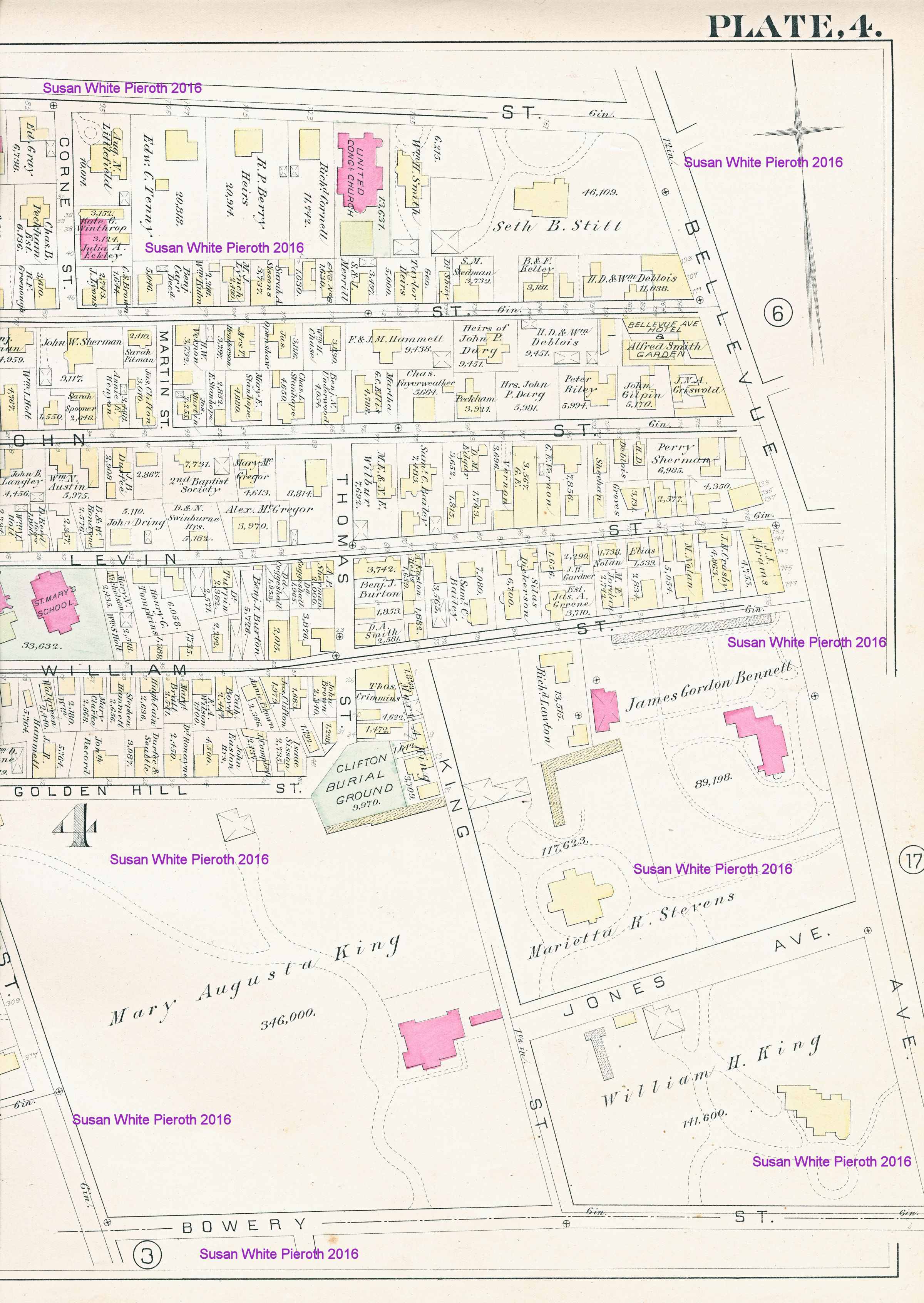
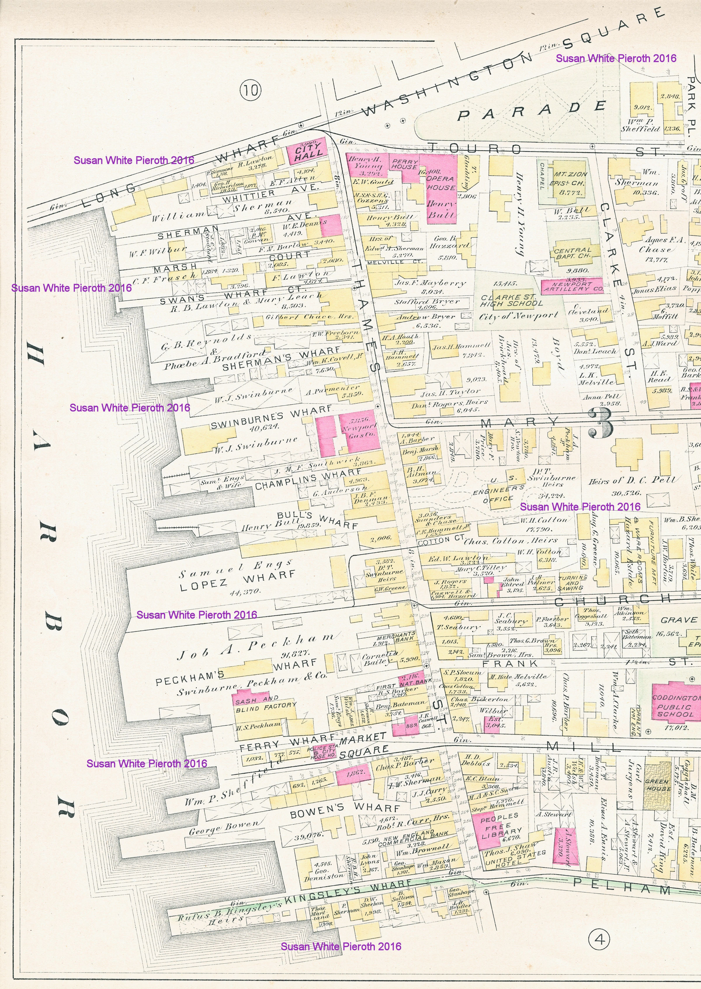
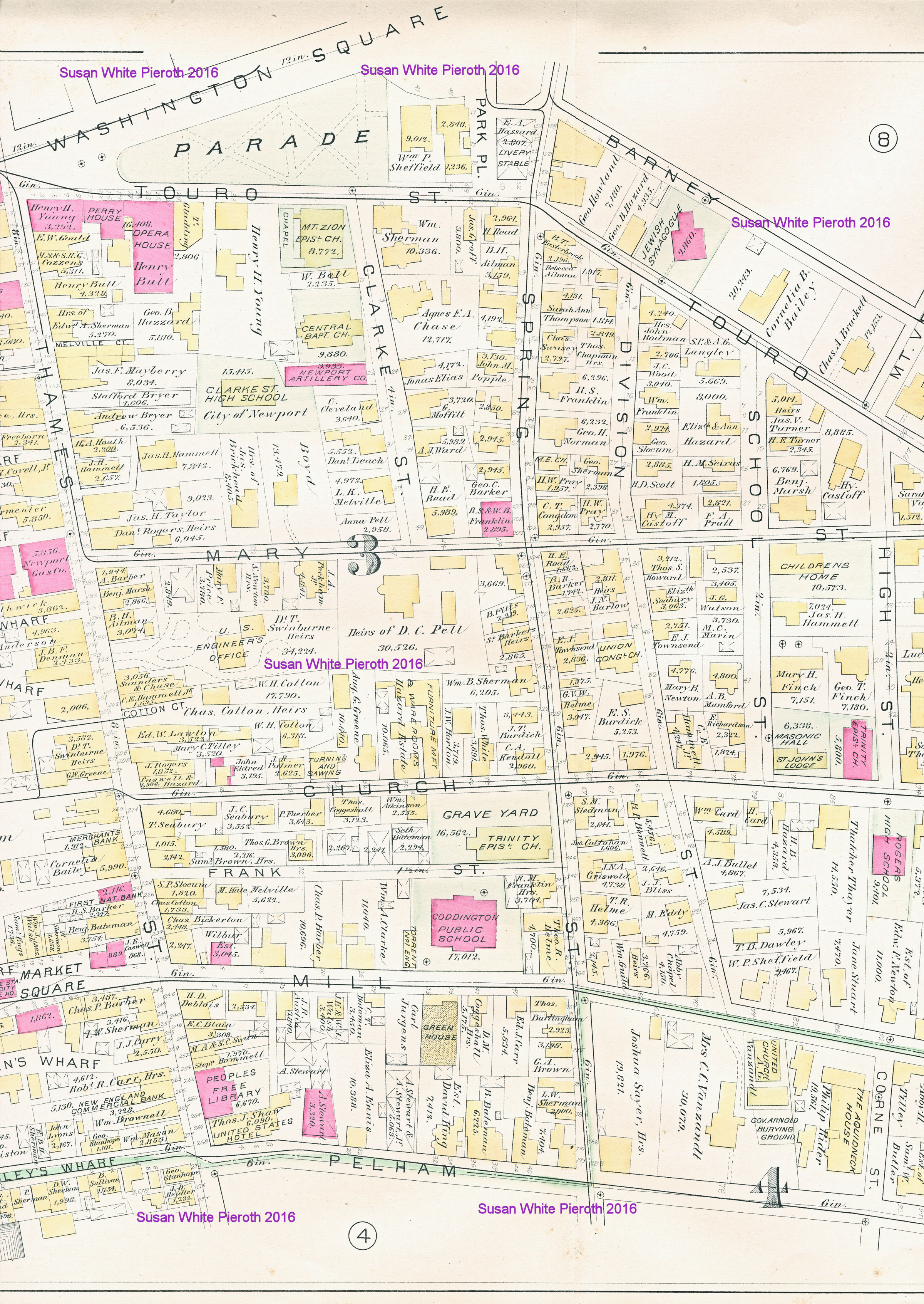
Plate 4:
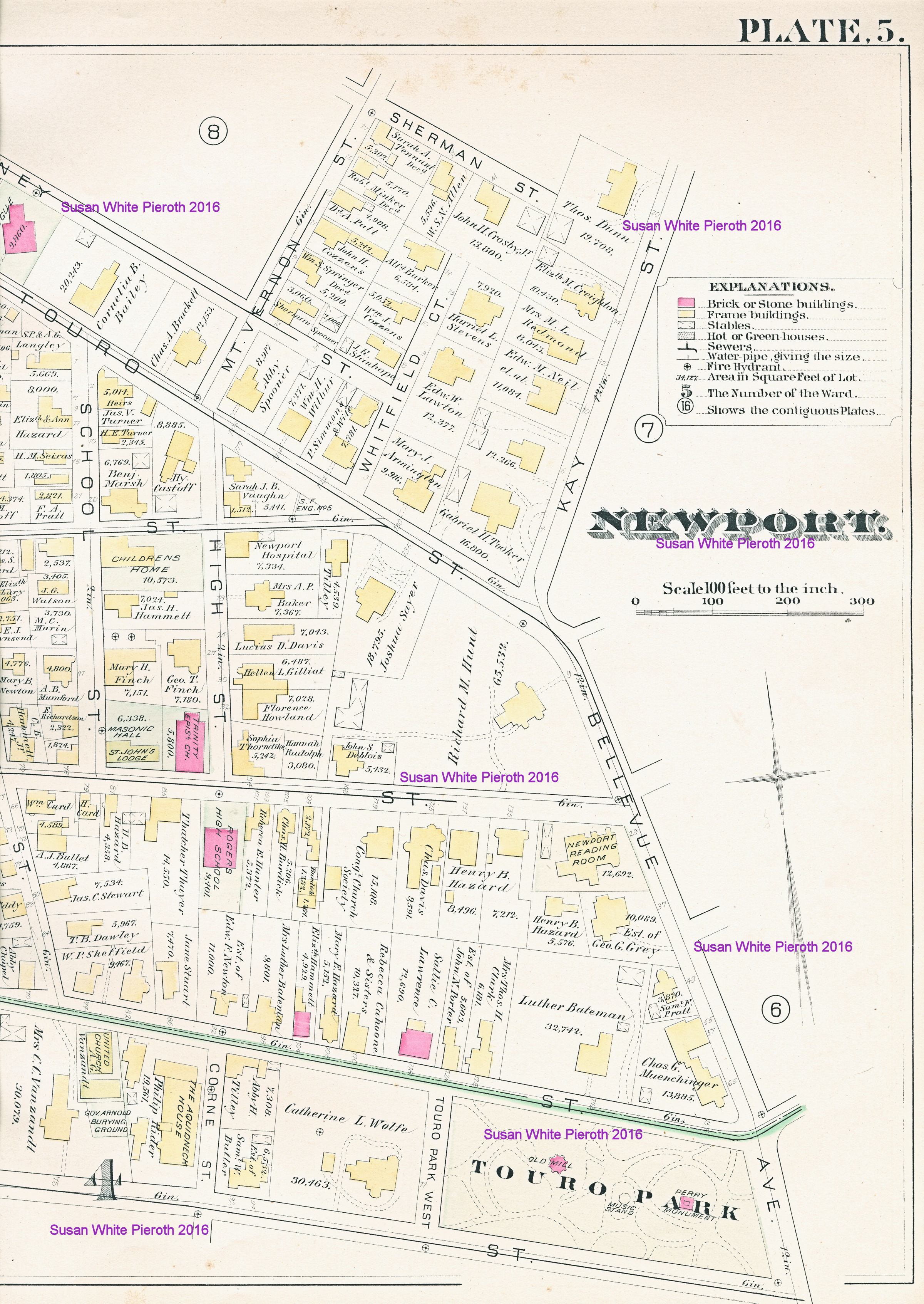
Plate 5:
Plate 6:
Map scans copyrighted by Susan
White Pieroth, 2016. These maps are made available to the public for
non-commercial purposes. If you wish to incorporate this document, or
any
scanned image, into any published work (including an internet page),
you must first obtain permission
from Susan
White Pieroth.
Next
Page
Back to the First Page