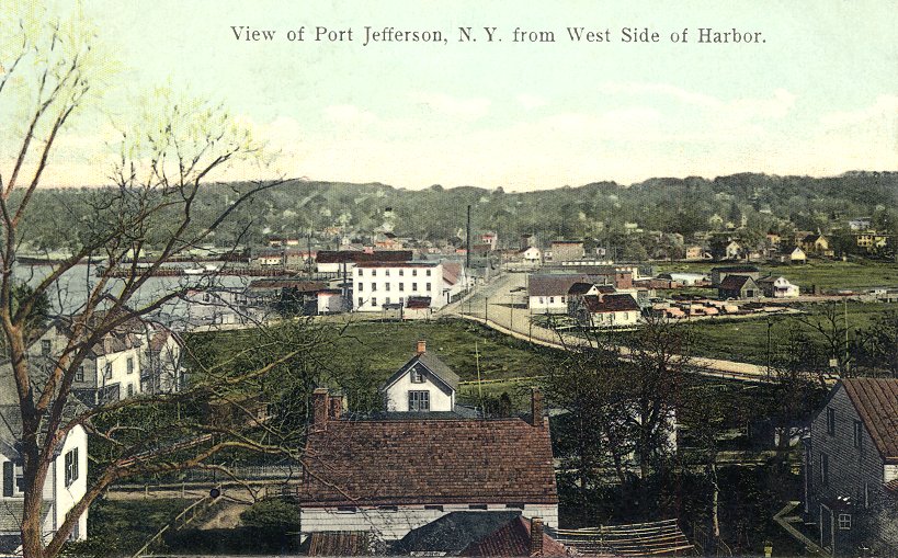
 |
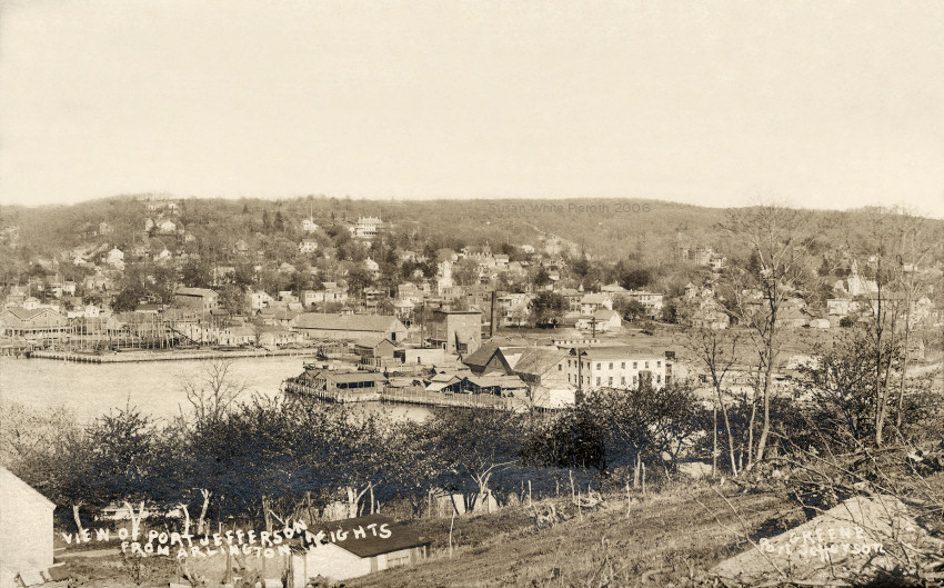
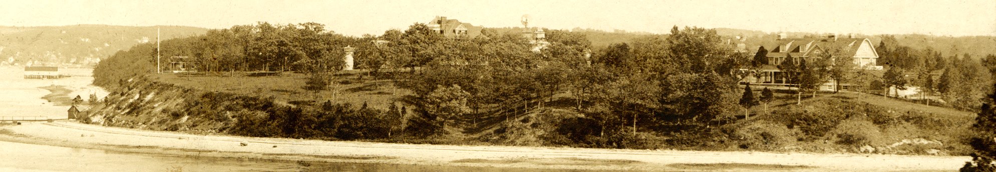
Left: View from Arlington Heights (west side) about 1906. Taken from north of the two views below. |
|
|
Left: View from Arlington Heights (west side) about 1906. Taken from north of the two views below. |
 |
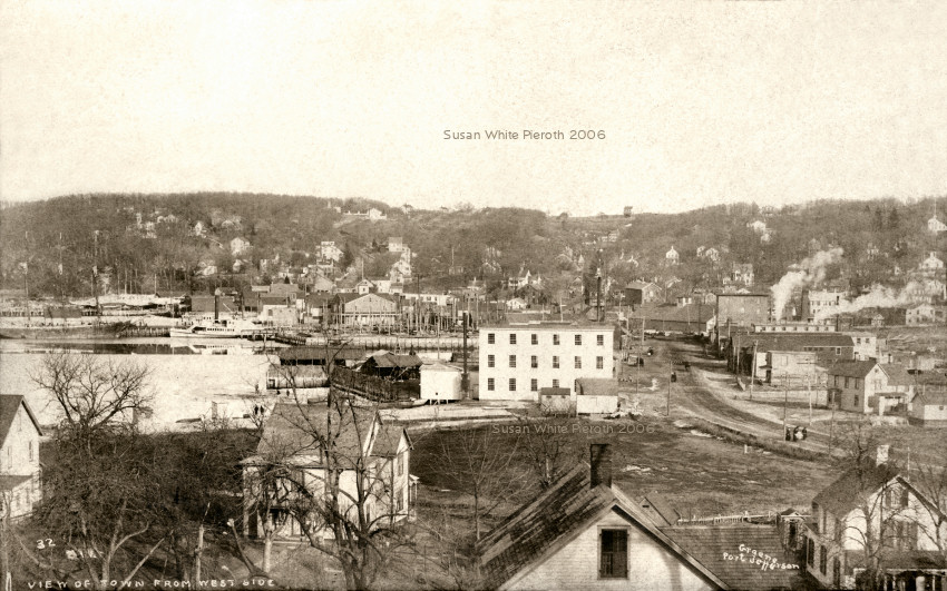 Left:
Mailed in 1912. The road at the right is West Broadway. It goes up the
hill at the right to East Setauket. Right: a Greene photo closer in
with
a view of the F.F.
Darling Store in
the back. Mailed in 1909. Left:
Mailed in 1912. The road at the right is West Broadway. It goes up the
hill at the right to East Setauket. Right: a Greene photo closer in
with
a view of the F.F.
Darling Store in
the back. Mailed in 1909. |
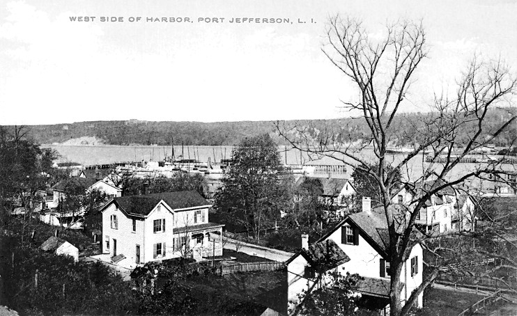 |
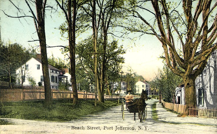 Left:
"West Side of Harbor." Looking east with Beach Street in the
foreground.
Right: "Beach Street" looking north. The note on the back says, "Aug.
1,
1914 came in with Sam in row boat for the mail." Left:
"West Side of Harbor." Looking east with Beach Street in the
foreground.
Right: "Beach Street" looking north. The note on the back says, "Aug.
1,
1914 came in with Sam in row boat for the mail." |
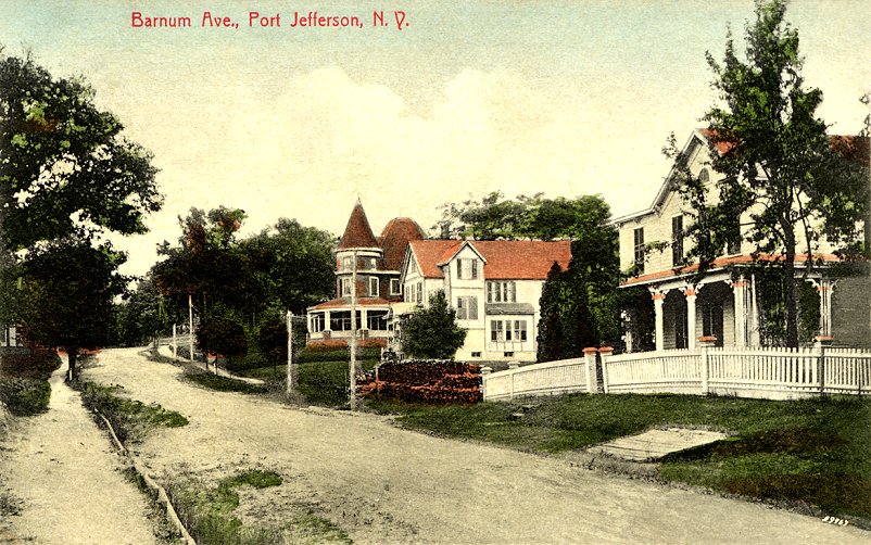 |
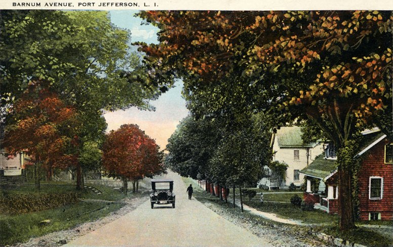 Left:
Barnum Ave." mailed in 1910. Named for the circus promoter P. T. Barnum
who purchase property, built this and other roads and buildings. This
road
connects West Broadway with Main Street. Right: A different view of
Barnum,
mailed in 1928. Left:
Barnum Ave." mailed in 1910. Named for the circus promoter P. T. Barnum
who purchase property, built this and other roads and buildings. This
road
connects West Broadway with Main Street. Right: A different view of
Barnum,
mailed in 1928. |
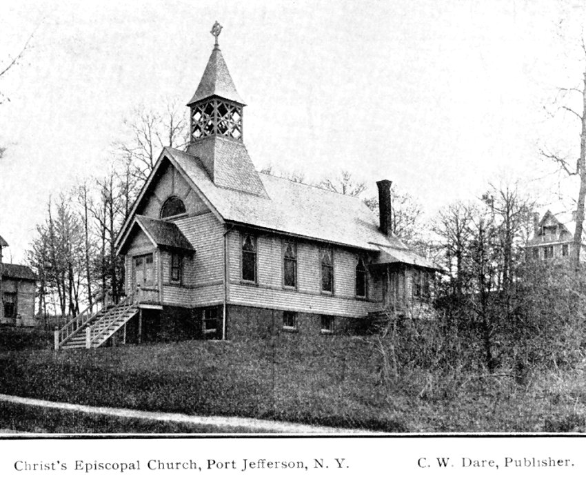 |
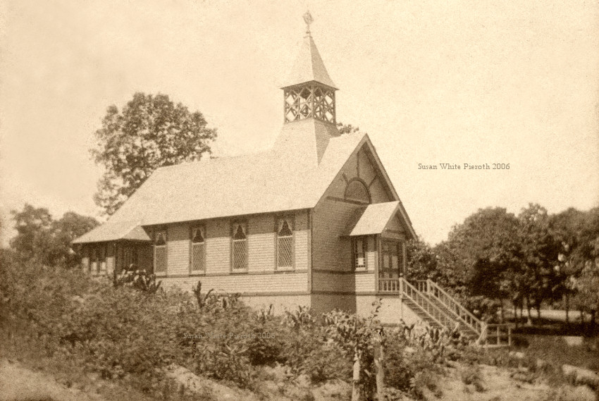 Left:
"Christ's Episcopal
Church, Port Jefferson, N. Y." published by C. W. Dare. The church is
still
on Barnum Avenue with a active congregation. Right: a real photograph
of the church - probably very early in the 1900's. Left:
"Christ's Episcopal
Church, Port Jefferson, N. Y." published by C. W. Dare. The church is
still
on Barnum Avenue with a active congregation. Right: a real photograph
of the church - probably very early in the 1900's. |
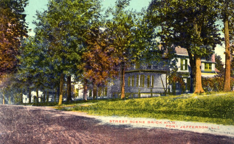 |
 Left: "Street Scene Brick
Kiln, Port Jefferson, L. I." Not mailed. This is the same area that P.
T. Barnum developed in the western part of Port Jefferson. This area
was
also known as Brick Hill, apparently because there was clay in the area. Right: "Setauket Hill, Port
Jefferson, L. I." mailed in 1911. West Broadway looking west? Left: "Street Scene Brick
Kiln, Port Jefferson, L. I." Not mailed. This is the same area that P.
T. Barnum developed in the western part of Port Jefferson. This area
was
also known as Brick Hill, apparently because there was clay in the area. Right: "Setauket Hill, Port
Jefferson, L. I." mailed in 1911. West Broadway looking west? |
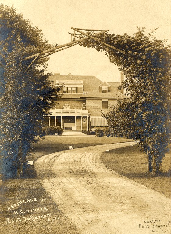 |
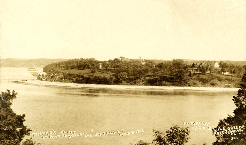
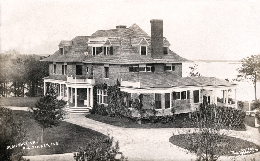 "Residence
of H. C. Tinker, Port Jefferson, L. I." This is the house at the left
of
the windmill in the picture above. It was torn down and new homes built
on the property. "Residence
of H. C. Tinker, Port Jefferson, L. I." This is the house at the left
of
the windmill in the picture above. It was torn down and new homes built
on the property. |
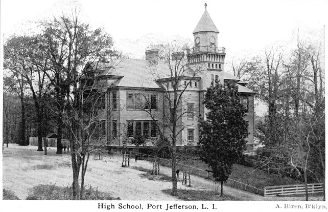 |
"High School, Port Jefferson,
L. I." dated 1913. The building burned down the night of July 3rd,
1913. This picture was taken by A. S. Greene.
The building that replaced it on High Street was last used as a Junior
High School, but was closed in 1992. See the Port Jefferson School
District web
site for more information on the schools.
|
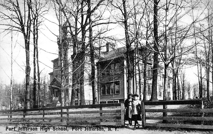 |
 Left:
"Port Jefferson High
School..." Published by Chas. S. Dickerson about 1910. Left:
"Port Jefferson High
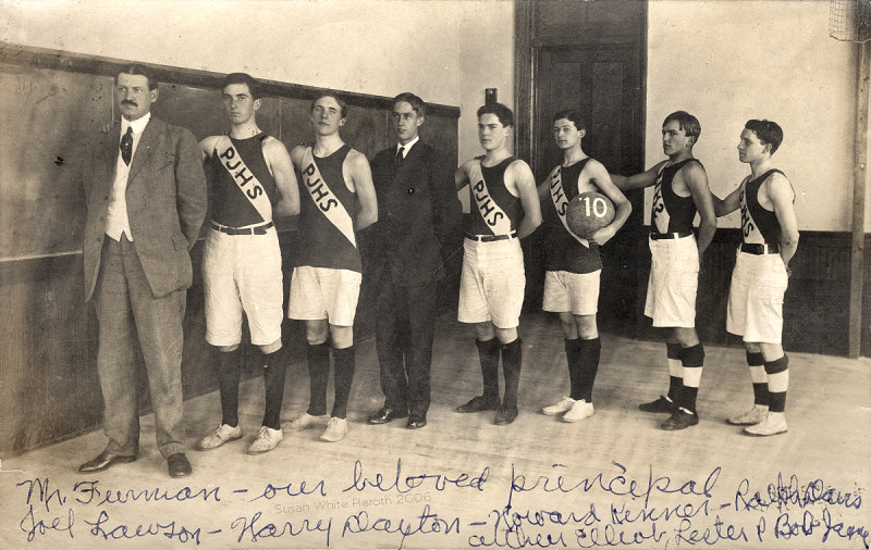
School..." Published by Chas. S. Dickerson about 1910.Right: The 1910 Port Jefferson High School basketball team. Mr. Furman the principal is at the left. |
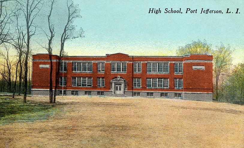 |
This is the High School that was built in 1914 to replace the one above that burnt down. It later was used as the Junior High School. Mailed in 1917. |
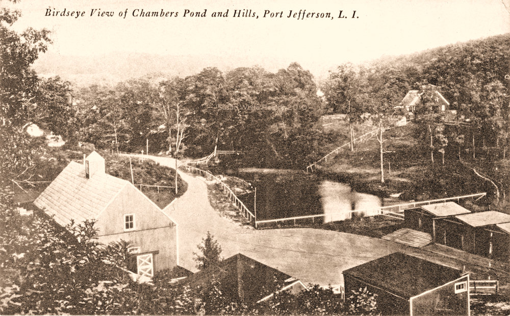 |
"Birdseye View of Chambers Pond and Hills, Port Jefferson, L. I." published by Chester Darling of Port Jefferson. The pond was constructed by the Chambers family. To the upper right is the back of the Daniel Jones homestead on Liberty Avenue. The U.S. Shipping Board tore it down and constructed the Plant Hotel, shown below. The pond is now dry high school property. |
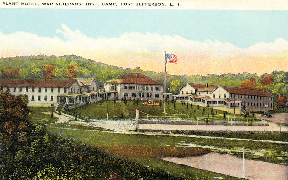 |
"Plant Hotel, War Veterans' Inst. [Instructional] Camp, Port Jefferson, L. I." published by Oettinger Variety Store. The hotel was built during about 1918 for the shipyard workers and used after the World War I as a training school for veterans. In 1937 a new high school was built on the site. |