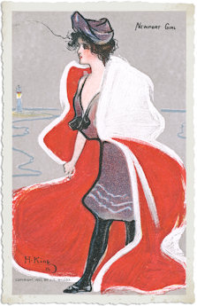
 |
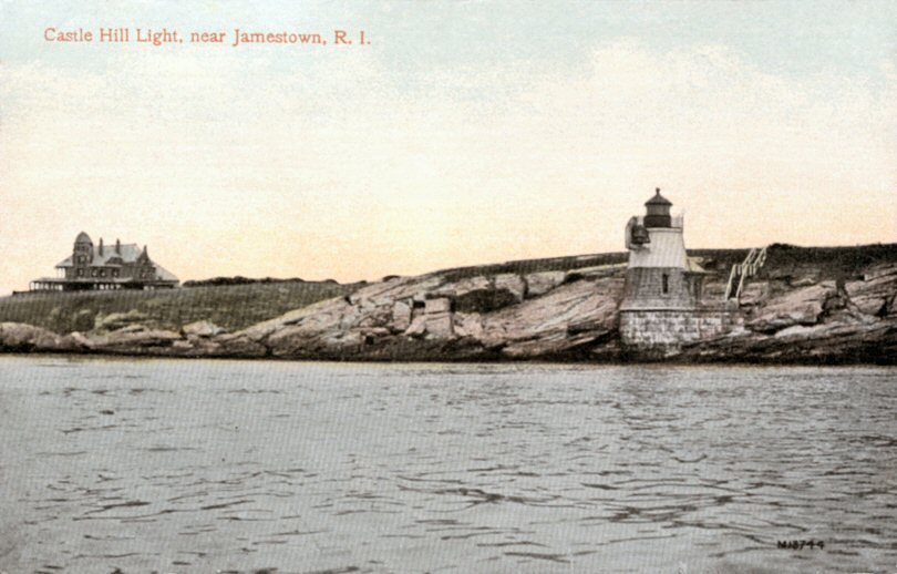
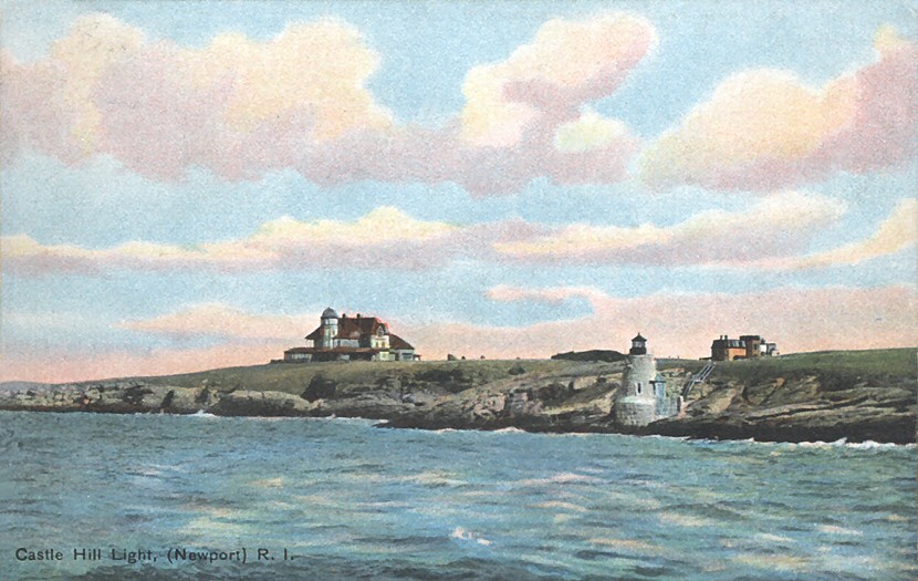 Left
and right: two views of Castle Hill Light early in the 1900's.
It is still there. For more information see this
site. Left
and right: two views of Castle Hill Light early in the 1900's.
It is still there. For more information see this
site.
|
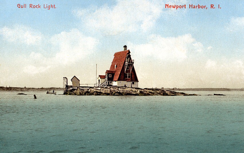 |
 Left:
Newport Harbor, Gull Rock Light. Left:
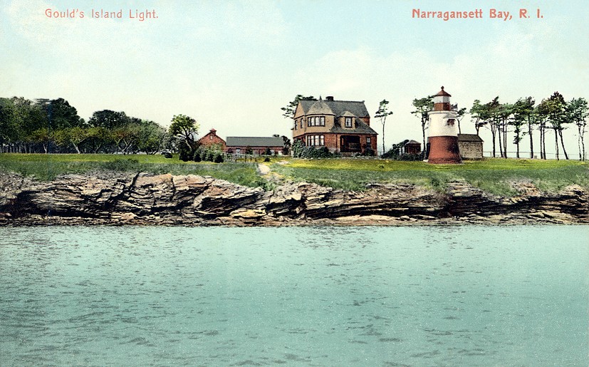
Newport Harbor, Gull Rock Light.Right: Gould Island Light. |
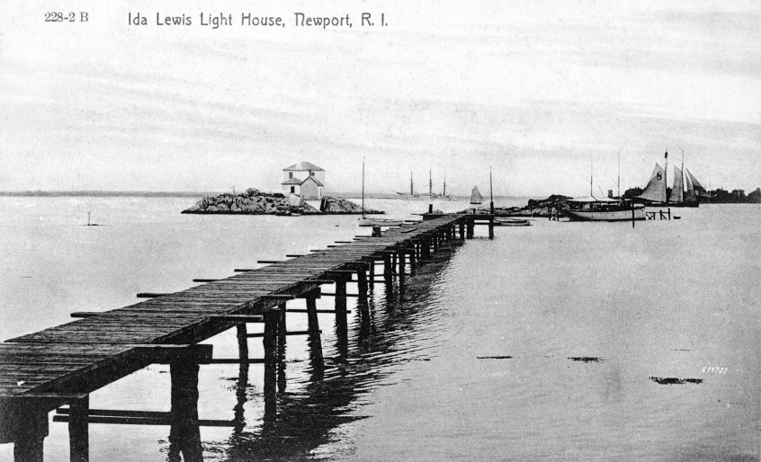 |
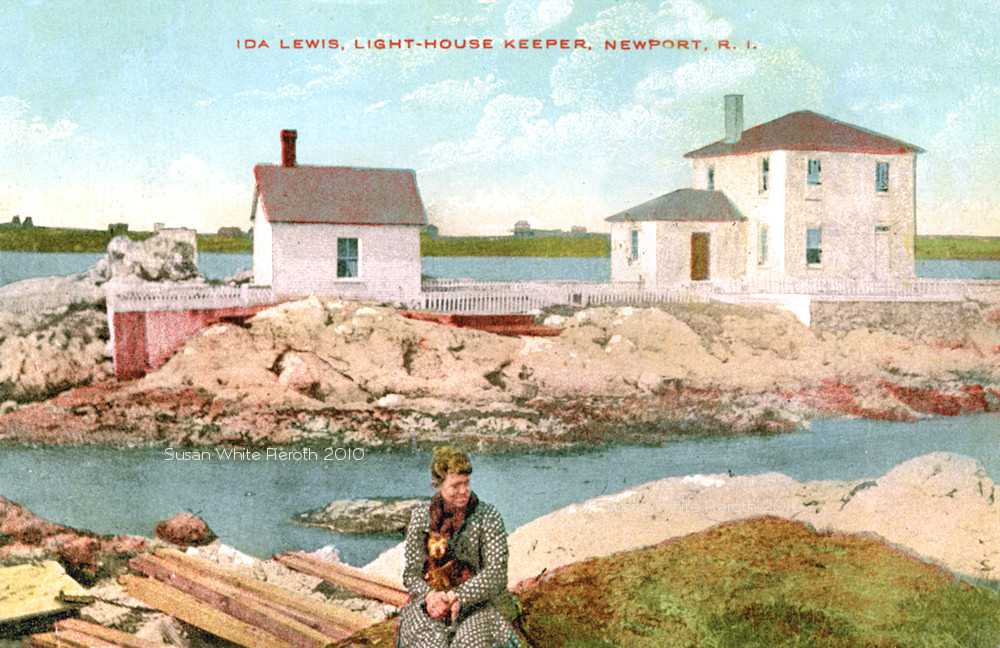 Left: Ida
Lewis Light House, named for the lighthouse keeper shown with her dog
on the right. It was previously known as Lime Rock Rock Light. For more
information, see this site. For scans of the feature article in the 1869 issue of Harper's Weekly, see this site. Left: Ida
Lewis Light House, named for the lighthouse keeper shown with her dog
on the right. It was previously known as Lime Rock Rock Light. For more
information, see this site. For scans of the feature article in the 1869 issue of Harper's Weekly, see this site. |
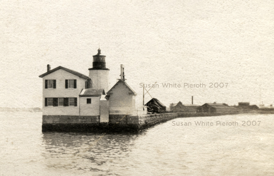 |
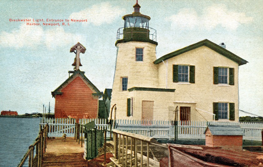 Left
and right the Newport Breakwater Light (also known as Goat Island Light
and Harbor Light) off the torpedo station, from opposite sides. The one
on the right was postmarked 1910. Only the lighthouse remains today.
For more information, see this
site. Left
and right the Newport Breakwater Light (also known as Goat Island Light
and Harbor Light) off the torpedo station, from opposite sides. The one
on the right was postmarked 1910. Only the lighthouse remains today.
For more information, see this
site.
|
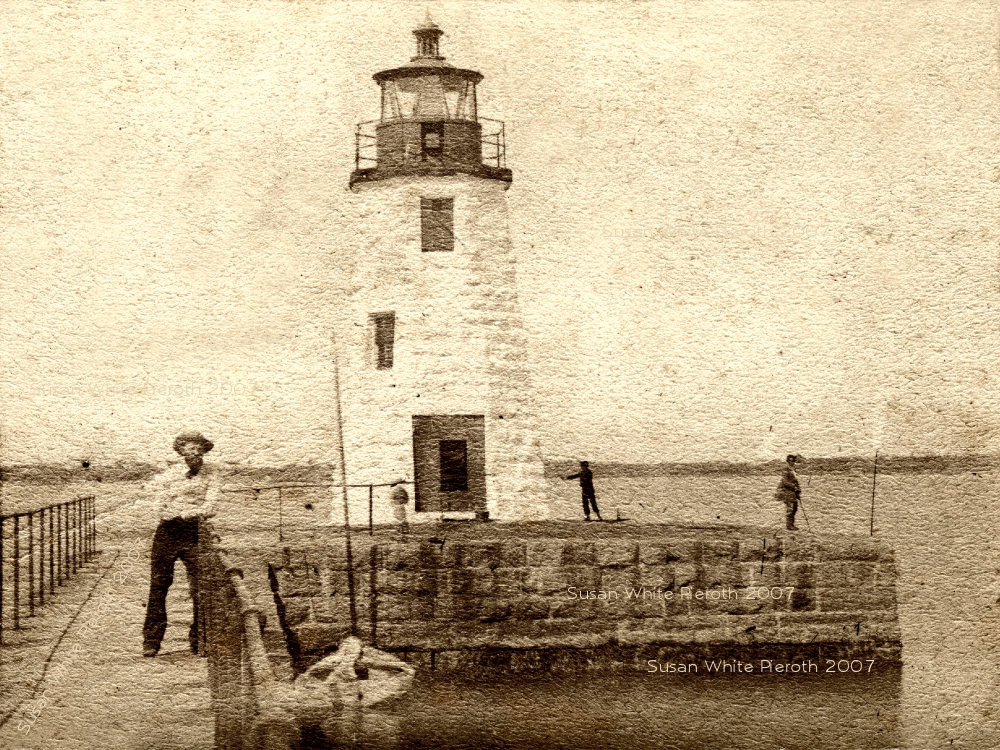 |
 Left:
the front of a old photo of the Goat
Island Light that would have been taken before the lighthouse
keeper's home was built in 1864. Click
here for the old inscription on the back. Left:
the front of a old photo of the Goat
Island Light that would have been taken before the lighthouse
keeper's home was built in 1864. Click
here for the old inscription on the back.Right: the lighthouse full circle after the lighthouse keepers home was removed. |
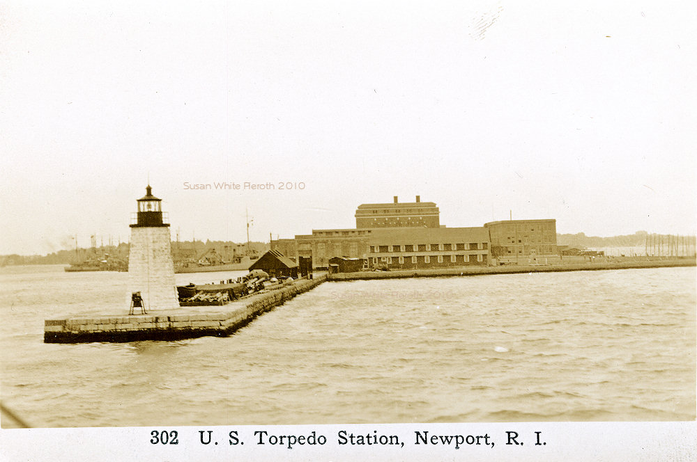
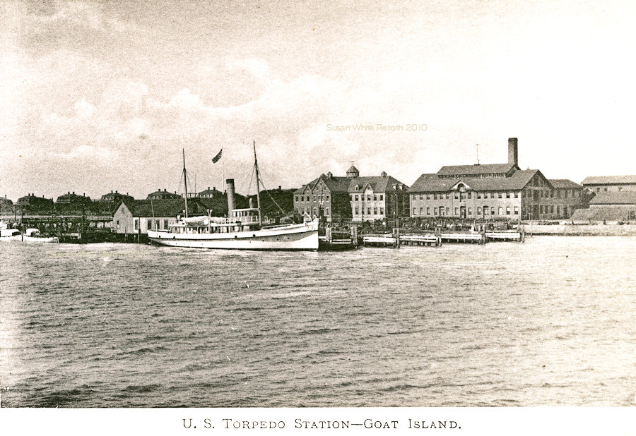 | 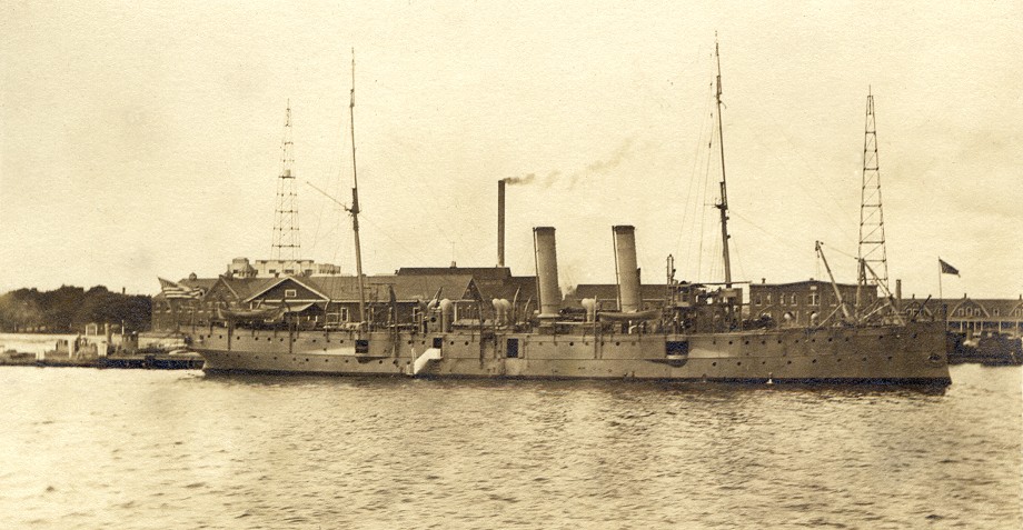 Left: U. S. Torpedo Station and Goat Island from an early view book. Left: U. S. Torpedo Station and Goat Island from an early view book.Right: On the back is written "Sept. 14, 1912." In 1965 someone added "Torpedo Station (Goat Island) in background. Looking west, Newport Harbor, R. I." The ship is a torpedo boat, the forerunner of destroyers. For an enlargement of the boat and buildings, click here. |
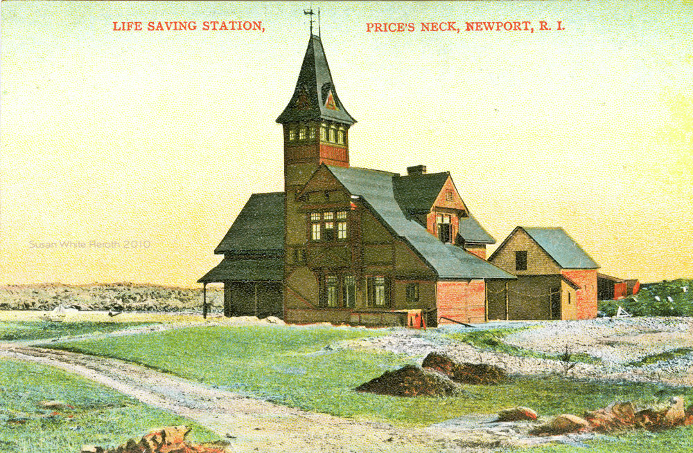 |
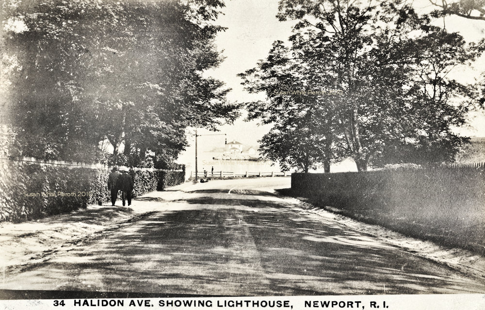 Left: Life Saving Station, Price's Neck. Left: Life Saving Station, Price's Neck.Right: Halidon Avenue with a view of Ida Lewis Light House in the distance. |
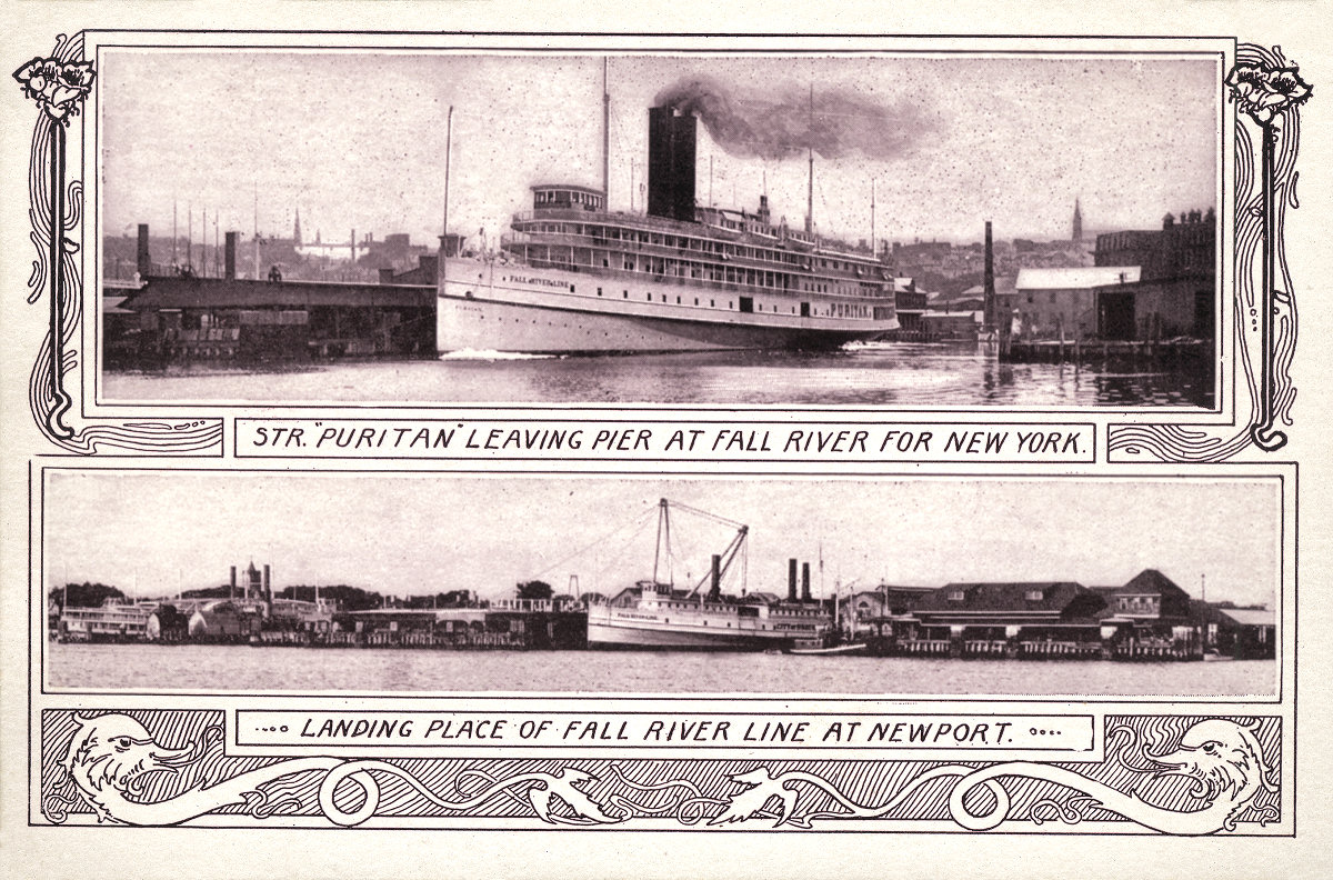 |
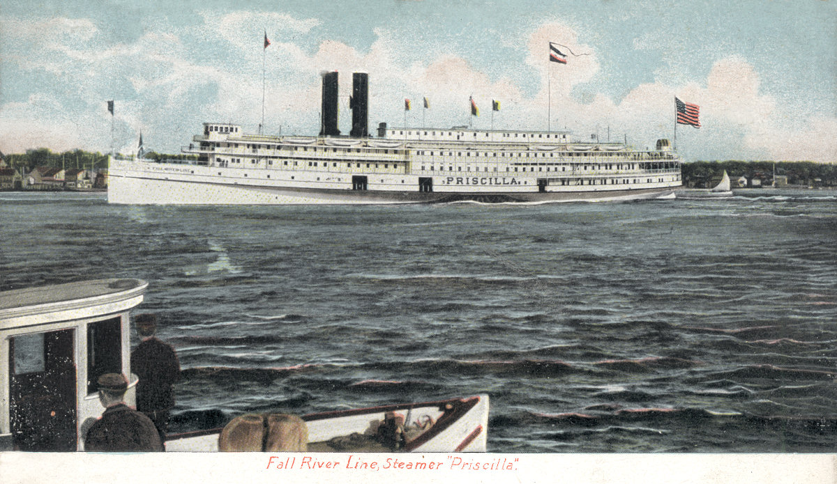 Left:
Steamer Puritan leaving Fall River, and the Fall River Line dock in
Newport. On another site I have the scans of
the 1907 publication, "80 Photographic Views of Fall River Line". Left:
Steamer Puritan leaving Fall River, and the Fall River Line dock in
Newport. On another site I have the scans of
the 1907 publication, "80 Photographic Views of Fall River Line".Right: The Fall River Line Steamer Priscilla. |
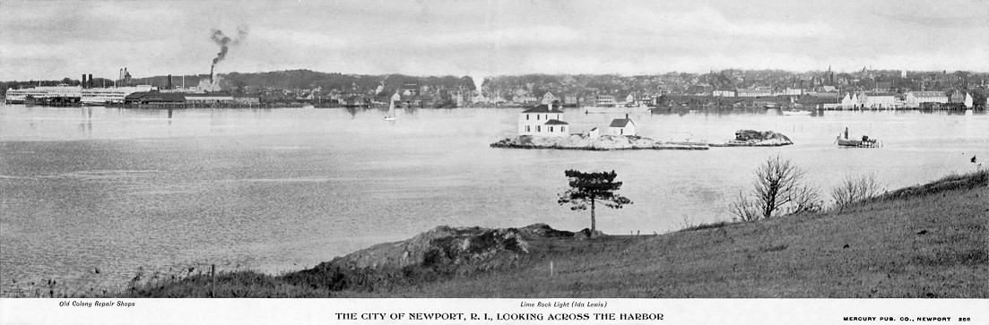 |
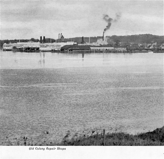
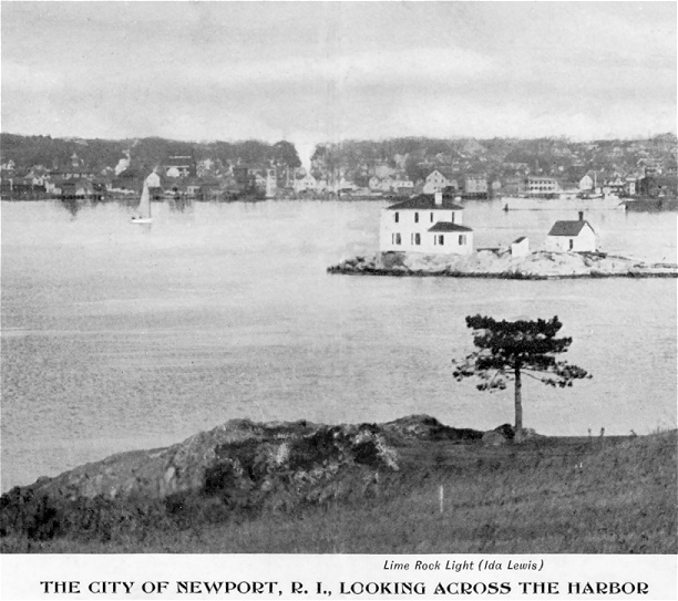
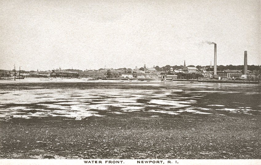 "Newport,
R. I. Looking Across the Harbor" Mailed in 1906. The left
shows "Old Colony Repair Shops." The middle
"Lime Rock Light (Ida Lewis)." The right,
the town and docks. Right: a view of the water
front. Click
here for an enlargement of the shore. "Newport,
R. I. Looking Across the Harbor" Mailed in 1906. The left
shows "Old Colony Repair Shops." The middle
"Lime Rock Light (Ida Lewis)." The right,
the town and docks. Right: a view of the water
front. Click
here for an enlargement of the shore. |
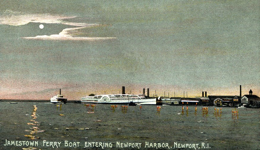 |
 "Jamestown
Ferry Boat
Entering Newport Harbor." Mailed in 1908.
The
name on the paddle wheel boat is "Rhode Island." Ferries across
Narragansett
Bay were eliminated in 1969 when the Newport Bridge was completed.
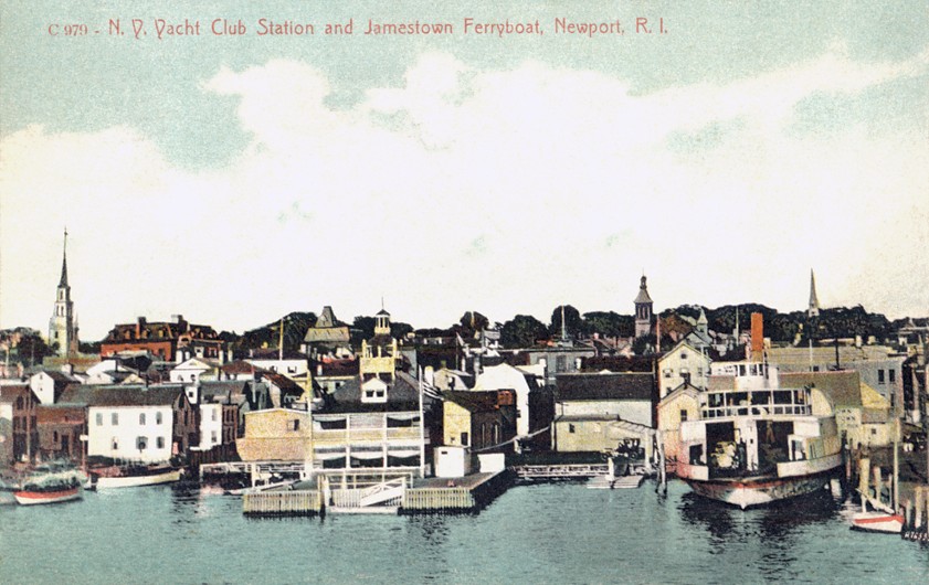
Right:
"N. Y. Yacht Club Station [center on Sayers Wharf] and Jamestown
Ferryboat." Mailed
in 1910. The Trinity Church is the spire at the
left. "Jamestown
Ferry Boat
Entering Newport Harbor." Mailed in 1908.
The
name on the paddle wheel boat is "Rhode Island." Ferries across
Narragansett
Bay were eliminated in 1969 when the Newport Bridge was completed.
Right:
"N. Y. Yacht Club Station [center on Sayers Wharf] and Jamestown
Ferryboat." Mailed
in 1910. The Trinity Church is the spire at the
left. |
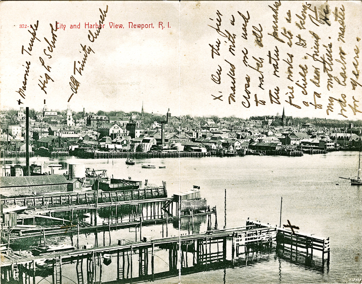 |
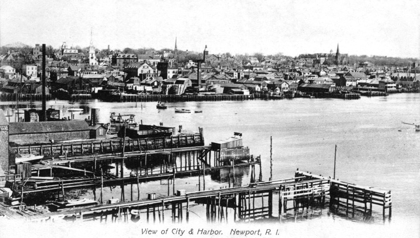 Two
versions of a Newport postcard printed for many years,
but it was originally taken very early in the 1900s, if not earlier.
The sender of the double size card at the left marked the masonic
temple, high school, and old Trinity church.
The note says, "On the pier marked with a cross we used to watch all
the water parades, fire works, etc. as a child. It belongs to a dear
friend of my mother's. He was harbor master for years." The NY Yacht
Club is at the far right.
For
an enlargement of the shoreline click
here. Two
versions of a Newport postcard printed for many years,
but it was originally taken very early in the 1900s, if not earlier.
The sender of the double size card at the left marked the masonic
temple, high school, and old Trinity church.
The note says, "On the pier marked with a cross we used to watch all
the water parades, fire works, etc. as a child. It belongs to a dear
friend of my mother's. He was harbor master for years." The NY Yacht
Club is at the far right.
For
an enlargement of the shoreline click
here. |
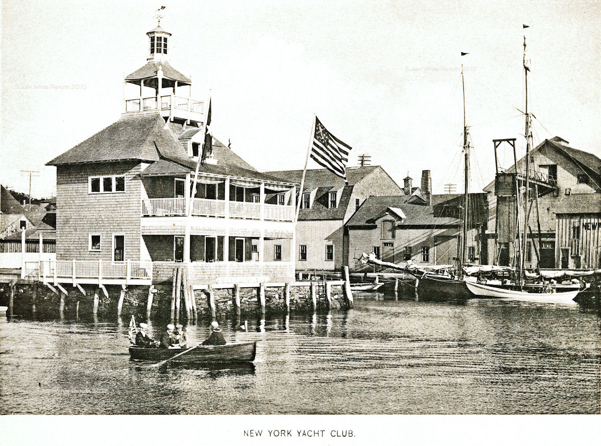 | 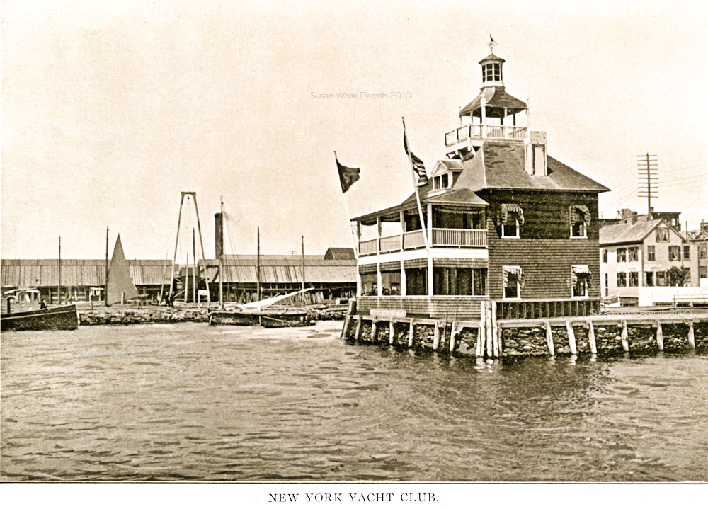 Left: New York Yacht Club from an 1897 view book. Left: New York Yacht Club from an 1897 view book.Right: New York Yacht Club from a different 1897 view book. Another view book image of the same vintage, but from shore, is here. |
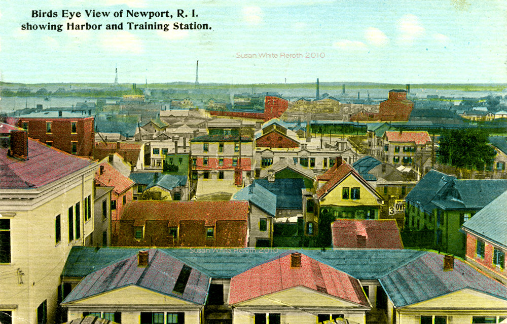 |
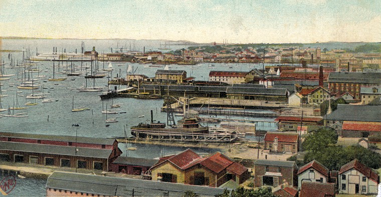 Left: Newport,
harbor and Training Station - mailed in 1912. Right: "Newport
Harbor" this is really a very good view of the wharves. About 1910. At
the far left in back is the sidewheeler. Left: Newport,
harbor and Training Station - mailed in 1912. Right: "Newport
Harbor" this is really a very good view of the wharves. About 1910. At
the far left in back is the sidewheeler. |
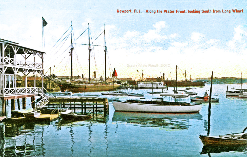 |
 Left: "Along the waterfront looking south from Long Wharf." Left: "Along the waterfront looking south from Long Wharf."Right: An old photo taken from the ferry as it leaves Newport. |
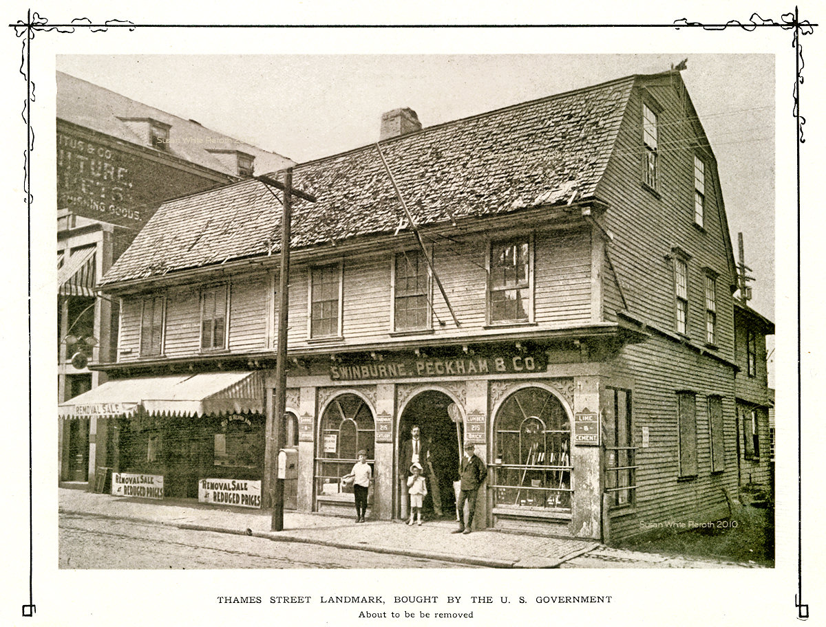 |
 Left: The
businesses at 215 Thames street from a view book about 1903. The store
at the left has signs state, "Removal Sale." The title says it was
bought by the U. S. Government and was about to be removed. Government
Landing was built on the site. Left: The
businesses at 215 Thames street from a view book about 1903. The store
at the left has signs state, "Removal Sale." The title says it was
bought by the U. S. Government and was about to be removed. Government
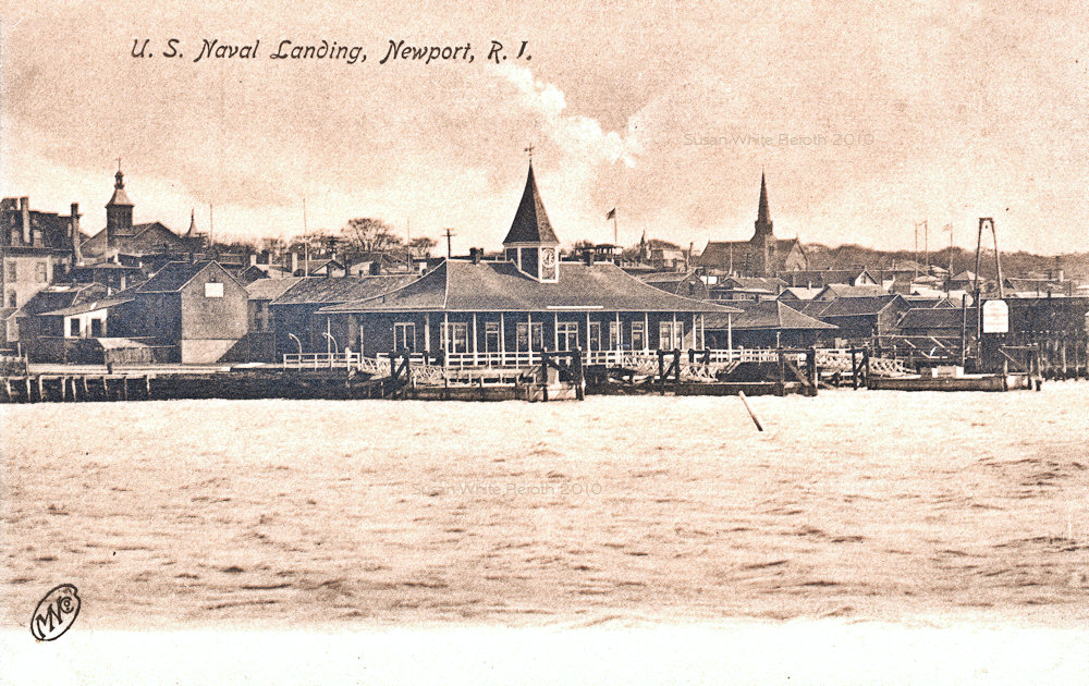
Landing was built on the site.Right: "U. S. Naval Landing, Newport". |
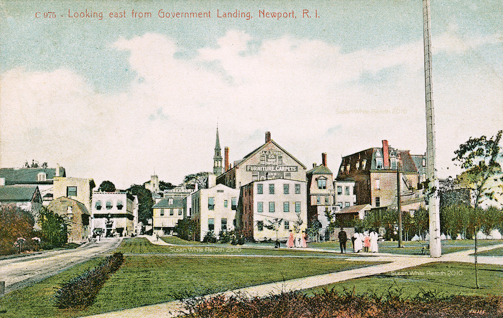 |  East From Government Landing. The sign on the taller middle building is for Titus Furniture store. East From Government Landing. The sign on the taller middle building is for Titus Furniture store.Right: View from Government Landing looking towards Thames Street (not a postcard). |
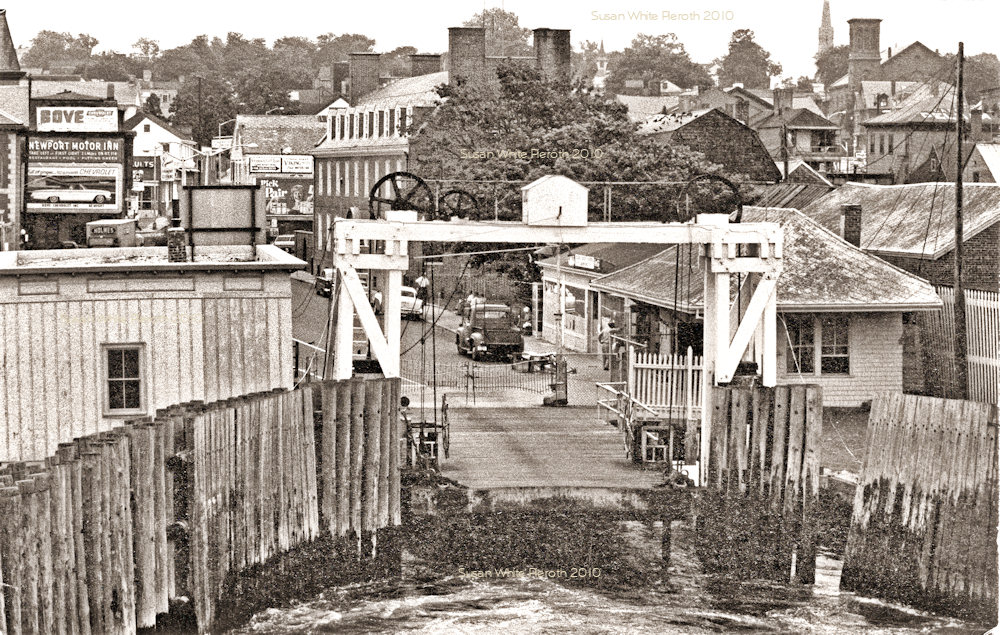
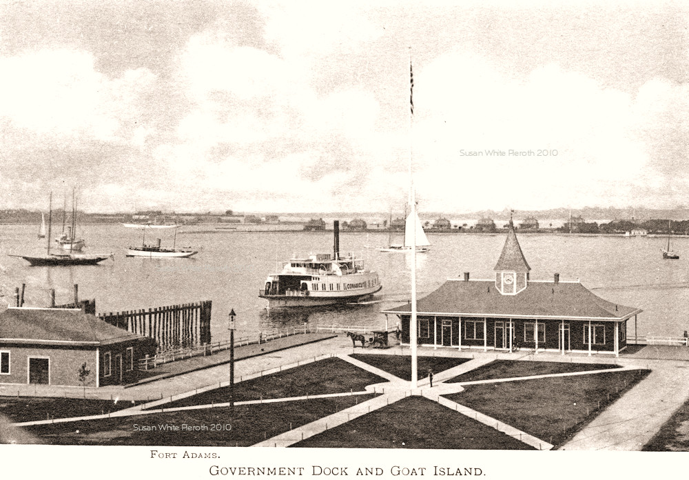 |  The
ferry Conanicut leaving Government Landing. Fort Adams is in the
distance on the left and Goat Island on the right. This is from an
early view book. The
ferry Conanicut leaving Government Landing. Fort Adams is in the
distance on the left and Goat Island on the right. This is from an
early view book.Right: Government Landing |
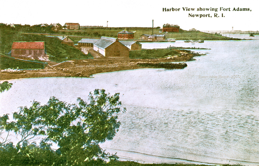 |
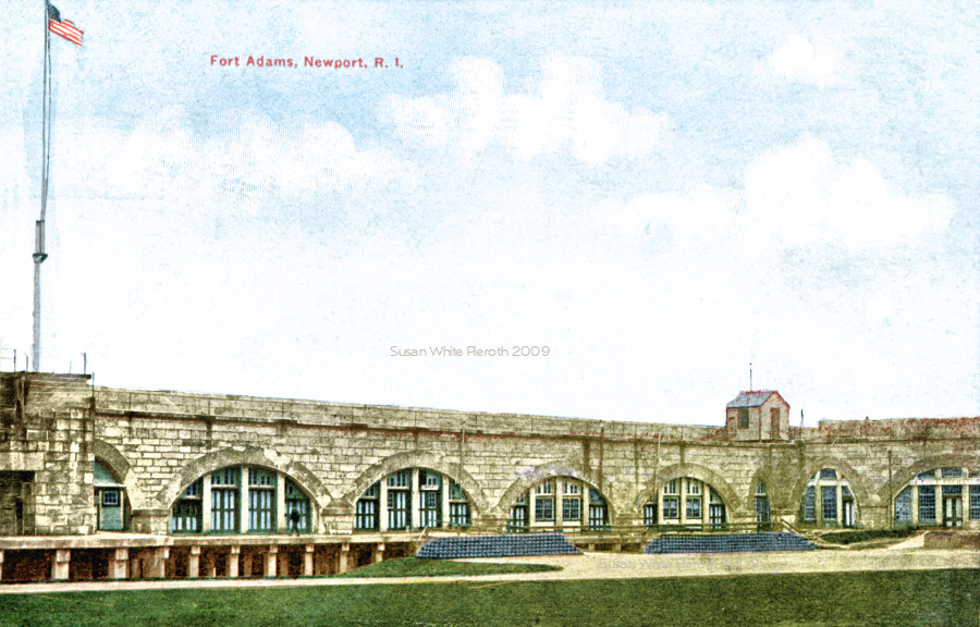
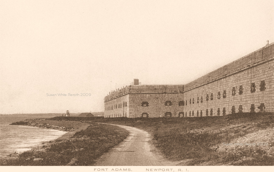 Left:
Harbor view showing Fort Adams. Left:
Harbor view showing Fort Adams.Right: One exterior wall of Fort Adams. |
 |
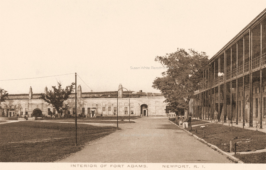 Both
images are of the interior of Fort Adams. Both
images are of the interior of Fort Adams. |