 |
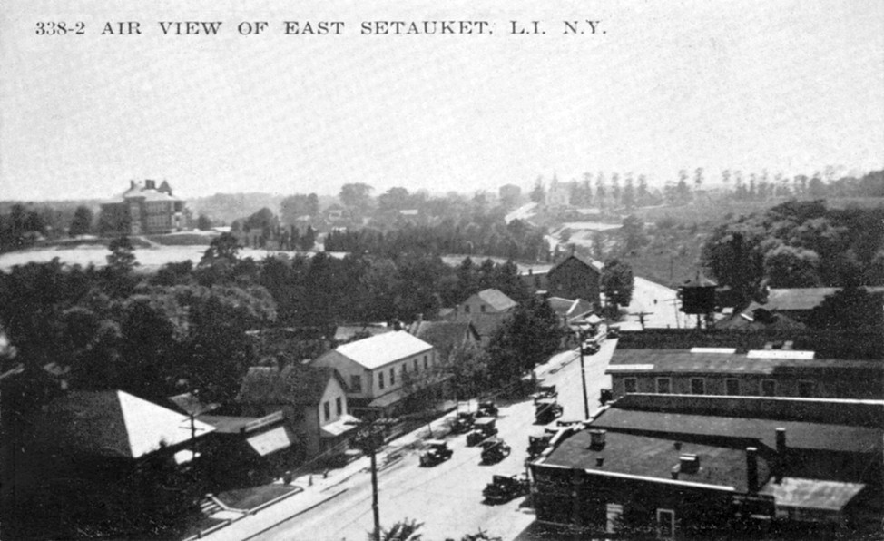
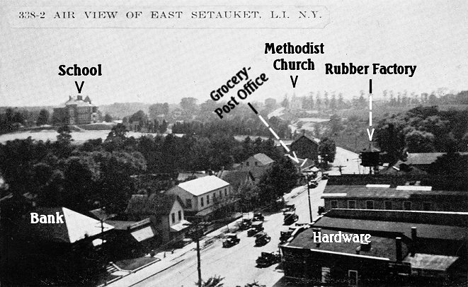 "Air
View of East Setauket, L. I., N. Y." Apparently from the 1930s. The key
labels some of the buildings. Many are shown on these pages. West of
the
bank several are no longer there. The factory is gone. "Air
View of East Setauket, L. I., N. Y." Apparently from the 1930s. The key
labels some of the buildings. Many are shown on these pages. West of
the
bank several are no longer there. The factory is gone. |
|
"Air
View of East Setauket, L. I., N. Y." Apparently from the 1930s. The key
labels some of the buildings. Many are shown on these pages. West of
the
bank several are no longer there. The factory is gone. |
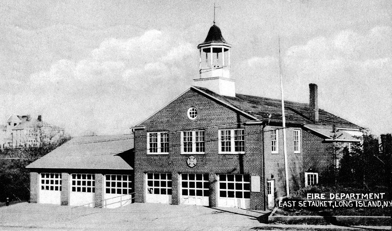 |
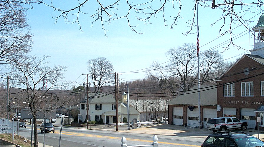
"Fire Department, East Setauket, Long Island, N. Y." The building, built in 1935, is still on 25A at the intersection of Old Town Road, and is used by a very active fire department. In the distance on the left is the Union School. The card was mailed in 1947. |
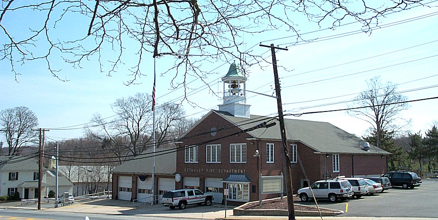 |
The Setauket Fire Department in March of 2002. There is now a bay window in place of the right garage door, an extension was made to the right, plus the windows and garage doors have been replaced. |
 |
Left: Now you
would be standing in a shopping center looking across at more stores,
houses
and bigger trees. 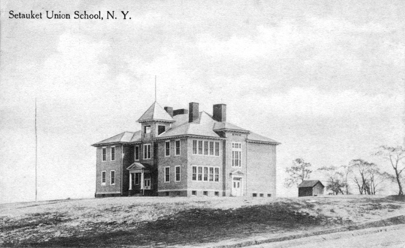 Right:
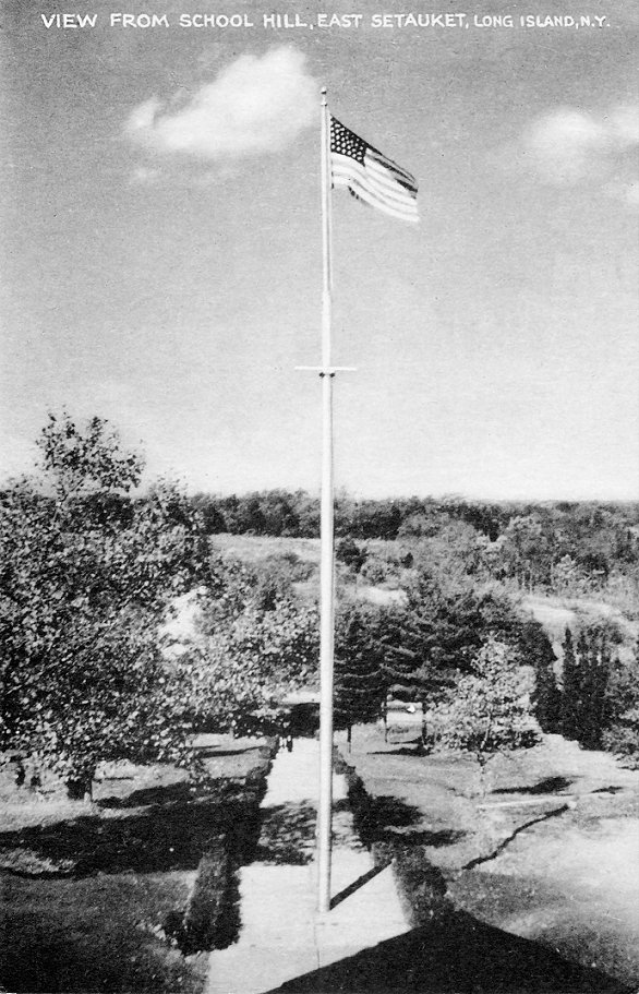
"Setauket Union School, N. Y." It was in East Setauket, where it was
mailed
some time between 1910 and 1918. In front is the flagpole shown in the
card at the left. The dirt road at the right is Jones Street. For a
picture
from the fire house looking east, click
here. Right:
"Setauket Union School, N. Y." It was in East Setauket, where it was
mailed
some time between 1910 and 1918. In front is the flagpole shown in the
card at the left. The dirt road at the right is Jones Street. For a
picture
from the fire house looking east, click
here.
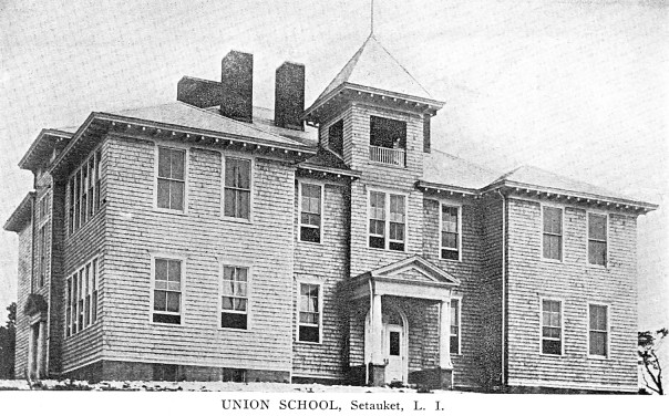 Right:
Another view of the Union School. The location has been excavated and
the
"Old School House" shopping center, where Mario's Restaurant has been
for
years, erected. [The cedar shakes took on a strange pattern when the
thumbnail
version was created.] Right:
Another view of the Union School. The location has been excavated and
the
"Old School House" shopping center, where Mario's Restaurant has been
for
years, erected. [The cedar shakes took on a strange pattern when the
thumbnail
version was created.] |
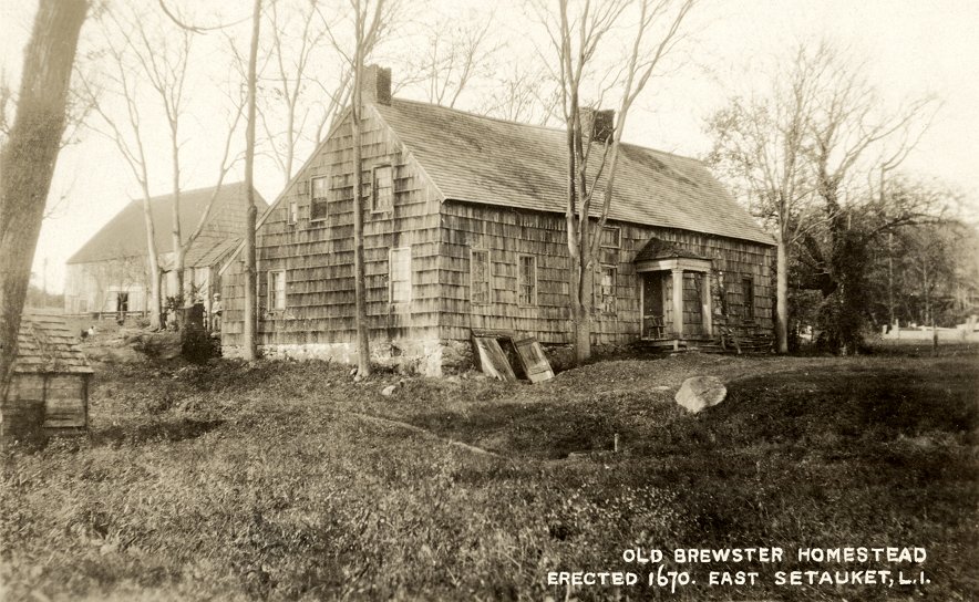 |
"Old Brewster Homestead Erected 1670. East Setauket, L.I." The Joseph Brewster house at the intersection of Runs Road was restored in 1968 to it's appearance as depicted by William Sidney Mount. The main difference from this old view is that the porch over the front door has been removed. The barn has not been there for many years before that. |
 |
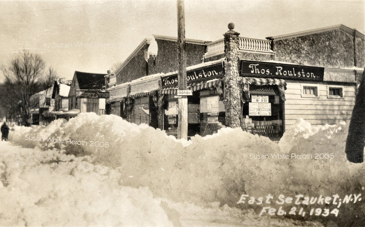
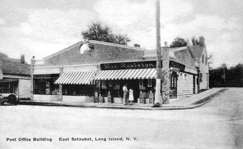 Left:
Main Street, February 21, 1934 (250
kb). Right: The card (mailed in 1933) says, "Post Office
Building,"
but the post office is either behind Thomas Roulston's grocery facing
Gnarled
Hollow Road, or inside. The structure on Gnarled Hollow is no longer
there. Left:
Main Street, February 21, 1934 (250
kb). Right: The card (mailed in 1933) says, "Post Office
Building,"
but the post office is either behind Thomas Roulston's grocery facing
Gnarled
Hollow Road, or inside. The structure on Gnarled Hollow is no longer
there. |
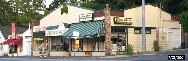 |
Here is a picture of the corner of Gnarled Hollow and 25A in July of 2001. The roof railing has been covered with shingles, but many details remain, including the stone, the windows and the division of stores. |
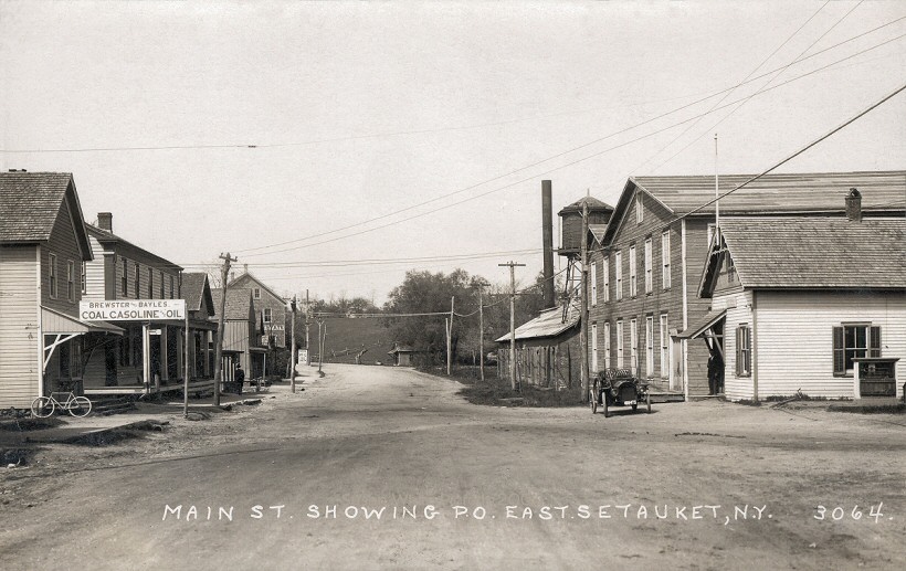 |
 "Main
Street Showing P.O. East Setauket" looking west. The small building on
the right is the post office on the corner of Shore Road. Beyond that
is
the second rubber factory. The license plate is 48947. Right: the same
view looking east from about Gnarled Hollow Rd. "Main
Street Showing P.O. East Setauket" looking west. The small building on
the right is the post office on the corner of Shore Road. Beyond that
is
the second rubber factory. The license plate is 48947. Right: the same
view looking east from about Gnarled Hollow Rd. |
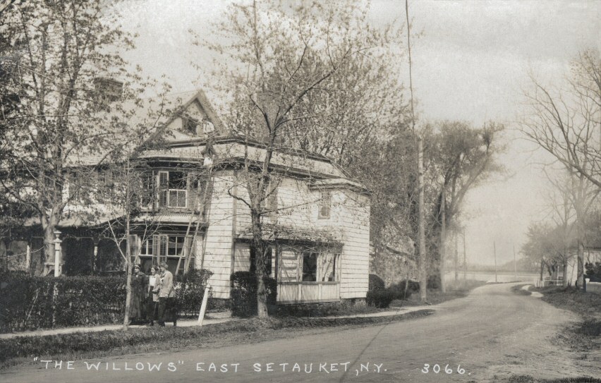 |
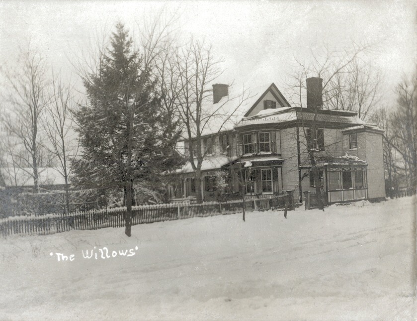 "'The
Willows' East Setauket, N.Y." This home on Shore Road is better known
as
the David Cleaves House. The house was built before 1820. David Cleaves
operated a shipyard next to his house. Right: a winter view mailed in
November
of 1908. "'The
Willows' East Setauket, N.Y." This home on Shore Road is better known
as
the David Cleaves House. The house was built before 1820. David Cleaves
operated a shipyard next to his house. Right: a winter view mailed in
November
of 1908. |
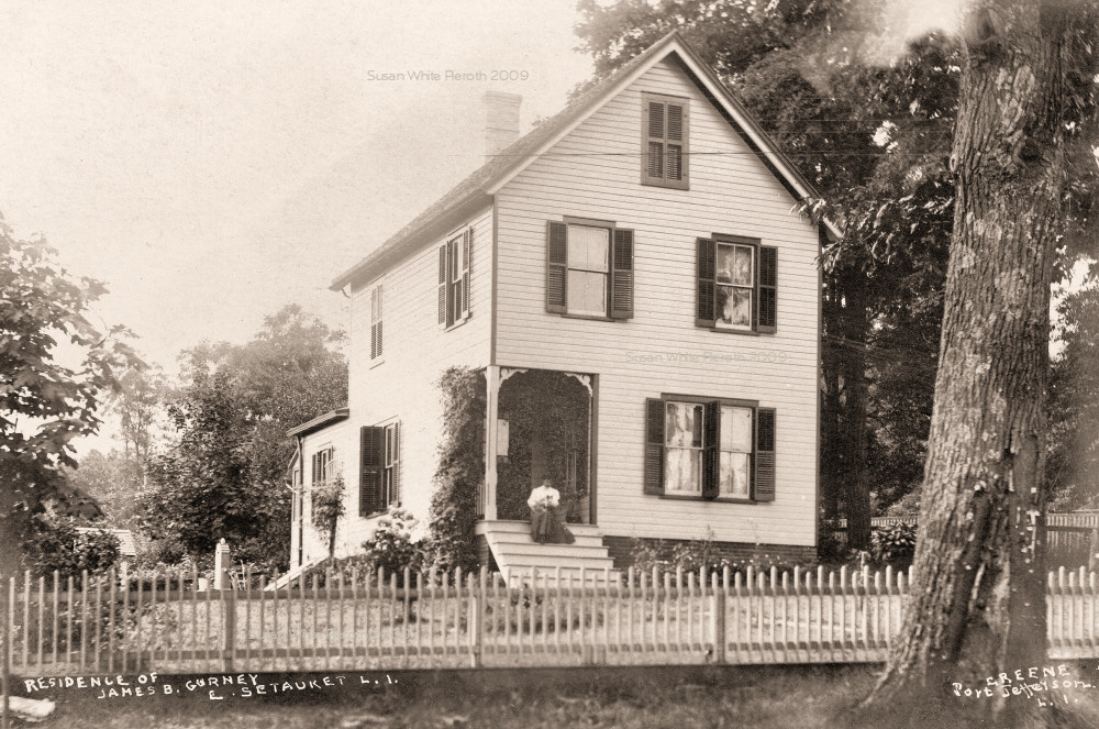 |
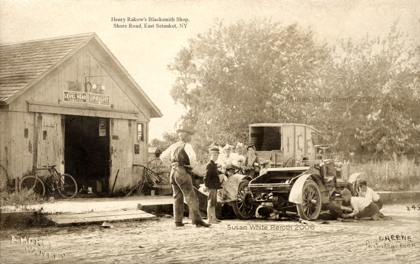 Left: James B. Gurney home. Right: "A Horse Needed" is of the Henry Rakow
blacksmith shop on Shore Road. Note the Ice wagon. The back of the card
identifies the location as the Rakow shop (I added the title in the
sky) and says Caleb Fordham is in the picture. Left: James B. Gurney home. Right: "A Horse Needed" is of the Henry Rakow
blacksmith shop on Shore Road. Note the Ice wagon. The back of the card
identifies the location as the Rakow shop (I added the title in the
sky) and says Caleb Fordham is in the picture. |
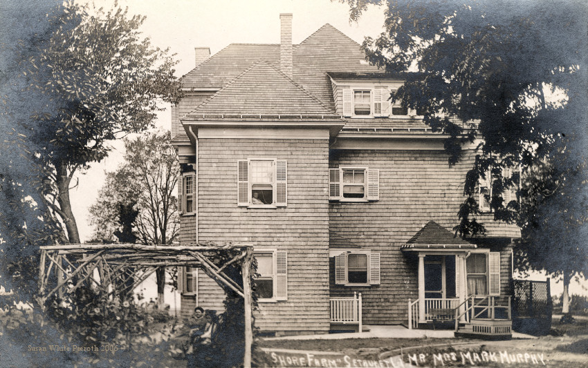 |
 "Shore
Farm, Setauket, LI. Mr. Mrs. Mark Murphy" mailed in 1910. There are two
people under the arbor and one in the window. Right: a different view. For a small image of the front, click here. The house is at
the corner of Bayview Avenue and Shore Road. "Shore
Farm, Setauket, LI. Mr. Mrs. Mark Murphy" mailed in 1910. There are two
people under the arbor and one in the window. Right: a different view. For a small image of the front, click here. The house is at
the corner of Bayview Avenue and Shore Road. |
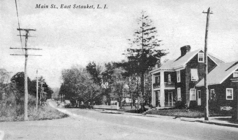 |
"Main St., East Setauket, L.I." This house was known as "Old Shinglesides" and was moved to Mills Lane in 1962 from its location just east of the Tinker National Bank (now HSBC). The street entering 25A from the left is Shore Road. |
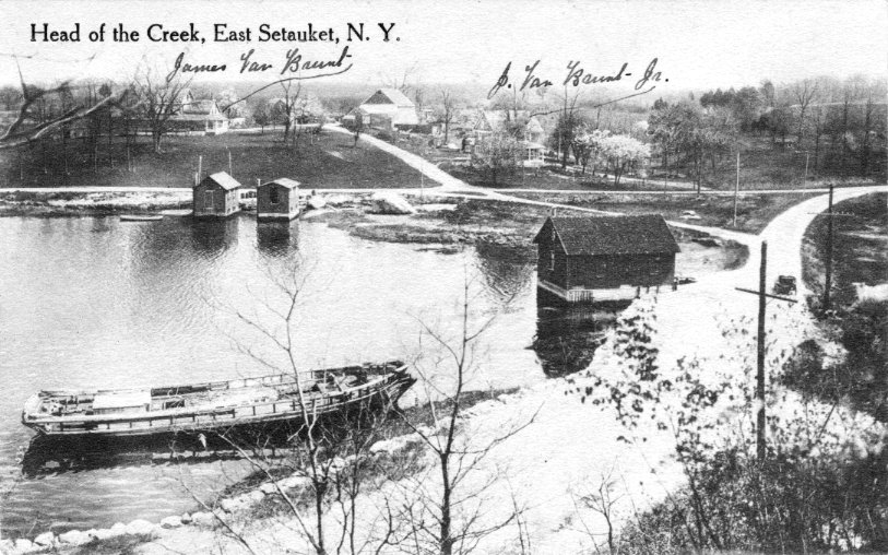 |
The card reads, "Head of the Creek, East Setauket, N. Y.," but even more interesting are the handwritten notations with arrows pointing to houses: James Van Brunt, and J. Van Brunt Jr. The road at the bottom of the picture is Shore Road, and the road that continues up the hill to Poquott is Van Brunt Manor Road. The card was not mailed, but it was printed after 1907. |
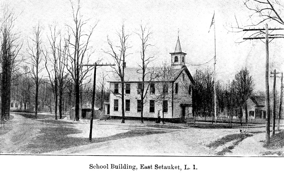 |
 "School
Building, East Setauket." Mailed in 1906. Built in the 1860s, it is
still
on 25A (without the belfry). In 1908 Inez M. Swezey wrote that she
taught
there. Right: "East Setauket School 1907" by A. S. Greene. For a 1905
student
roster, click
here. "School
Building, East Setauket." Mailed in 1906. Built in the 1860s, it is
still
on 25A (without the belfry). In 1908 Inez M. Swezey wrote that she
taught
there. Right: "East Setauket School 1907" by A. S. Greene. For a 1905
student
roster, click
here. |
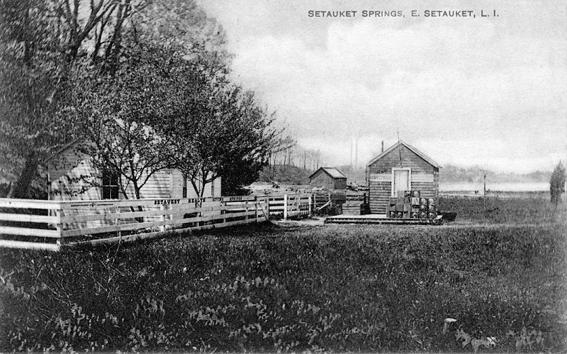 |
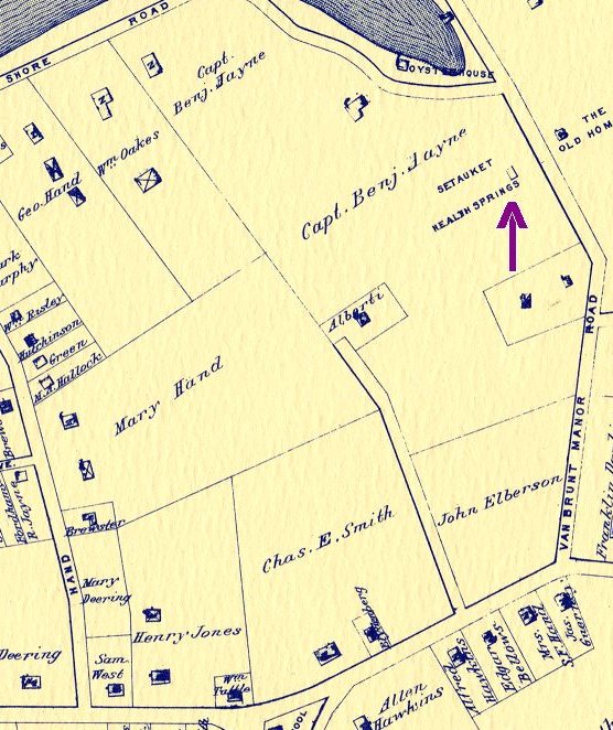 "Setauket
Springs, E. Setauket, L. I." "Setauket Health Giving Springs" is on the
fence. Printed in Germany. The location is shown off Van Brunt Manor
Road
on this 1909 map. Click for a wider and larger view. "Setauket
Springs, E. Setauket, L. I." "Setauket Health Giving Springs" is on the
fence. Printed in Germany. The location is shown off Van Brunt Manor
Road
on this 1909 map. Click for a wider and larger view. |
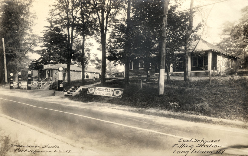 |
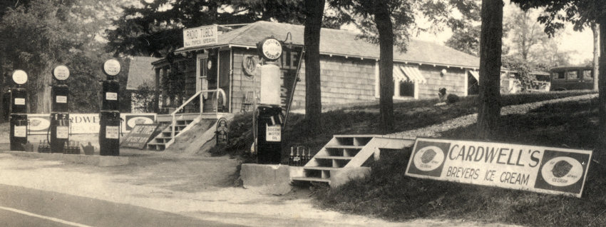
"East Setauket Filling Station, Long Island, N.Y." This real photo postcard by Greenacres Studio in Port Jefferson is not dated, but the car parked in back indicates it's pre-WWII. Caldwell's on 25A sells Breyers ice cream, radio tubes, tires and SOCONY oil and gas. The successor to this station is no longer there. For an enlargement of the station, click here. |